Two Russian Shahed-variant drones transit Kyiv-Chernihiv border region
What happened
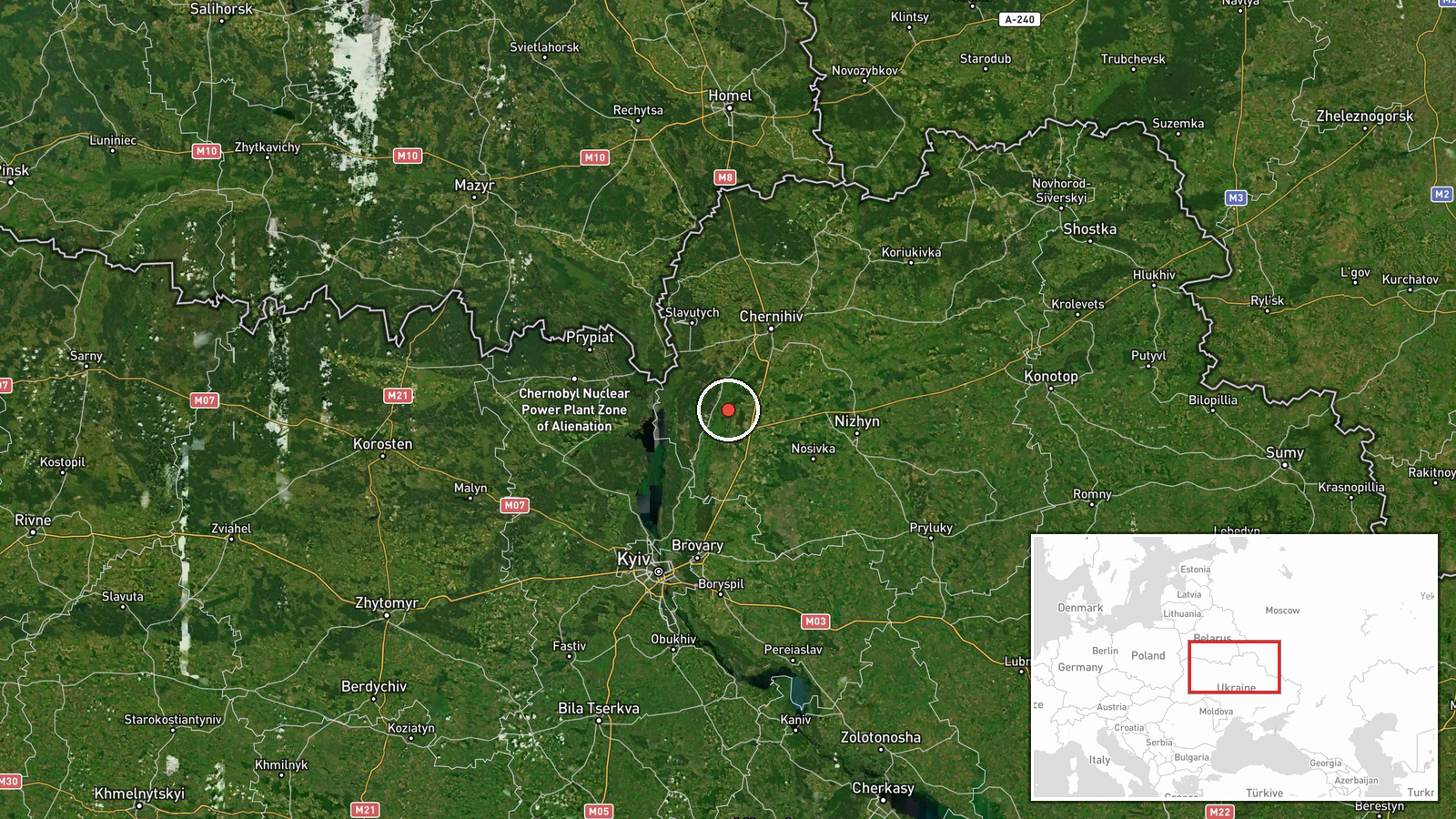
Ukrainian air monitoring detected two Russian reactive jet-powered Shahed-variant kamikaze drones transiting the border region between Kyiv and Chernihiv oblasts on 1 September at 05:27 UTC. The drones were reportedly identified as part of ongoing Russian unmanned aircraft operations. No immediate strike or impact was reported in this initial detection. The sighting represents a continued pattern of Russian drone activity targeting or crossing northern Ukrainian airspace.
Context and assessment
The Kyiv-Chernihiv border region has remained under sustained Russian aerial pressure throughout the conflict. This detection follows a series of related Russian strikes and transits over the preceding 24 hours, including Shahed-136 operations over Kyiv Oblast on 31 August, ballistic missile activity detected near Kyiv, and reconnaissance drone flights originating from Russian territory. The northern approach corridor toward Kyiv remains a significant Russian air avenue of attack. Shahed-variant drones, Iran-supplied cruise munitions, typically fly at low altitude and are often used in coordinated multi-wave strikes. The pattern suggests Russian air operations may be concentrating pressure on the Kyiv region during this period.
Sources and confidence
Reported by Telegram channel @war_monitor on 1 September. Single-source detection with no cross-confirmation from independent Ukrainian channels noted in available data. Confidence score of 6.0 reflects typical reliability of Ukrainian air-monitoring channels but limited redundancy. Confirmation from additional air defense or monitoring sources, or subsequent strike reports in the region, would raise confidence. Clarification of intended target or final disposition would strengthen the assessment.
Location
The Kyiv-Chernihiv border region, determined at regional precision level (latitude 51.15, longitude 31.0). This area encompasses the territory roughly 100–150 kilometres north of central Kyiv where the two oblasts meet. The border region is relatively rural with mixed settlements and forest coverage. Proximity to both Kyiv City and Chernihiv City makes it a natural transit corridor for Russian air operations approaching northern Ukraine.
Related events nearby
- Ukrainian air monitoring confirms continued Russian Shahed-136 reactive jet-powered UAV transit operations ove2026-08-31 06:58 UTC · Drone Transit · Kyiv Oblast, Ukraine
- Russian Zircon hypersonic ballistic missiles detected transiting from Pryatin toward Kyiv. Part of ongoing mul2026-08-31 23:34 UTC · Ballistic Missile · Kyiv, Kyiv City, Ukraine
- Ukrainian air-monitoring channel issues ballistic missile threat alert for Boryspil, Kyiv Oblast. Suspected ba2026-08-31 23:27 UTC · Siren · Boryspil, Kyiv Oblast, Ukraine
- Russian reconnaissance or kamikaze drone (reactive/jet-powered UAV) transiting through Krasiatychyi, Kyiv Obla2026-08-31 20:38 UTC · Drone Transit · Krasiatychyi, Kyiv Oblast, Ukraine
- Russian reconnaissance or kamikaze drone (reactive/jet-powered UAV) detected transiting from Tsimbulatovo, Ore2026-08-31 21:16 UTC · Drone Transit · En route: Tsimbulatovo, Orel Oblast, Russia → Kyiv
▶ View this event on the live map
Intel Mapper aggregates open-source reports from monitored Telegram and X channels, geolocates them, cross-checks duplicates across sources and assigns a confidence score. Entries are updated as new confirmations arrive. Read how we verify events.