Russian Shahed-variant drone tracked over Hlevakha in Kyiv Oblast
What happened
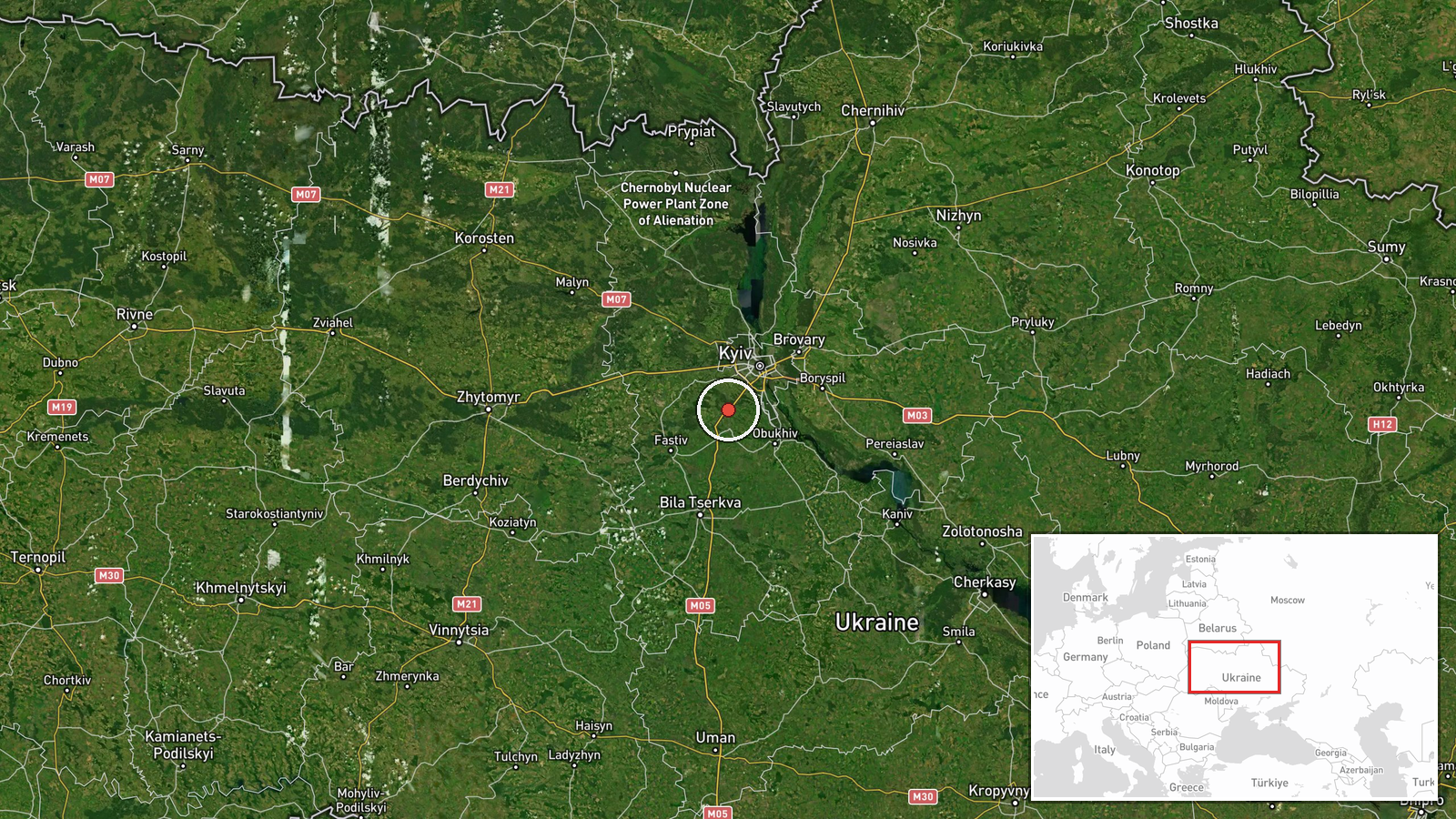
Ukrainian air monitoring reportedly tracked a Russian reactive unmanned aerial vehicle of Shahed-variant design transiting the Hlevakha area in Kyiv Oblast on the evening of September 2nd. The drone was observed following a flight pattern directed toward the Kyiv metropolitan region. The report was posted to Telegram by the war_monitor channel, which noted the aircraft's location and trajectory without specifying whether an interception or impact occurred.
Context and assessment
Hlevakha lies approximately 30 kilometers southwest of central Kyiv and sits along a common aerial approach corridor to the capital. This sighting follows a similar transit event reported near Boyarka, also in Kyiv Oblast, earlier the same evening, suggesting a coordinated or multi-wave drone operation targeting the metropolitan area. Such Shahed-variant strikes have formed part of Russia's sustained campaign against Ukrainian civilian and military infrastructure. The timing coincides with Ukrainian authorities' formal implementation of an air threat differentiation system for the civilian population, reflecting the regularity of these incursions.
Sources and confidence
Report sourced solely from Telegram channel @war_monitor. No cross-confirmation from official Ukrainian air defense statements or independent sources is noted. Confidence score of 6.0 reflects single-source reporting and the routine nature of such transit observations. Confirmation from Ukrainian air force statements or evidence of drone interception would strengthen confidence; absence of follow-up reporting on impact or interdiction may indicate the drone passed through the area without striking a target.
Location
Hlevakha is a settlement in Kyiv Oblast located approximately 30 kilometers southwest of Kyiv city center, positioned in the suburban fringe of the metropolitan region. The settlement sits near the Irpin River valley, a geography that influences aerial approach vectors toward the capital. Nearby Boyarka, where a related drone transit was reported hours earlier, lies to the north.
Related events nearby
- Russian reactive (Shahed-variant) UAV tracked transiting Kyiv Oblast toward Kyiv metropolitan area. Ukrainian 2026-09-02 21:09 UTC · UAS Strike · Boyarka, Kyiv Oblast, Ukraine
- Ukrainian authorities formally implement air threat differentiation system for civilian population. Monitoring2026-09-02 14:51 UTC · Statement · Kyiv, Ukraine
- Ukrainian President Zelensky states that following his warnings, international airlines have begun halting fli2026-09-02 19:48 UTC · Statement · Kyiv, Ukraine
- Ukraine's Foreign Ministry warned international civil aviation authorities that Russian airspace is unsafe for2026-09-02 13:54 UTC · Statement · Kyiv, Ukraine
- Armed standoff erupted overnight between Ukrainian SBU and HUR personnel in a Kyiv residential street. Three H2026-09-02 10:02 UTC · Security · Kyiv, Ukraine
▶ View this event on the live map
Intel Mapper aggregates open-source reports from monitored Telegram and X channels, geolocates them, cross-checks duplicates across sources and assigns a confidence score. Entries are updated as new confirmations arrive. Read how we verify events.