Two Russian Shahed-variant drones tracked toward Slavutych in northern Ukraine
What happened
Ukrainian air monitoring detected two Russian reactive unmanned aerial vehicles, identified as Shahed-variant types, in transit from Bryansk Oblast toward Slavutych in Chernihiv Oblast on September 3 at approximately 03:27 UTC. The detection was reported via Telegram by war monitoring channels tracking air threats across northern Ukraine. The report does not specify whether the drones reached their destination or were intercepted.
Context and assessment
Slavutych lies approximately 50 kilometers north of Kyiv and serves as the primary residential settlement for personnel associated with the nearby Chornobyl Nuclear Power Station. The town has been repeatedly targeted or transited by Russian drone strikes since the full-scale invasion began, making it a persistent focus of Ukrainian air defense efforts. This incident is part of a sustained pattern: related reports from September 2–3 document at least fourteen Shahed-variant drones detected across multiple transit routes in northern and central Ukraine, including separate strikes toward Kyiv Oblast, Vinnytsia, and other regions. The frequency and geographic spread suggest Russia is maintaining pressure across Ukrainian airspace with multi-directional drone campaigns, likely seeking to overwhelm defensive capacity or strike civilian infrastructure.
Sources and confidence
Reported by Telegram channel @war_monitor, a single source. No cross-confirmation from other independent channels or official Ukrainian military statements is noted in available data. Confidence score of 6.0 reflects the single-source reporting and lack of secondary confirmation, though the channel's track record and alignment with related simultaneous reports across Ukraine support moderate credibility. Confirmation from Ukrainian official sources or multiple independent monitors would strengthen confidence.
Location
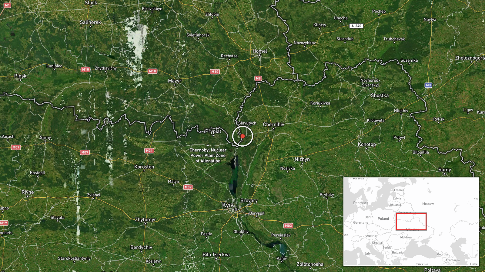
Slavutych is a settled town in Chernihiv Oblast in northern Ukraine, approximately 50 kilometers north of Kyiv city center. It is situated in a relatively flat region with the Dnieper River system to its west. The settlement is administratively distinct from nearby Chornobyl Raion and serves as the principal civilian hub for nuclear facility personnel. Geographic precision is high, based on known settlement coordinates.
Related events nearby
- Six Russian Shahed-136 reactive (jet-powered) kamikaze drones detected transiting from Slavutych toward Kyiv O2026-09-02 15:41 UTC · Drone Transit · Slavutych, Chornobyl Raion, Kyiv Oblast, Ukraine
- Two Russian Shahed reactive (jet-powered) kamikaze drones tracked transiting past Dimer toward Borodianka in K2026-09-02 04:09 UTC · Drone Transit · Dimer, Kyiv Oblast, Ukraine
- Ukrainian air monitoring reports multiple Russian reactive (Shahed-variant) UAVs tracked in transit across Ukr2026-09-03 02:46 UTC · Drone Transit · Kyiv Oblast, Ukraine
- Two Russian Shahed-136 reactive (jet-powered) kamikaze drones detected transiting over Kyiv Oblast: 1 drone to2026-09-02 15:41 UTC · Drone Transit · Kyiv Oblast, Ukraine
- Ukrainian President Zelensky states that following his warnings, international airlines have begun halting fli2026-09-02 19:48 UTC · Statement · Kyiv, Ukraine
▶ View this event on the live map
Intel Mapper aggregates open-source reports from monitored Telegram and X channels, geolocates them, cross-checks duplicates across sources and assigns a confidence score. Entries are updated as new confirmations arrive. Read how we verify events.