Russia strikes Odesa, Kyiv, Kharkiv with 12 cruise missiles and 50+ drones
What happened
Russian forces launched an overnight strike across three Ukrainian oblasts on 5–6 September 2026, deploying approximately 12 Kh-55/Kh-101 cruise missiles (Banderol variant) and at least 50 attack drones of mixed types, according to monitoring channel @war_monitor. The missiles targeted Odesa, Kyiv, and Kharkiv oblasts. The drone component followed reconnaissance drone activity over the Black Sea and Izmail district on the preceding evening, suggesting a coordinated multi-wave operation.
Context and assessment
The strike reflects Russia's sustained campaign against Ukrainian infrastructure and population centers using standoff weapons. Odesa Oblast remains a high-priority target for Russian air operations due to its strategic port facilities and military supply routes. The scale—combining cruise missiles with drone salvos exceeding 50 platforms—indicates continued Russian effort to degrade Ukrainian air defenses and strike multiple targets simultaneously. The temporal sequence of reconnaissance drones on 5 September followed by the main attack suggests operational planning. Repeated strikes on Odesa and nearby regions over recent days indicate either persistent targeting cycles or concentration on specific objectives in the region.
Sources and confidence
@war_monitor (Telegram) provided the primary report via monitoring assessment. Single-source reporting limits independent cross-confirmation; confidence of 6.0 reflects this gap. The channel's track record of air defense monitoring lends credibility to the drone count and missile type identification, though casualty and damage figures were not included. Confirmation from additional Ukrainian official sources, damage assessments, or Russian statements would raise confidence significantly.
Location
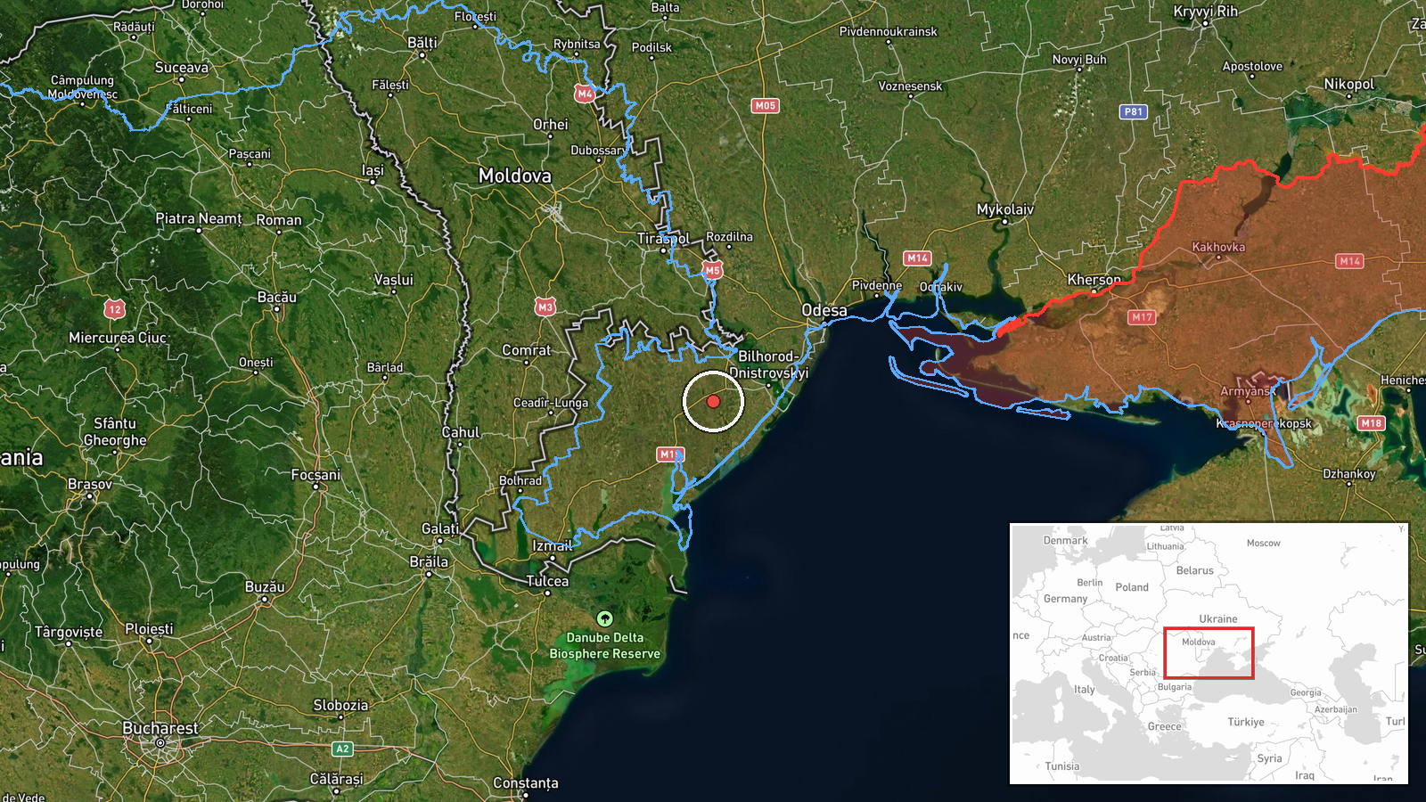
The strike encompassed three oblasts: Odesa (southwestern Ukraine, on the Black Sea coast), Kyiv (central), and Kharkiv (northeastern). Odesa Oblast is home to Ukraine's primary seaports and has faced repeated drone and missile strikes. Izmail district in Odesa saw drone transit activity hours before the main attack. Regional precision rather than specific facility coordinates reflects available data.
Related events nearby
- One reactive/jet-propelled Shahed-variant 'Banderoль' (courier) drone detected in transit over Odesa Oblast, h2026-09-06 12:58 UTC · Drone Transit · Odesa Oblast, Ukraine
- One ballistic missile (reactive/jet-propelled UAV) struck Odesa city. No immediate casualty or damage reports 2026-09-06 09:27 UTC · UAS Strike · Odesa, Odesa Oblast, Ukraine
- Russian forces struck two logistics centers in Odesa with missiles. No casualty figures reported in initial as2026-09-06 15:52 UTC · Ballistic Missile · Odesa, Odesa Oblast, Ukraine
- Two reactive/jet-propelled UAVs (Shahed-variant 'Banderoль' drones) detected in transit over Berezivskyi Distr2026-09-06 12:52 UTC · Drone Transit · Berezivskyi District, Odesa Oblast, Ukraine
▶ View this event on the live map
Intel Mapper aggregates open-source reports from monitored Telegram and X channels, geolocates them, cross-checks duplicates across sources and assigns a confidence score. Entries are updated as new confirmations arrive. Read how we verify events.