Russian Shahed drones tracked transiting Cherkasy Oblast toward Kyiv
What happened
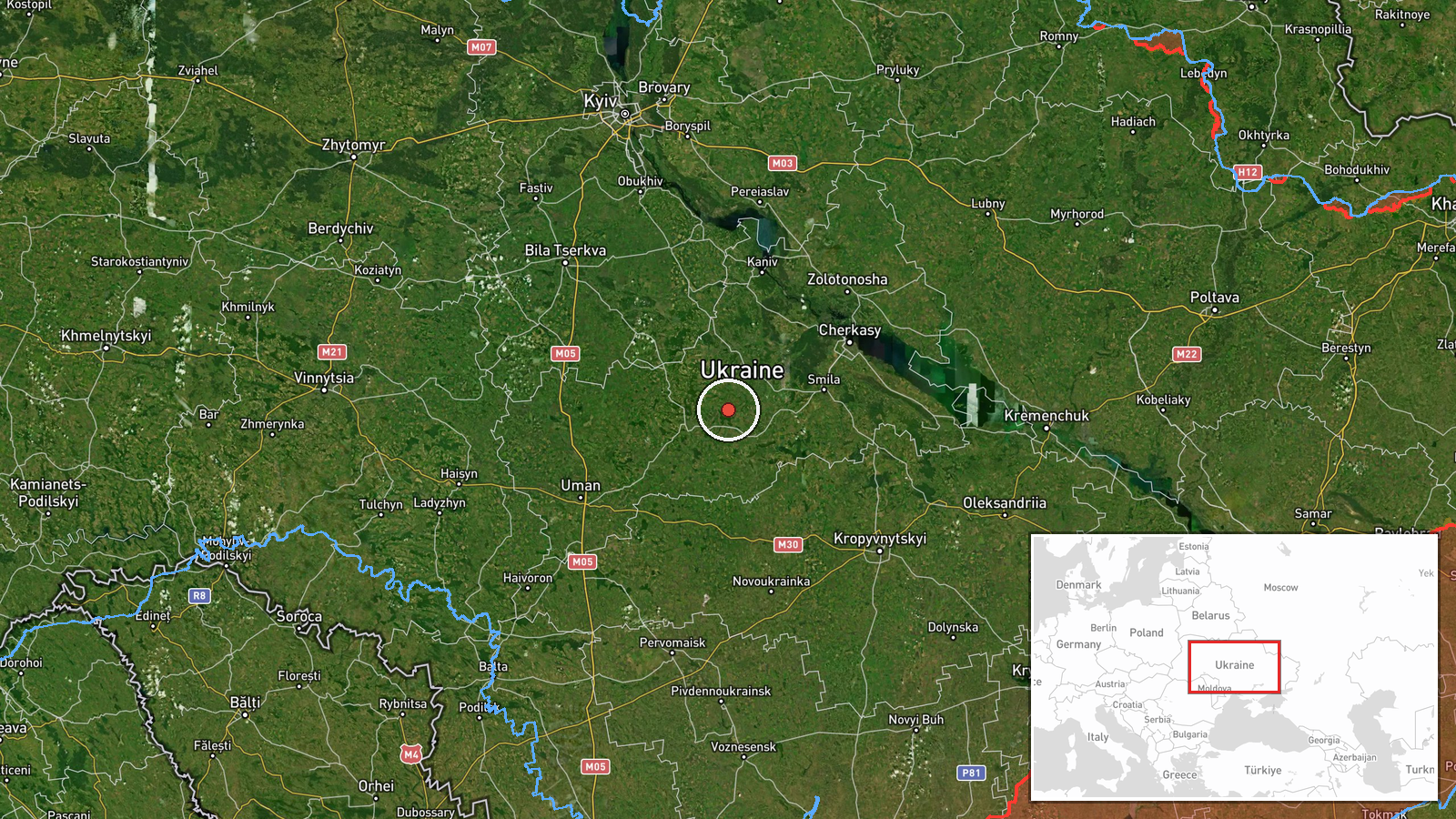
Two Russian jet-powered Shahed drones were detected flying over Cherkasy Oblast in a direction consistent with movement toward Kyiv region on the evening of 7 September 2026. The transit was monitored as part of ongoing overnight air defense tracking. The drones' specific origin point and intended target remain unclear from available reporting, though the reported flight path suggests a northwestward trajectory toward the capital region.
Context and assessment
Cherkasy Oblast sits roughly 150 kilometers south of Kyiv and has served as a transit corridor for Russian unmanned aircraft targeting the capital throughout the conflict. This sighting fits a documented pattern of overnight drone operations against Kyiv, with multiple vectors reportedly tracked in the preceding hours. The use of jet-powered Shahed drones indicates an effort to penetrate air defenses with faster platforms than older turboprop variants. Such transit reports suggest Russia maintains regular pressure on Kyiv's airspace despite Ukrainian air defense operations.
Sources and confidence
Reported by the Telegram channel @war_monitor, which specializes in real-time Ukrainian military situation updates. Single source reporting limits independent cross-confirmation. Confidence level of 6.0 reflects typical reliability of this monitoring channel but notes absence of corroborating Ukrainian official statements in available data. Ukrainian General Staff operational briefings would raise confidence if issued separately.
Location
Cherkasy Oblast, a region in central Ukraine approximately 150 kilometers south of Kyiv. The reference point near Drabiv indicates the detection occurred in the southern part of the oblast. The locale reflects a common approach corridor for Russian unmanned aircraft transiting from southern launching areas toward the capital region.
Related events nearby
- Russian Shahed-136 kamikaze drones detected transiting Kyiv Oblast. One drone tracked toward Krukivshchyna, on2026-09-08 16:34 UTC · Drone Transit · Kyiv Oblast, Ukraine
- Ukrainian air-raid monitoring detected 3 groups of Russian cruise missiles transiting toward Kyiv Oblast with 2026-09-08 02:04 UTC · Cruise Missile · Kyiv Oblast, Ukraine
- Ukrainian air-raid alert monitoring system reports all-clear signal (threat repeal) for Kyiv region after ball2026-09-07 23:25 UTC · Siren · Kyiv Oblast, Ukraine
- Russian jet-powered Shahed drones detected in transit over Kyiv and Vinnytsia oblasts overnight. Additional la2026-09-07 17:26 UTC · Drone Transit · Kyiv Oblast, Ukraine
- President Zelensky appeals to the United States for ballistic missile air-defense packages to strengthen Ukrai2026-09-08 14:47 UTC · Statement · Kyiv, Kyiv Oblast, Ukraine
▶ View this event on the live map
Intel Mapper aggregates open-source reports from monitored Telegram and X channels, geolocates them, cross-checks duplicates across sources and assigns a confidence score. Entries are updated as new confirmations arrive. Read how we verify events.