Two Russian Shahed drones transit over Bila Tserkva in Kyiv Oblast
What happened
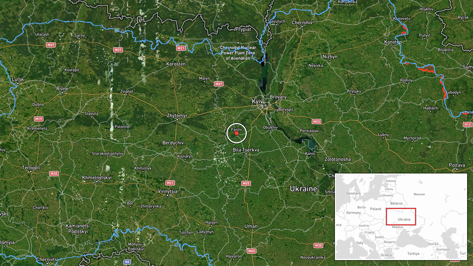
Two Russian reactive jet-powered Shahed-variant unmanned aerial vehicles were observed transiting over Bila Tserkva in Kyiv Oblast on September 16 at approximately 14:48 UTC. Ukrainian air raid alert systems were activated in response to the drone passage. According to the report from Telegram channel @war_monitor, no impact or interception was confirmed at the time of reporting. The drones were tracked as they moved through the airspace above the settlement.
Context and assessment
Bila Tserkva lies approximately 80 kilometers south of Kyiv and serves as a significant urban center in the region. The observation of reactive Shahed variants transiting the area reflects ongoing Russian aerial operations targeting Ukrainian territory. This incident follows a similar drone transit over nearby Makariv on September 15, suggesting a pattern of Russian reconnaissance or strike missions probing defenses in Kyiv Oblast. The frequency of such transits may indicate either targeting preparation or attempts to overwhelm air defense networks through multiple simultaneous or sequential incursions across the region.
Sources and confidence
Report sourced from single Telegram channel (@war_monitor) with no cross-confirmation from other monitoring channels noted. Confidence score of 6.0 reflects limited source redundancy. Elevation would require corroboration from additional open-source monitoring accounts or official Ukrainian air force statements. The absence of impact confirmation slightly reduces but does not eliminate credibility, as transits are routinely documented before engagement.
Location
Bila Tserkva identified at settlement precision in Kyiv Oblast, located approximately 80 kilometers south of Ukraine's capital. The settlement sits along the Ros River in the southwestern portion of the oblast. Geographic setting places it on a likely air corridor connecting Crimean and Russian launch sites to targets deeper within Ukrainian territory, making it a typical transit zone for Russian aerial operations.
Related events nearby
- One Russian reactive (jet-powered Shahed-variant) drone spotted transiting over Makariv, Kyiv Oblast. Ukrainia2026-09-15 16:24 UTC · Drone Transit · Makariv, Kyiv Oblast, Ukraine
- Ukrainian air defense alert: suspected ballistic missile (Iskander/S-400) launch or S-300 air defense activity2026-09-15 19:14 UTC · Siren · Kyiv, Ukraine
- President Zelensky declares Ukraine will continue striking Russian oil infrastructure, estimating annual costs2026-09-16 09:47 UTC · Statement · Kyiv, Ukraine
- Ukrainian President Zelensky warns Putin that stopping the war now would not constitute victory and suggests P2026-09-16 07:03 UTC · Statement · Kyiv, Ukraine
- Ukrainian Armed Forces General Staff honors emergency rescue workers (DESNZ) killed protecting civilians under2026-09-16 04:34 UTC · Statement · Kyiv, Ukraine
▶ View this event on the live map
Intel Mapper aggregates open-source reports from monitored Telegram and X channels, geolocates them, cross-checks duplicates across sources and assigns a confidence score. Entries are updated as new confirmations arrive. Read how we verify events.