Russian Shahed drone detected in transit toward Kropyvnytskyi
What happened
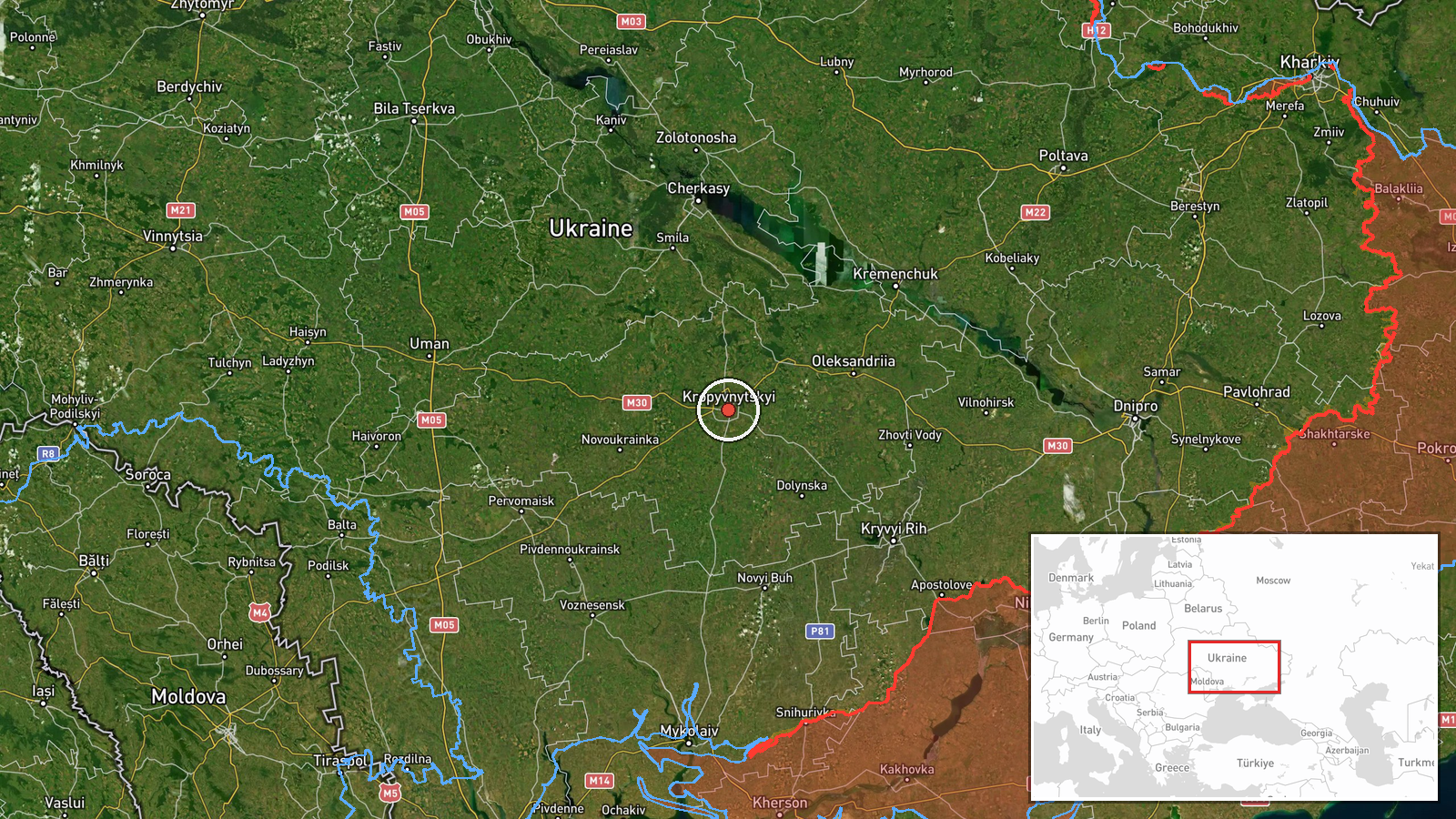
Ukrainian air monitoring reported one Russian Shahed-class jet-powered unmanned aerial vehicle in transit toward Kropyvnytskyi, Kirovohrad Oblast, approaching from the east on 19 September at approximately 03:55 UTC. The report was issued by the Telegram channel @war_monitor. No immediate impact or interception was specified in the available information.
Context and assessment
Kropyvnytskyi, a major industrial and administrative center in central Ukraine, has been an occasional target of Russian drone operations. This detection occurs within a broader pattern of Russian Shahed drone activity across central and southern Ukraine on 18–19 September, with simultaneous or near-concurrent transits reported toward Novyi Buh (Mykolaiv Oblast), Cherkasy, and Kremenchuk. The eastward approach and concentration of reactive drone flights across multiple axes suggests a coordinated campaign targeting infrastructure or military positions across a wide geographic area. Shahed drones, particularly the Shahed-136 variant, are cruise-type weapons typically employed against stationary targets including power plants, ammunition depots, and logistics hubs.
Sources and confidence
Single source: Telegram channel @war_monitor, identified as Ukrainian air defense monitoring. No cross-confirmation from independent sources or official Ukrainian military statements is noted. Confidence score of 6.0 reflects reliance on a single reporting channel; confirmation from additional sources or official air force statements would substantially increase confidence.
Location
Kropyvnytskyi, the administrative center of Kirovohrad Oblast in south-central Ukraine (48.51°N, 32.26°E). The city lies approximately 320 km southeast of Kyiv and serves as a major regional transport and industrial hub. The drone's approach direction was from the east, consistent with launch zones in Russian-controlled or contested territory to the southeast.
Related events nearby
- Ukrainian air defense monitoring detected 10 Russian reactive (jet-powered Shahed-136 variant) drones in trans2026-09-18 20:06 UTC · Drone Transit · Novyi Buh, Mykolaiv Oblast, Ukraine
- Ukrainian air defense monitoring detected multiple Russian reactive (jet-powered Shahed-136) drones in transit2026-09-18 17:41 UTC · Drone Transit · Cherkasy, Cherkasy Oblast, Ukraine
- Five Russian reactive (jet-powered Shahed-136) drones detected transiting eastward through Poltava Oblast (Pav2026-09-18 14:12 UTC · Drone Transit · Kremenchuk, Poltava Oblast, Ukraine
▶ View this event on the live map
Intel Mapper aggregates open-source reports from monitored Telegram and X channels, geolocates them, cross-checks duplicates across sources and assigns a confidence score. Entries are updated as new confirmations arrive. Read how we verify events.