Russian Shahed drone detected transiting over Cherkasy Oblast
What happened
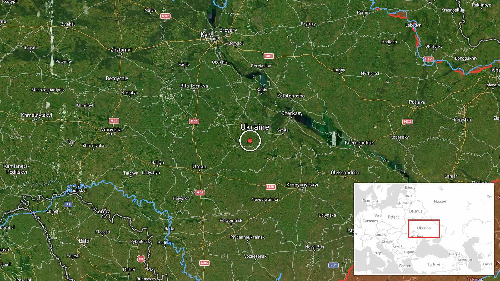
Ukrainian air monitoring reported one Russian Shahed-type reactive (jet-powered) unmanned aerial vehicle in transit over Cherkasy Oblast on 20 September at 00:21 UTC. The detection occurred near Smila, a city in the central region. The report indicates the drone was moving through the airspace; Ukrainian air alert systems remained active during the detection window.
Context and assessment
Cherkasy Oblast lies in central Ukraine along the Dnieper River corridor, a key transport and targeting axis for Russian drone operations. This detection follows a sustained pattern of Shahed transits across central Ukrainian airspace on 19–20 September, including simultaneous sightings over Kyiv Oblast, Kirovohrad Oblast, and confirmed strikes near Fastiv that killed three civilians. The concentration of drone activity over this region suggests either coordinated multi-axis operations, targeting of infrastructure, or transits toward western objectives. Such persistent activity indicates continued Russian reliance on attrition-capable drone swarms.
Sources and confidence
Reported by Telegram channel @war_monitor on 20 September 00:21 UTC. Single-source detection with no cross-confirmation in provided data. Confidence score of 6.0 reflects active Ukrainian air monitoring infrastructure and consistent reporting patterns across related events the same night, but single-channel attribution limits verification. Additional independent confirmation from Ukrainian military or radar data would raise confidence; absence of strike reports would lower it if the drone was intercepted.
Location
Detection geolocation placed in Cherkasy Oblast near Smila (49.15°N, 31.23°E), a city on the Tysmianica River in central Ukraine. The region lies roughly 180 km south-southeast of Kyiv and represents the southern extent of recent drone transits over central Ukraine. Geo-precision is regional rather than precise, consistent with air-monitoring reporting conventions.
Related events nearby
- One Russian Shahed-class reactive (jet-powered) UAV detected in transit toward Kropyvnytskyi city and surround2026-09-19 03:55 UTC · Drone Transit · Kropyvnytskyi, Kirovohrad Oblast, Ukraine
- Russian drone attack on Fastiv district killed three civilians—mother and two children. Private houses damaged2026-09-19 19:20 UTC · UAS Strike · Fastiv, Kyiv Oblast, Ukraine
▶ View this event on the live map
Intel Mapper aggregates open-source reports from monitored Telegram and X channels, geolocates them, cross-checks duplicates across sources and assigns a confidence score. Entries are updated as new confirmations arrive. Read how we verify events.