Russian Shahed drones tracked transiting from Donetsk toward Poltava Oblast
What happened
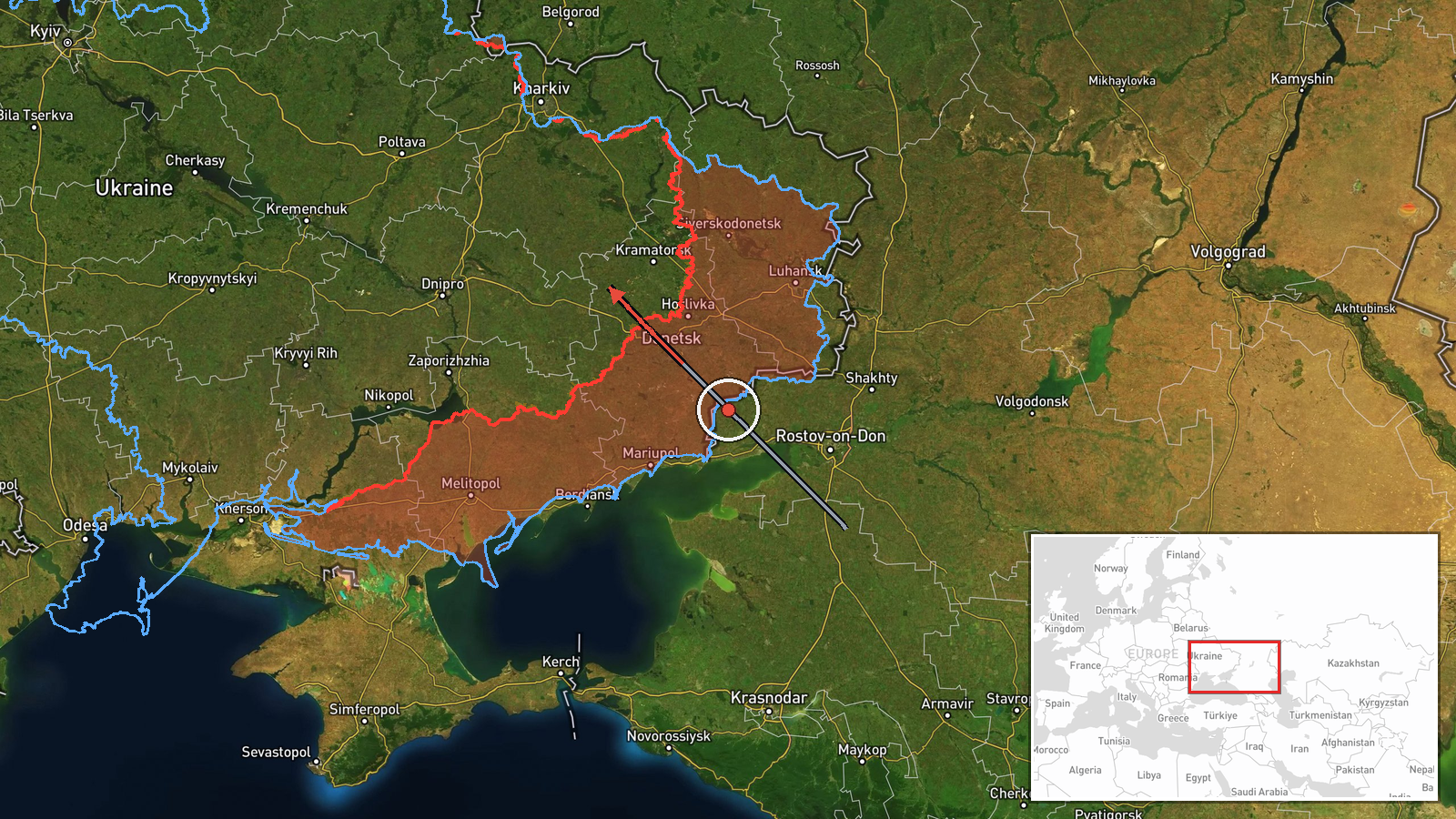
Two Russian jet-propelled reconnaissance drones of Shahed-class type were detected in transit on September 21 at 16:47 UTC, originating from Donetsk Oblast and passing via Kremenchuk airspace in the direction of Globine in Poltava Oblast. The report was posted to Telegram by @war_monitor, a Ukrainian military monitoring channel. The drones' intended final destination and any subsequent strike activity remain unreported in available sources.
Context and assessment
Poltava Oblast, located in central Ukraine roughly 450 kilometers from the front lines, has become an increasingly frequent target for Russian drone operations in recent months. The routing through Kremenchuk—a major transportation and industrial hub on the Dnieper River—suggests the drones may have been targeting infrastructure or military assets in or near Poltava proper. This transit aligns with a broader pattern observed on September 21 alone: Ukrainian air defense tracked multiple Russian drone batches, including three Shahed-type drones detected north of Pavlohrad earlier that day. The General Staff reported 10,237 kamikaze drone launches over the entire conflict. Such reconnaissance and strike sorties typically precede or accompany air defense saturation attacks.
Sources and confidence
Single-source report from Telegram channel @war_monitor, a Ukrainian open-source military monitor with regular reporting on drone and artillery activity. No cross-confirmation from official Ukrainian General Staff channels or independent verification is noted. Confidence score of 6.0 reflects the single source and low geographic precision (regional rather than facility-specific). Confirmation from air alert systems or damage reports would raise confidence; independent visual or radar verification would strengthen the assessment.
Location
Transit route determined at regional level: origin in Donetsk Oblast (Russian-occupied, eastern Ukraine); route passing through Kremenchuk (major city on the Dnieper River in central Ukraine, Poltava Oblast); destination direction toward Globine, a town in northwestern Poltava Oblast. The broader region lies in central Ukraine's industrial heartland, approximately 450 km west of active front-line positions.
Related events nearby
- Three Russian Shahed-type reactive (jet-powered) kamikaze drones detected in transit north of Pavlohrad, Dnipr2026-09-21 00:04 UTC · Drone Transit · Pavlohrad, Dnipropetrovsk Oblast, Ukraine
- Ukrainian General Staff reports 1,671st day of war: 238 combat engagements, 91 airstrikes (295 guided bombs), 2026-09-21 05:06 UTC · Report · Ukraine
- Ukrainian FPV quadcopter drone attacked Russian motorcycle-mounted soldiers; one soldier wounded. Drone did no2026-09-21 01:00 UTC · UAS Strike · Bakhmut, Donetsk Oblast, Ukraine
- Ukrainian forces struck a Russian UAV command post (pункт управління БпЛА) near the Dniproenergia power plant 2026-09-21 09:23 UTC · UAS Strike · Dniproenergia Power Plant, Donetsk Oblast, Ukraine
▶ View this event on the live map
Intel Mapper aggregates open-source reports from monitored Telegram and X channels, geolocates them, cross-checks duplicates across sources and assigns a confidence score. Entries are updated as new confirmations arrive. Read how we verify events.