Russian Shahed drones transit Chornobyl zone and approach Kyiv region
What happened
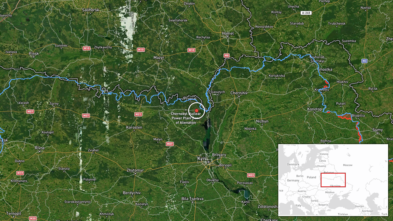
Russian Shahed-type reactive drones were tracked transiting over Kyiv Oblast on 23 September at 13:38 UTC. According to the Telegram channel @war_monitor, two drones passed near the Chornobyl Exclusion Zone while a third was detected in the vicinity of Kaniv. An air alert was issued across the region. The drones were reportedly jet-motorized variants capable of sustained flight, consistent with previous Russian drone operations in the corridor.
Context and assessment
This transit occurred during an intensive drone operation spanning the morning and early afternoon of 23 September, with at least five separate Shahed-type sightings reported across Kyiv Oblast and Chernihiv Oblast. The aircraft approached from Bryansk Oblast, Russia, following a pattern of strikes and reconnaissance flights over the capital region. The Chornobyl Exclusion Zone and the Kaniv area lie on direct routes toward Kyiv city; earlier the same day, a drone was tracked over Nivki district in central Kyiv at high altitude. The frequency and persistence of these transits suggest either sustained pressure against civilian infrastructure or preparation for larger-scale operations.
Sources and confidence
Single source: Telegram channel @war_monitor, which has provided consistent real-time air defense and drone tracking data throughout 23 September. Cross-confirmation exists via related Shahed transits reported in the same timeframe over nearby locations (Slavutych, Kurenivka, Kyiv Oblast). Confidence score of 6.0 reflects the single-channel report and regional-level location precision; score would rise with independent confirmation from Ukrainian air force statements or multiple independent channels.
Location
The Chornobyl Exclusion Zone is located approximately 130 km north of Kyiv city, centered near coordinates 51.27°N, 30.22°E. Kaniv lies roughly 110 km south of the capital on the Dnieper River. Both settlements mark transit corridors commonly used by Russian drones approaching Kyiv from the north and northeast. The exclusion zone's status as restricted airspace makes drone activity there tactically and operationally significant.
Related events nearby
- Three Russian Shahed-136 reactive (jet-motorized) kamikaze drones detected in transit from Bryansk Oblast, Rus2026-09-23 04:14 UTC · Drone Transit · Slavutych, Chornobyl Raion, Kyiv Oblast, Ukraine
- Two Russian Shahed-type (reactive) drones transited from Bryansk Oblast toward Slavutych, Chernihiv Oblast. Ai2026-09-23 13:11 UTC · Drone Transit · Slavutych, Chernihiv Oblast, Ukraine
- Russian Shahed-type reactive drone transited over Nivki district, Kyiv at high altitude. Air alert issued for 2026-09-23 13:32 UTC · Drone Transit · Kurenivka, Kyiv, Ukraine
- Air raid alert issued in Kyiv region, with sirens activated in Sireć and Kryukivshchyna areas. High alert stat2026-09-23 11:14 UTC · Siren · Sireć, Kyiv Oblast, Ukraine
- One Russian Shahed-type (reaktiv) drone departed Slavutych and transited toward Kyiv region at low altitude. M2026-09-23 11:58 UTC · Drone Transit · Kyiv Oblast, Ukraine
▶ View this event on the live map
Intel Mapper aggregates open-source reports from monitored Telegram and X channels, geolocates them, cross-checks duplicates across sources and assigns a confidence score. Entries are updated as new confirmations arrive. Read how we verify events.