Two Russian Shahed drones tracked transiting from Vinnytsia toward Khmelnytskyi Oblast
What happened
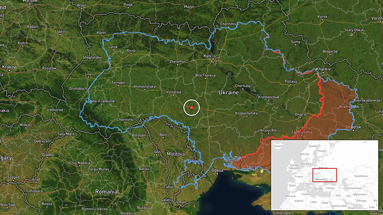
Ukrainian air monitoring on 24 September at 03:37 UTC detected two Russian Shahed-variant unmanned aerial vehicles (UAVs) equipped with jet engines transiting southward from Haysin in Vinnytsia Oblast toward Khmelnytskyi Oblast. The drones were in flight at the time of detection. No strike or engagement outcome was reported in the monitoring data.
Context and assessment
This transit aligns with an intensifying pattern of Russian drone activity across central Ukraine on 24 September. Related detections the same day tracked additional Shahed variants over Cherkasy and Vinnytsia Oblasts, and a separate drone routing from Vinnytsia toward Khmelnytskyi at 01:59 UTC. The southern trajectory toward Khmelnytskyi Oblast suggests possible targeting of industrial or administrative infrastructure in that region, though Russian drone operations increasingly span multiple routes across central Ukraine. The use of jet-engined Shaheds indicates longer-range penetration capability compared to earlier variants.
Sources and confidence
Reported by Telegram channel @war_monitor, which aggregates Ukrainian official air-monitoring data. Single-source detection with low location confidence (regional rather than point-specific). Confidence score of 6.0 reflects the inherent uncertainty in pin-pointing UAV position from monitoring reports, but the report aligns temporally and geographically with corroborating detections of Russian drone activity in the same region within minutes.
Location
Haysin is a town in Vinnytsia Oblast in central Ukraine, roughly 180 kilometres south-southwest of Kyiv. The reported southern vector indicates movement toward Khmelnytskyi Oblast, situated immediately south of Vinnytsia. Geographic precision is regional rather than exact due to single-source reporting.
Related events nearby
- Ukrainian air monitoring reports 2 Russian reactive (jet-engined) Shahed variant UAVs transiting over Vinnytsi2026-09-24 02:37 UTC · Drone Transit · Vinnytsia Oblast, Ukraine
- Ukrainian air monitoring detected one Russian reactive (jet-engined) Shahed variant UAV transiting over Smila 2026-09-23 17:07 UTC · Drone Transit · Uman, Cherkasy Oblast, Ukraine
- Ukrainian air monitoring reports 1 Russian reactive (jet-engined) Shahed variant UAV transiting from Vinnytsia2026-09-24 01:59 UTC · Drone Transit · Vovkovyntsi, Khmelnytskyi Oblast, Ukraine
- Ukrainian air monitoring reports 3 Russian reactive (jet-engined) Shahed variant UAVs transiting over Cherkasy2026-09-24 02:37 UTC · Drone Transit · Cherkasy Oblast, Ukraine
- Ukrainian air monitoring detected 1 Russian reactive (jet-engined) Shahed-variant UAV transiting over Novodnis2026-09-24 03:31 UTC · Drone Transit · Novodnistrovsk, Chernivtsi Oblast, Ukraine
▶ View this event on the live map
Intel Mapper aggregates open-source reports from monitored Telegram and X channels, geolocates them, cross-checks duplicates across sources and assigns a confidence score. Entries are updated as new confirmations arrive. Read how we verify events.