Russian Shahed drone tracked over Kyiv at 4 km altitude in massed attack
What happened
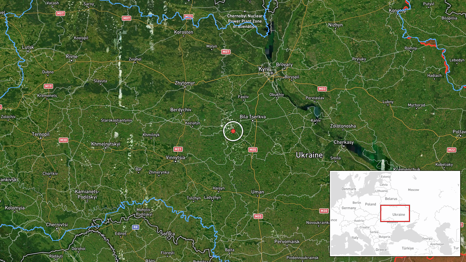
A Russian Shahed-type jet-propelled kamikaze drone was detected transiting through Shuliaivka in Kyiv district on 25 September at 18:23 UTC, flying at 4 kilometres altitude. The detection was part of a broader massed Russian drone attack on Kyiv reported by monitoring channels. The drone was tracked in transit rather than at point of impact or interception.
Context and assessment
Shuliaivka lies in northwestern Kyiv district, part of the densely populated Ukrainian capital that has faced repeated Russian drone campaigns throughout 2026. This transit detection occurred amid a sustained wave of Shahed strikes, including a strike on a 16-storey residential building in Pecherskyi District hours earlier that killed a 14-year-old. Multiple Shahed transits were tracked across Kyiv and Kyiv Oblast on 25 September—over Vasylkiv, Telichka, and Krukovshchyna—suggesting a coordinated, multi-vector attack. Such operational patterns indicate Russian intent to saturate air defences across a wide area and strike multiple targets simultaneously.
Sources and confidence
Reported by Telegram channel @war_monitor, a single source. No cross-confirmation in available data. The moderate confidence score (6.0/10) reflects single-source attribution; confidence could be raised by corroboration from Ukrainian air force or SBU channels, or lowered if the detection cannot be independently verified against other monitoring networks.
Location
Shuliaivka is a settlement in Kyiv district in the northwest of the capital, approximately 10 km from central Kyiv. The settlement sits on relatively open terrain north of the Dnieper River. Coordinates place it on the standard approach vector used by Russian long-range drone campaigns targeting Kyiv from the northeast and north.
Related events nearby
- Russian Shahed-type reactive (jet-propelled) kamikaze drone tracked transiting over Krukovshchyna, Kyiv at 2.82026-09-25 18:29 UTC · Drone Transit · Krukovshchyna, Kyiv, Ukraine
- Russian Shahed-type kamikaze drone detected transiting through Vasylkiv in Kyiv Oblast, tracked en route from 2026-09-25 17:11 UTC · Drone Transit · Vasylkiv, Kyiv Oblast, Ukraine
- One reactive (jet-powered) Shahed-136 variant drone detected transiting at altitude over Obolonski District (Х2026-09-25 00:16 UTC · Drone Transit · Telichka, Kyiv Oblast, Ukraine
- Russian Shahed-136 drone struck a 16-story residential building in Pecherskyi District, Kyiv at approximately 2026-09-25 06:31 UTC · UAS Strike · Pecherskyi District, Kyiv, Ukraine
- Ukrainian intelligence indicates preparations for a major strike campaign using drones and missiles against Ru2026-09-25 17:53 UTC · Statement · Kyiv, Ukraine
▶ View this event on the live map
Intel Mapper aggregates open-source reports from monitored Telegram and X channels, geolocates them, cross-checks duplicates across sources and assigns a confidence score. Entries are updated as new confirmations arrive. Read how we verify events.