Russian drone transits through Poltava Oblast toward Kyiv region
What happened
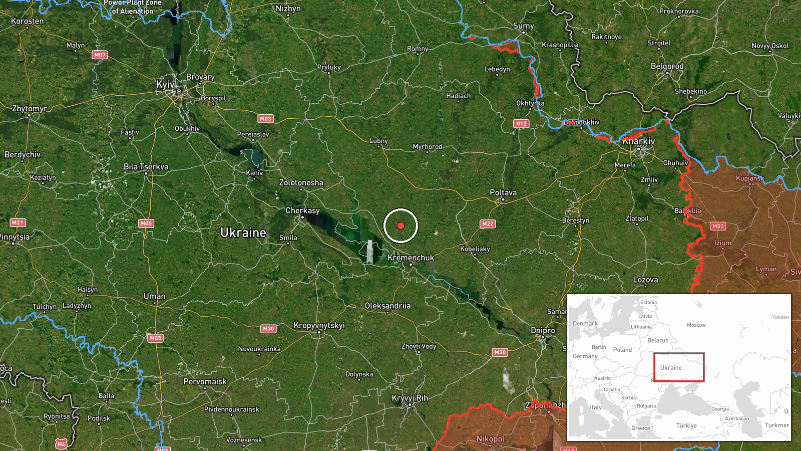
A Russian jet-propelled drone, reportedly a Shahed or similar reactive-propelled system, was tracked transiting the Globyne area of Poltava Oblast on a course toward Kyiv region on 26 September at 18:53 UTC. The report indicates this was part of an ongoing Russian aerial reconnaissance and attack wave targeting central Ukraine. The original Ukrainian-language report, posted to Telegram, uses the term 'closest reactive' (nearest jet-propelled drone) in reference to the tracked asset.
Context and assessment
Globyne sits in central Poltava Oblast, approximately 140 kilometers south of Kyiv, positioning it along a common transit corridor for Russian air operations targeting the capital and surrounding regions. The persistent use of long-range drones and cruise missiles against Kyiv and central Ukraine has been a defining feature of Russian air strategy throughout the conflict, with waves typically occurring multiple times weekly. Such transit reports, often provided by Ukrainian air defense monitors in near-real time, serve to alert both civilian and military audiences to incoming threats. The specific mention of drone reconnaissance paired with attack capability suggests Russian operational intent to conduct both surveillance and strikes during this sortie.
Sources and confidence
Report originates from @war_monitor on Telegram, a Ukrainian open-source monitoring channel tracking Russian air activity. Single-source reporting limits independent corroboration; confidence score of 6.0 reflects plausible claim consistent with documented Russian operational patterns but absence of cross-confirmation. Score would increase with reports from additional independent monitors or official Ukrainian air defense statements; would decrease if subsequent all-clear signals contradict the sighting.
Location
Globyne is a settlement in Poltava Oblast, central-eastern Ukraine, located at approximately 49.38°N, 33.28°E. The region is a historically industrial and agricultural area situated roughly midway between Russian-held territory to the southeast and Kyiv to the northwest. Poltava city lies approximately 30 kilometers to the east; the settlement marks a typical vector for drone transits heading toward the capital region.
Related events nearby
- Russia released footage of Ukrainian kamikaze drones being shot down. The video evidence demonstrates air defe2026-09-26 19:40 UTC · Drone Shootdown · Kyiv, Ukraine
- Ukrainian FPV-kamikaze drones targeted Russian soldiers. Video evidence released showing attack on Russian mil2026-09-26 19:00 UTC · UAS Strike · Kyiv, Ukraine
▶ View this event on the live map
Intel Mapper aggregates open-source reports from monitored Telegram and X channels, geolocates them, cross-checks duplicates across sources and assigns a confidence score. Entries are updated as new confirmations arrive. Read how we verify events.