Russian drone transits over Kyiv region in ongoing aerial reconnaissance
What happened
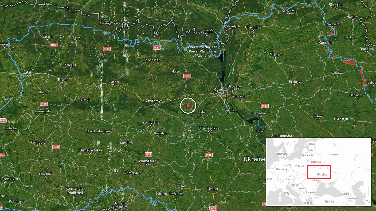
A Russian Shahed or reactive jet-propelled drone was detected transiting over the Kruikivshchyna area of Kyiv region on 26 September at 19:43 UTC, according to Telegram channel @war_monitor. The drone was operating as part of continuing Russian aerial reconnaissance activities over the Ukrainian capital region. No strike or engagement was reported in connection with this transit.
Context and assessment
The Kyiv region has faced sustained Russian drone operations throughout September 2026. This transit occurred amid a broader pattern of reconnaissance flights detected the same day over multiple settlements including Borodyanky, Lisnyky, and central Kyiv districts, typically at varying altitudes between 3.8 and high altitude. Ukrainian military intelligence warned on 26 September evening of Russian preparations for a combined missile attack expected on the night of 27 September, involving ballistic and cruise missiles. Repeated drone transits over populated areas often precede such strikes or serve to probe air defences, suggesting this activity may be connected to larger planned operations.
Sources and confidence
Reported by Telegram channel @war_monitor only, with no cross-confirmation from other open sources. Single-source reporting results in a moderate confidence score of 6.0. Confirmation from additional Ukrainian military or civilian channels, or visual/signal intelligence corroboration, would strengthen confidence. Retraction or contradictory reports would lower it.
Location
Kruikivshchyna is a settlement northwest of central Kyiv, located at approximately 50.24°N, 29.57°E in Kyiv region. The area lies in the suburban ring surrounding the capital, near Tarasivka. The settlement sits roughly 25 km northwest of Kyiv's city centre, in relatively flat terrain typical of central Ukrainian geography.
Related events nearby
- Russian Shahed-136 reactive (jet-propelled) kamikaze drone detected transiting toward Moshchun, Kyiv Oblast. O2026-09-26 00:17 UTC · Drone Transit · Borodyanky, Kyiv Oblast, Ukraine
- Two Russian Shahed-136 reactive kamikaze drones detected transiting over Borschahivka (4 km altitude) and Chab2026-09-26 04:54 UTC · Drone Transit · Lisnyky, Kyiv Oblast, Ukraine
- One Russian Shahed-136 reactive (jet-propelled) kamikaze drone detected transiting over Pankivshchyna/Nova Zab2026-09-26 02:14 UTC · Drone Transit · Pankivshchyna/Nova Zabudova, Kyiv, Ukraine
- Ukrainian President Zelenskyy states that according to intelligence reports, Putin plans to expand the war in 2026-09-26 18:29 UTC · Statement · Kyiv, Ukraine
- Ukrainian military intelligence warns of Russian preparations for a combined missile attack on the night of 272026-09-26 18:25 UTC · Report · Kyiv, Ukraine
▶ View this event on the live map
Intel Mapper aggregates open-source reports from monitored Telegram and X channels, geolocates them, cross-checks duplicates across sources and assigns a confidence score. Entries are updated as new confirmations arrive. Read how we verify events.