Russian Shahed drone strikes Zhytomyr city in overnight attack
What happened
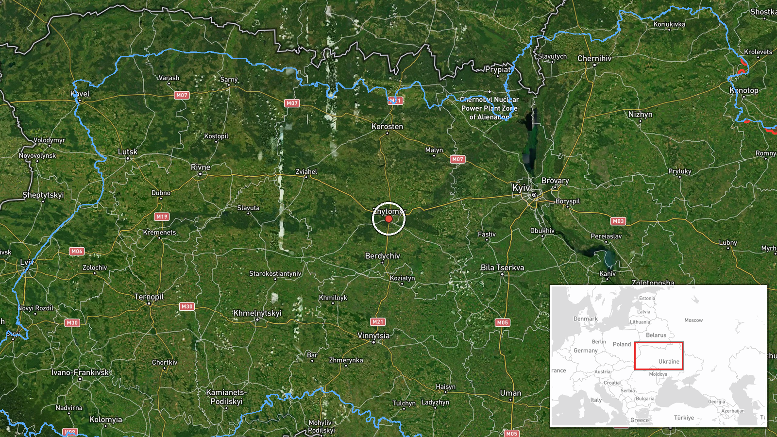
A Russian Shahed reactive drone struck Zhytomyr city in Zhytomyr Oblast on the night of 27 September at approximately 00:41 UTC, according to Telegram channel @war_monitor. The attack occurred as part of an ongoing Russian aerial campaign targeting Ukrainian population centers. Zhytomyr lies roughly 140 kilometers west of Kyiv and is a significant regional administrative and industrial hub. The single-source report does not specify damage or casualties.
Context and assessment
Zhytomyr has been subjected to recurring Russian drone and missile attacks throughout the conflict as a medium-sized city within operational range of Russian launch sites. The strike follows a pattern of sustained Russian aerial operations detected across Kyiv and Zhytomyr oblasts over 26–27 September, including multiple Shahed transits observed over Kyiv Oblast and air raid alerts in Kyiv itself. These drone waves typically represent efforts to overwhelm Ukrainian air defenses, degrade civilian morale, and strike infrastructure. The concentration of reported drone activity across multiple oblasts suggests a coordinated multi-directional campaign rather than isolated incidents, consistent with Russian tactics of distributed attacks to disperse Ukrainian response capacity.
Sources and confidence
The report originates from a single Telegram channel, @war_monitor, with no cross-confirmation from other open-source monitors or official Ukrainian sources documented in the provided data. Confidence is moderate (6.0/10) due to single-source reporting. Corroboration from additional monitoring channels, official SBU or DSNS statements, or satellite imagery would raise confidence. Absence of damage assessment or any secondary confirmation lowers reliability pending additional reporting.
Location
Zhytomyr city is determined by regional-level precision (oblast). The city serves as the administrative center of Zhytomyr Oblast, located approximately 140 km west-northwest of Kyiv at coordinates 50.25521°N, 28.658428°E. The settlement is situated on the Teteriv River in northwestern Ukraine and functions as a major transport and industrial node linking central Ukraine to the west.
Related events nearby
- Russian Shahed/reactive (jet-propelled) drone transiting over Kruikivshchyna area in Kyiv region as part of on2026-09-26 19:43 UTC · Drone Transit · Kruikivshchyna, Kyiv, Ukraine
- One Russian Shahed/reactive (jet-propelled) drone detected transiting from Ivankiv in the direction of Hostome2026-09-26 22:43 UTC · Drone Transit · Ivankiv to Hostomel/Kyiv direction, Kyiv Oblast, U
- Two Russian Shahed/reactive (jet-propelled) UAVs detected transiting over Kyiv Oblast: one from Bila Tserkva t2026-09-26 20:45 UTC · Drone Transit ·
- Air raid siren alert activated in Shuliavka district, Kyiv, indicating incoming Russian drone/missile threat t2026-09-27 00:42 UTC · Siren · Shuliavka District, Kyiv, Ukraine
- Two Russian Shahed-136 reactive kamikaze drones detected transiting over Borschahivka (4 km altitude) and Chab2026-09-26 04:54 UTC · Drone Transit · Lisnyky, Kyiv Oblast, Ukraine
▶ View this event on the live map
Intel Mapper aggregates open-source reports from monitored Telegram and X channels, geolocates them, cross-checks duplicates across sources and assigns a confidence score. Entries are updated as new confirmations arrive. Read how we verify events.