Russian Shahed-variant UAVs detected transiting Brovary and Chornobyl zone
What happened
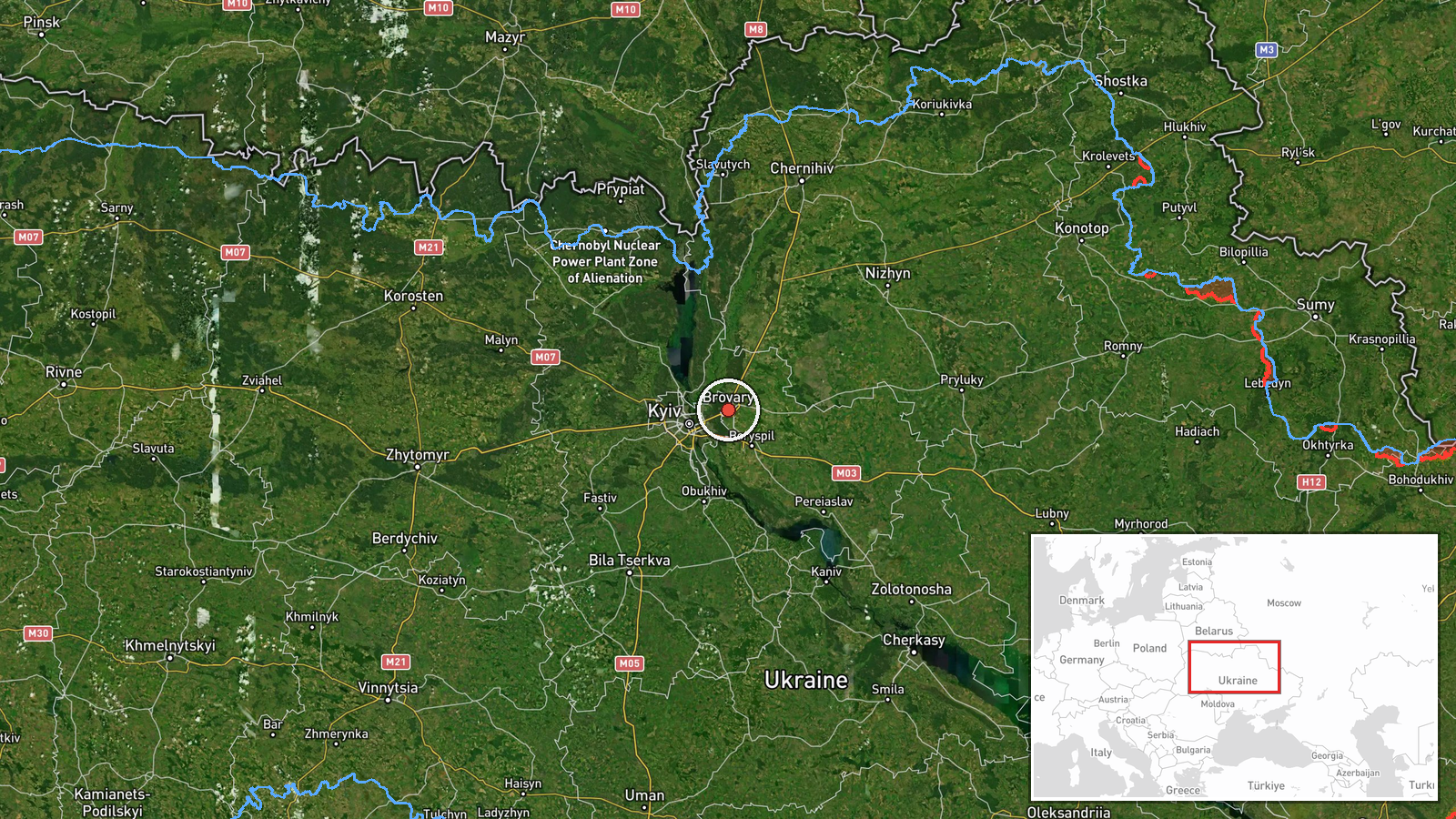
Ukrainian air monitoring detected two Russian reactive (jet-propelled) Shahed-variant unmanned aerial vehicles on 27 September around 13:00 UTC. One drone was observed in transit over Brovary district in Kyiv Oblast; a second was reported within the Chornobyl restricted zone. The report comes from the Telegram channel @war_monitor and describes drone transits rather than strikes or interceptions.
Context and assessment
These detections occur amid a sustained Russian campaign of aerial strikes against Kyiv and surrounding areas. On 26 September, massed attacks using Geran-4 and Geran-5 jet-propelled kamikaze drones struck multiple targets across the capital. Ukrainian military intelligence has warned of preparations for a combined missile attack planned for the night of 27 September, including ballistic and cruise missile threats. The Brovary district lies northeast of central Kyiv and has been regularly targeted. The Chornobyl detection suggests either reconnaissance activity or transit to other targets. Shahed-variant drones typically serve as reconnaissance platforms or loitering munitions; their presence in these zones indicates ongoing Russian aerial operations despite Ukrainian air defenses.
Sources and confidence
Single-source report from Telegram channel @war_monitor. Confidence score of 6.0 reflects unconfirmed status from one channel; no cross-confirmation from Ukrainian Air Force or other official sources is noted. Confidence would rise with corroboration from SBU, military statements, or multiple independent channels. It would lower if the drone detection is later contradicted or the source proves unreliable.
Location
Brovary district is located approximately 20 km northeast of central Kyiv in Kyiv Oblast, situated along major transit corridors. The Chornobyl restricted zone lies roughly 100 km north of Kyiv and encompasses the decommissioned nuclear power station and surrounding exclusion area. Geographic precision is regional rather than pinpoint; drones were likely detected via radar or other air-monitoring systems during transit.
Related events nearby
- One Russian Shahed/reactive (jet-propelled) drone detected transiting from Ivankiv in the direction of Hostome2026-09-26 22:43 UTC · Drone Transit · Ivankiv to Hostomel/Kyiv direction, Kyiv Oblast, U
- One Russian Shahed/reactive (jet-propelled) drone detected transiting from Nizhyn toward Kyiv region. Continua2026-09-26 19:32 UTC · Drone Transit · Kyiv Reservoir, Kyiv, Ukraine
- Three Russian reactive (jet-propelled Shahed) drones detected transiting over Chernihiv Oblast in the directio2026-09-27 03:52 UTC · Drone Transit · Desna River area toward Kipti, Chernihiv Oblast, U
- Russian reactive/jet-powered Shahed-variant UAV launched from Vorzel toward Kyiv at 6 km altitude. Single dron2026-09-27 12:51 UTC · UAS Strike · Vorzel, Kyiv Oblast, Ukraine
- Air raid siren activated in Shuliavka district, Kyiv, indicating incoming Russian drone/missile threat. Part o2026-09-27 00:42 UTC · Siren · Shuliavka District, Kyiv, Ukraine
▶ View this event on the live map
Intel Mapper aggregates open-source reports from monitored Telegram and X channels, geolocates them, cross-checks duplicates across sources and assigns a confidence score. Entries are updated as new confirmations arrive. Read how we verify events.