Russian Shahed drone detected transiting near Slavutych in northern Kyiv region
What happened
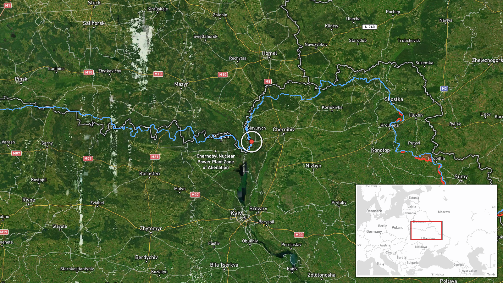
Ukrainian air monitoring detected one Russian jet-powered Shahed-variant unmanned aerial vehicle passing near Slavutych, Chernihiv Oblast, on 27 September at approximately 21:42 UTC. The drone was in transit, according to a report posted to the Telegram channel @war_monitor. This observation forms part of what Ukrainian sources describe as persistent Russian drone reconnaissance and transit operations across northern Ukraine.
Context and assessment
Slavutych sits within the broader northern Kyiv region, an area that has seen sustained Russian aerial activity in recent days. Related Ukrainian air monitoring reports from 27 September document multiple Shahed transits across Chernihiv and Kyiv oblasts, including operations near the Chornobyl Exclusion Zone, the Desna River corridor, and routes toward central Kyiv. The frequency of these single and multi-drone transits suggests Russian reconnaissance efforts to monitor Ukrainian defensive positions and infrastructure in the north, though specific tactical intent remains unclear. Such drone movements typically precede or accompany broader aerial campaigns.
Sources and confidence
Reported by a single Telegram channel (@war_monitor), which monitors Ukrainian air defense alerts. No cross-confirmation from other open-source channels is noted in available data. The confidence score of 6.0 reflects single-source reporting; confirmation from Ukrainian official statements or multiple independent monitors would strengthen assessment. Lack of visual or radar verification also limits confidence.
Location
Slavutych is located in Chernihiv Oblast approximately 50 km north-northeast of central Kyiv, near the Belarus border. The settlement lies outside the Chornobyl Exclusion Zone but in the wider region subject to Russian aerial activity. Geo-precision is regional; the exact drone altitude and specific heading are not provided.
Related events nearby
- Ukrainian air monitoring reports one Russian reactive (jet-powered) Shahed-variant UAV detected transiting ove2026-09-27 12:57 UTC · Drone Transit · Chornobyl Exclusion Zone, Kyiv Oblast, Ukraine
- Three Russian reactive (jet-propelled Shahed) drones detected transiting over Chernihiv Oblast in the directio2026-09-27 03:52 UTC · Drone Transit · Desna River area toward Kipti, Chernihiv Oblast, U
- Ukrainian air monitoring detected two Russian jet-powered Shahed-variant UAVs in transit toward Kyiv Oblast. P2026-09-27 16:22 UTC · Drone Transit · Kyiv Oblast, Ukraine
- Ukrainian air monitoring confirms two Russian jet-powered Shahed-variant UAVs detected transiting from Chernih2026-09-27 15:05 UTC · Drone Transit · Kyiv Oblast, Ukraine
- Two Russian Shahed/reactive (jet-propelled) drones detected transiting over Kyiv Oblast: one over Knyazhychi, 2026-09-27 00:15 UTC · Drone Transit · Kyiv Oblast, Ukraine
▶ View this event on the live map
Intel Mapper aggregates open-source reports from monitored Telegram and X channels, geolocates them, cross-checks duplicates across sources and assigns a confidence score. Entries are updated as new confirmations arrive. Read how we verify events.