Russian Shahed drone transits toward Kyiv via Lisnyky as massed attack continues
What happened
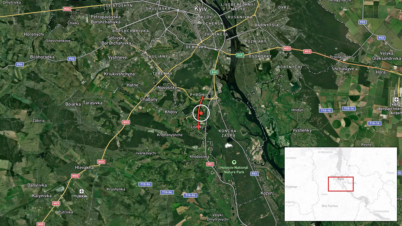
Ukrainian air monitoring detected a Russian Shahed-type kamikaze drone in transit from Pyrohiv toward Lisnyky on October 1 at 17:55 UTC. The sighting was reported by Telegram channel @war_monitor. Lisnyky lies in the northwestern approaches to Kyiv. The detection occurred amid a broader pattern of multiple Shahed drones tracked over Ukrainian airspace throughout the day, suggesting a coordinated strike operation targeting the capital.
Context and assessment
Lisnyky sits in Kyiv Oblast's northwestern sector, positioning it along a typical ingress route toward central Kyiv. Related detections the same day—over Telychka, Nova Zabudova, Hnidyn, Bortnychi, and Solomianka—indicate Russian forces conducted a massed drone strike. A related event reports a Shahed-136 specifically transiting through the Lisnyky district toward central Kyiv at 17:54 UTC, one minute prior, suggesting possible coordination or a single drone tracked by multiple monitoring posts. Shahed-136s are jet-powered cruise missiles favored for deep strikes on urban targets. The temporal clustering and geographic concentration indicate likely targeting of Kyiv's city center or critical infrastructure.
Sources and confidence
Single source: Telegram channel @war_monitor. No independent cross-confirmation reported for this specific transit. Related events from the same channel at 17:54 UTC (Telychka sighting) provide marginal corroboration of drone activity in the same corridor. Confidence score of 6.0 reflects single-source reporting and lack of secondary confirmation. Score would rise with Ukrainian air defense statements or multiple independent monitors; would fall if subsequent reports contradict the route or timing.
Location
Lisnyky is a settlement in northwestern Kyiv Oblast, approximately 25–30 km northwest of central Kyiv. It lies along the left (northern) bank of the Dnieper River. The origin point Pyrohiv is similarly positioned in the Kyiv region. The settlement-level precision derives from Ukrainian air monitoring channels; no GPS coordinates were independently verified.
Related events nearby
- Russian Shahed-136 reactive (jet-engine) kamikaze drone detected transiting from Pirogovo through Lisnyky dist2026-10-01 17:54 UTC · Drone Transit · Telychka, Ukraine
- Russian Shahed-type kamikaze drone detected over Nova Zabudova (Ukrainian air monitoring).2026-10-01 15:28 UTC · Drone Transit · Nova Zabudova, Ukraine
- Russian Shahed-type kamikaze drone detected over Hnidyn (Ukrainian air monitoring).2026-10-01 17:08 UTC · Drone Transit · Hnidyn, Ukraine
- Russian Shahed-136 reactive (jet-engine) kamikaze drone detected in transit over Solomianka district, Kyiv, he2026-10-01 05:52 UTC · Drone Transit · Solomianka, Kyiv, Ukraine
- Russian Shahed-type kamikaze drone detected over Bortnychi (Ukrainian air monitoring).2026-10-01 17:07 UTC · Drone Transit · Bortnychi, Ukraine
▶ View this event on the live map
Intel Mapper aggregates open-source reports from monitored Telegram and X channels, geolocates them, cross-checks duplicates across sources and assigns a confidence score. Entries are updated as new confirmations arrive. Read how we verify events.