Russian Shahed-136 drone transits westward over Nizhyn in Chernihiv Oblast
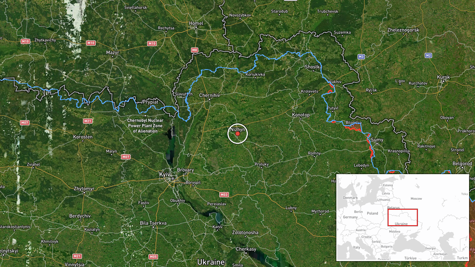
What happened
Ukrainian air monitoring reported a single Russian reactive drone, assessed as a Shahed-136 variant, passing over Nizhyn in Chernihiv Oblast on 3 October at 22:17 UTC while traveling westward. The report provides no details of interception, damage, or final destination. The drone's transit comes hours after multiple Russian cruise and ballistic missiles were tracked through the same region with apparent vectors toward Kyiv.
Context and assessment
Nizhyn lies in northern Chernihiv Oblast, approximately 130 kilometers northeast of Kyiv. The town sits along a direct approach route to the capital and has been a regular waypoint in Russian strike campaigns throughout the conflict. The westward trajectory of this Shahed-136 follows a pattern evident in the same day's air activity: multiple cruise missiles detected near Konotop and Nizhyn between 06:51 and 06:56 UTC, followed by ballistic missiles over Pryluky and Barishivka later that evening, all heading toward Kyiv. The accumulation of drone and missile transits through this corridor on a single date may indicate a coordinated or sequential targeting operation against infrastructure or military positions in the Kyiv region.
Sources and confidence
Report sourced from Telegram channel @war_monitor, a Ukrainian air defense monitoring outlet. Single-source reporting lowers confidence to 6.0. No cross-confirmation from other Ukrainian official channels or international monitors is noted. Confidence would rise with secondary confirmation from SBU, Air Force Ukraine statements, or damage assessments; it would fall if the drone was intercepted before reaching its intended target.
Location
Nizhyn is a city in central Chernihiv Oblast, located at approximately 51.05°N, 31.88°E. The settlement sits on the Desna River, a tributary of the Dnieper, roughly 130 km north-northeast of Kyiv. The region is characterized by flat terrain typical of northern Ukraine and lies within established Russian strike corridors targeting the capital and surrounding military installations.
Related events nearby
- Four Russian subsonic cruise missiles (Kh-47/UMPC-5 'Banderol' variants) detected en route toward Nizhyn, Cher2026-10-03 06:56 UTC · Cruise Missile · Nizhyn, Chernihiv Oblast, Ukraine
- One Russian ballistic missile (likely Iskander or Kinzhal) transited over Pryluky in Chernihiv Oblast, headed 2026-10-03 18:22 UTC · Ballistic Missile · Pryluky, Chernihiv Oblast, Ukraine
- One Russian ballistic missile (likely Iskander or Kinzhal) transited over Barishivka in Kyiv Oblast, western t2026-10-03 18:28 UTC · Ballistic Missile · Barishivka, Kyiv Oblast, Ukraine
- One Russian reactive/jet-powered drone (Shahed-136 variant) detected transiting over Brovarskyi District, Kyiv2026-10-03 22:33 UTC · Drone Transit · Brovarskyi District, Kyiv Oblast, Ukraine
- One Russian reactive/jet-powered drone (Shahed-136 variant) transiting from Bobrovytsya toward Brovarskyi Dist2026-10-03 22:28 UTC · Drone Transit · Brovarskyi District, Kyiv Oblast, Ukraine
▶ View this event on the live map
Intel Mapper aggregates open-source reports from monitored Telegram and X channels, geolocates them, cross-checks duplicates across sources and assigns a confidence score. Entries are updated as new confirmations arrive. Read how we verify events.