Four Shahed-136 drones detected transiting toward Kropyvnytskyi in central Ukraine
What happened
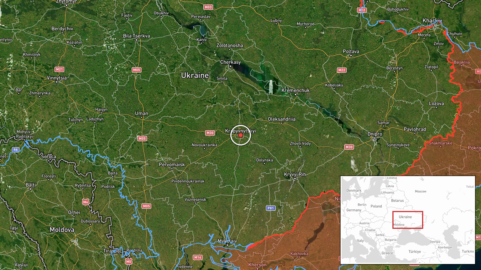
Four Russian Shahed-136 loitering munitions were reportedly detected in transit toward Kropyvnytskyi in Kirovohrad Oblast on October 4 at 09:29 UTC, according to Telegram channel @war_monitor. The report uses the colloquial Ukrainian term 'Banderoль' (Bandera) for the drones. The observation was made during what the source characterizes as a massed overnight Russian drone campaign directed at central Ukraine. No impact assessment or final target confirmation is provided in the available report.
Context and assessment
Kropyvnytskyi, a regional administrative center roughly 340 kilometers south-southwest of Kyiv, has been a recurring target of Russian long-range strike campaigns throughout the conflict. The city's infrastructure—including energy facilities, transportation hubs, and military-related logistics—makes it strategically valuable to Ukrainian operations. Shahed-136 drones, supplied to Russia by Iran, are subsonic loitering munitions with limited accuracy; they are typically deployed in waves to saturate air defenses or strike soft infrastructure. Detection of transiting drones suggests Ukrainian air surveillance remains active in the region, though this provides limited advance warning given the weapons' speed and typical flight patterns. Repeated targeting of central Ukrainian cities indicates persistent Russian efforts to degrade civilian and military logistics networks outside the main line of contact.
Sources and confidence
Reported by a single Telegram channel, @war_monitor, with no cross-confirmation from other OSINT sources visible in available data. The confidence score of 6.0 reflects the established tracking record of this channel but the single-source nature of the report. Confirmation would come from Ukrainian air defense statements, independent SIGINT analysis, or secondary OSINT corroboration of impacts.
Location
Kropyvnytskyi city center is located at approximately 48.51° N, 32.27° E in Kirovohrad Oblast (formerly Kirovograd), central Ukraine. The city sits on the Inhul River and serves as a major regional hub. Geo-precision is marked as regional rather than facility-specific, indicating drone transit near the city rather than a pinpointed target. No origin location is identified in available data.
Related events nearby
- One Russian Shahed-136 reactive (jet-powered) drone detected transiting past Kropyvnytskyi, Kirovohrad Oblast 2026-10-04 09:45 UTC · Drone Transit · Kropyvnytskyi, Kirovohrad Oblast, Ukraine
- Russian Shahed-136 reactive drone detected transiting toward Aleksandriia, Kirovohrad Oblast, as part of ongoi2026-10-04 09:35 UTC · Drone Transit · Aleksandriia, Kirovohrad Oblast, Ukraine
▶ View this event on the live map
Intel Mapper aggregates open-source reports from monitored Telegram and X channels, geolocates them, cross-checks duplicates across sources and assigns a confidence score. Entries are updated as new confirmations arrive. Read how we verify events.