Russian Shahed drone detected transiting toward Aleksandriia in overnight massed campaign
What happened
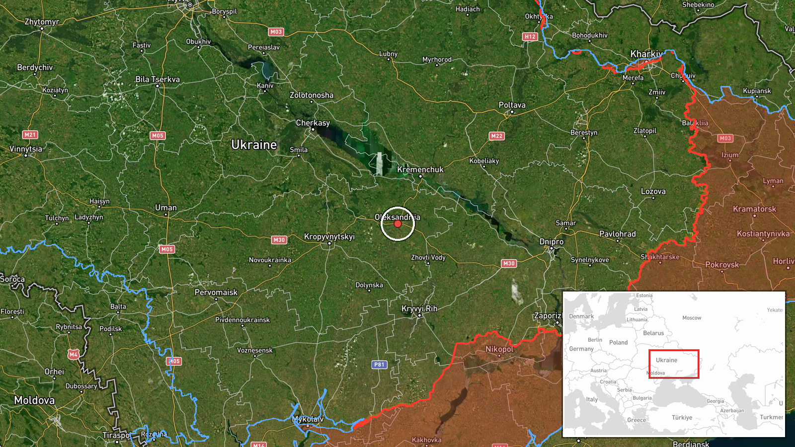
A single Russian Shahed-136 reactive (jet-powered) drone was detected in transit toward Aleksandriia in Kirovohrad Oblast on the morning of 4 October 2026, according to monitoring channels. The sighting was part of a broader overnight Russian drone operation affecting the region, with concurrent reports of additional Shahed-136 drones transiting near the nearby city of Kropyvnytskyi during the same period. The drones were tracked as they moved through Ukrainian airspace.
Context and assessment
Aleksandriia sits in central-western Ukraine in Kirovohrad Oblast, a region that has experienced repeated Russian drone strikes targeting civilian and military infrastructure. The detection of multiple Shahed-136 transits within the same operational window—including four drones detected near Kropyvnytskyi approximately 16 minutes before this sighting—suggests a coordinated massed drone campaign typical of Russian night operations. Such patterns often precede or accompany strikes on logistics nodes, energy facilities, or military positions. The persistence of these operations reflects Russia's continued effort to degrade Ukrainian air defense responsiveness and strike distributed targets across central Ukraine.
Sources and confidence
Single source from Telegram channel @war_monitor. Cross-confirmation exists through related events on the same date and in the same region showing parallel drone transits. The confidence score of 6.0 reflects reliance on a single monitoring channel without independent corroboration. Confirmation by additional open-source monitors, air alert systems, or Ukrainian military statements would strengthen confidence.
Location
Aleksandriia is located in Kirovohrad Oblast in central Ukraine at approximately 48.67°N, 33.12°E. The city is a significant regional hub situated roughly 75 kilometers south-southwest of Kropyvnytskyi. Precision is regional rather than facility-specific, indicating the drone was detected en route through or near the city rather than targeting a confirmed discrete point.
Related events nearby
- One Russian Shahed-136 reactive (jet-powered) drone detected transiting past Kropyvnytskyi, Kirovohrad Oblast 2026-10-04 09:45 UTC · Drone Transit · Kropyvnytskyi, Kirovohrad Oblast, Ukraine
- Four Russian Shahed-136 reactive drones detected transiting toward Kropyvnytskyi, Kirovohrad Oblast as part of2026-10-04 09:29 UTC · Drone Transit · Kropyvnytskyi, Kirovohrad Oblast, Ukraine
▶ View this event on the live map
Intel Mapper aggregates open-source reports from monitored Telegram and X channels, geolocates them, cross-checks duplicates across sources and assigns a confidence score. Entries are updated as new confirmations arrive. Read how we verify events.