Ukraine reports 4 Russian Zircon/Oniks missiles transiting toward Obukhiv south of Kyiv
What happened
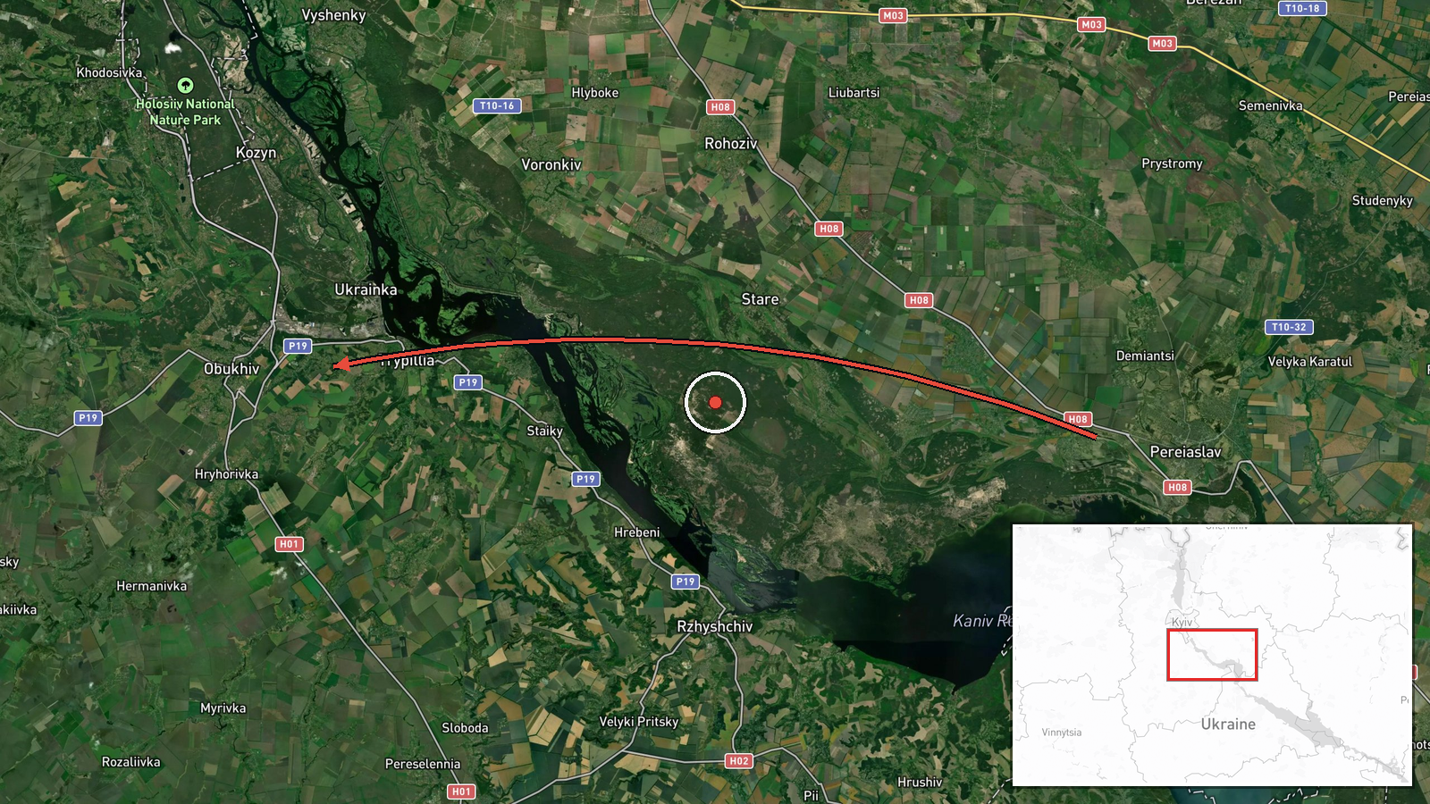
Ukrainian air monitoring channels detected four Russian Zircon or Oniks cruise missiles passing over Pereiaslav and heading toward Obukhiv, a town approximately 40 kilometers south of Kyiv, on the morning of October 7, 2026 at 00:21 UTC. The report was issued via Telegram by war monitoring accounts tracking real-time air activity. Minutes later, the same monitoring network reported six additional cruise missiles over Obukhiv itself, indicating sustained missile operations in the Kyiv region during the same timeframe.
Context and assessment
Obukhiv lies in Kyiv Oblast on the southern approaches to the capital and hosts industrial and infrastructure facilities that have been repeat targets of Russian long-range strikes throughout the conflict. The detection of four missiles transiting toward the town, followed immediately by six more over the target area, suggests a coordinated salvo attack. This strike coincided with ballistic missile launches detected over Kyiv city itself the same morning, indicating a multi-axis missile campaign. Recent reports of Ukrainian defensive preparations—including protective netting installed on Kyiv's Northern Bridge—underscore the sustained Russian capability to threaten the capital region. The frequency and scale of cruise missile employment in early October align with patterns of Russian attrition against Ukrainian energy infrastructure and military-industrial targets.
Sources and confidence
Single-source reporting via Telegram channel @war_monitor, a Ukrainian air-monitoring aggregator. No cross-confirmation from official Ukrainian military or international sources provided in available data. Confidence score of 6.0 reflects typical real-time air monitoring reliability but limited independent verification. Confirmation by Ukrainian official statements, radar data release, or damage reports would substantially raise confidence. Contradictory subsequent reports or absence of follow-up detections would lower it.
Location
Obukhiv is a town in Kyiv Oblast, approximately 40 kilometers south-southwest of Kyiv city center (50.12°N, 30.63°E). The settlement sits near the Stugna River in a relatively flat, industrial zone. Pereiaslav, mentioned as the reference point for the missile transit, lies roughly 80 kilometers further southeast along the suspected flight path. The trajectory suggests missiles were launched from Russian territory or Belarus, traveling northwest toward the Kyiv metropolitan area.
Related events nearby
- Ukrainian air monitoring: 6 Russian Zircon/Oniks missiles over Obukhiv.2026-10-07 00:26 UTC · Cruise Missile · Obukhiv, Ukraine
- Russian ballistic missiles targeted Kyiv with reported direct hits on Trypillia substation. Additionally, 13 R2026-10-07 00:44 UTC · Ballistic Missile · Trypillia Substation, Kyiv, Ukraine
- Ukraine installed protective netting on the Northern Bridge in Kyiv to defend against potential Russian drone 2026-10-06 11:09 UTC · Deployment · Kyiv, Ukraine
- Ukrainian air monitoring reports isolated Russian Shahed-type (reactive/jet-powered) drones transiting over Ky2026-10-07 02:37 UTC · Drone Transit · Kyiv, Ukraine
- Ukrainian air monitoring: 4 Russian Zircon/Oniks missiles passing Lubny, heading toward Kyiv Oblast.2026-10-07 00:20 UTC · Cruise Missile · Kyiv Oblast, Ukraine
▶ View this event on the live map
Intel Mapper aggregates open-source reports from monitored Telegram and X channels, geolocates them, cross-checks duplicates across sources and assigns a confidence score. Entries are updated as new confirmations arrive. Read how we verify events.