Russian Shahed drones detected transiting toward Dnipro from Voronezh
What happened
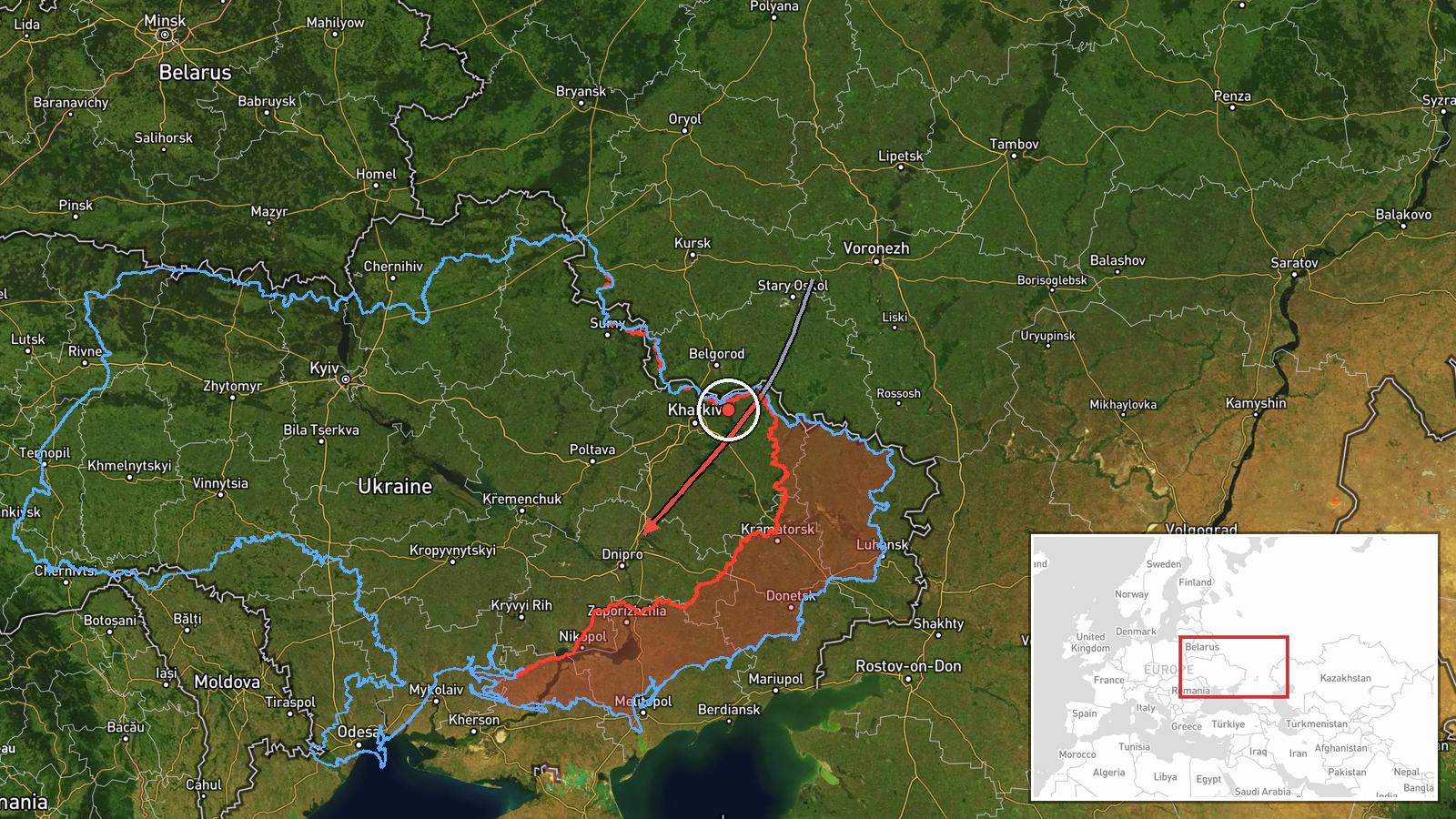
Ukrainian air monitoring systems detected Russian Shahed-type unmanned aerial vehicles exiting Russian airspace from the Voronezh direction and heading toward Dnipro region on October 7 at 00:26 UTC. The detection was reported by the Telegram channel @war_monitor, which tracks Ukrainian air defense notifications. Shahed drones are Iranian-origin loitering munitions that Russia has employed extensively in strikes on Ukrainian infrastructure and population centers throughout the conflict.
Context and assessment
Dnipro, located in central-eastern Ukraine, has emerged as a frequent target of Russian airstrikes and drone attacks, particularly its industrial and energy infrastructure. The detection of drone transit from Voronezh—a major Russian logistics and staging hub roughly 400 kilometers north—aligns with established Russian strike patterns against the city. Notably, Ukrainian air monitoring systems recorded at least four separate ballistic missile detections over Dnipro within minutes of the drone transit report (00:18–00:27 UTC), suggesting a coordinated, multi-vector attack. This layered approach combining unmanned and ballistic systems indicates an attempt to overwhelm air defense networks.
Sources and confidence
Reported by a single Telegram channel (@war_monitor) specializing in Ukrainian air monitoring alerts. No independent cross-confirmation is noted. Confidence score of 6.0 reflects the single source and preliminary transit detection; confirmation would require follow-up reports of drone impact or interception. Simultaneous ballistic missile alerts over the same target within one minute marginally support the overall strike activity pattern.
Location
Dnipro city center and surrounding Dnipropetrovsk Oblast, central-eastern Ukraine (48.47°N, 35.04°E). The location was identified by region-level precision based on Ukrainian air defense reporting zones. Dnipro sits on the Dnieper River and serves as a major industrial and transportation hub; nearby infrastructure includes power plants and manufacturing facilities historically targeted in Russian campaigns.
Related events nearby
- Ukrainian air monitoring: 1 Russian Kalibr cruise missile over Dnipro.2026-10-07 01:50 UTC · Cruise Missile · Dnipro, Ukraine
- Ukrainian air monitoring: 1 Russian Kalibr cruise missile heading toward Dnipro.2026-10-07 01:44 UTC · Cruise Missile · Dnipro, Ukraine
- Ukrainian air monitoring confirms ongoing Russian ballistic missile threat over Dnipro. Multiple ballistic mis2026-10-07 00:27 UTC · Ballistic Missile · Dnipro, Dnipropetrovsk Oblast, Ukraine
- Ukrainian air monitoring: 1 Russian ballistic missile over Dnipro.2026-10-07 00:27 UTC · Ballistic Missile · Dnipro, Ukraine
- Ukrainian air monitoring: 1 Russian ballistic missile over Dnipro.2026-10-07 00:20 UTC · Ballistic Missile · Dnipro, Ukraine
▶ View this event on the live map
Intel Mapper aggregates open-source reports from monitored Telegram and X channels, geolocates them, cross-checks duplicates across sources and assigns a confidence score. Entries are updated as new confirmations arrive. Read how we verify events.