Russian cruise missiles tracked toward Pryluky and Kremenchuk in renewed strike wave
What happened
Ukrainian air monitoring reported detection of Russian cruise missile groups heading toward Pryluky and Kremenchuk on the morning of October 7, 2026. The alert, issued at 03:52 UTC, indicated four cruise missile groups in the direction of Pryluky and one group targeting Kremenchuk. This represents part of a broader strike sequence that began earlier in the morning, with multiple missile detections occurring within minutes of one another across central Ukraine.
Context and assessment
Pryluky and Kremenchuk are significant industrial and infrastructure targets in central-eastern Ukraine. Pryluky hosts an airbase and fuel storage facilities, while Kremenchuk contains major petroleum refineries and power infrastructure. The repeated detections within minutes suggest a coordinated multi-vector missile campaign, consistent with Russian doctrine targeting Ukrainian energy and military logistics. Related events show ballistic missiles struck Kyiv earlier the same morning, including reported direct hits on the Trypillia power substation. The pattern indicates sustained Russian pressure across multiple Ukrainian regions using both strategic bombers and cruise and ballistic missiles.
Sources and confidence
Single source: Telegram channel @war_monitor, posting real-time Ukrainian air defense monitoring. No cross-confirmation from independent sources or other monitoring channels provided in available data. Confidence score of 6.0 reflects reliance on a single channel and lack of corroborating reports. Confirmation from Ukrainian official sources or multiple independent monitors would increase confidence; independent verification of missile impact would strengthen assessment.
Location
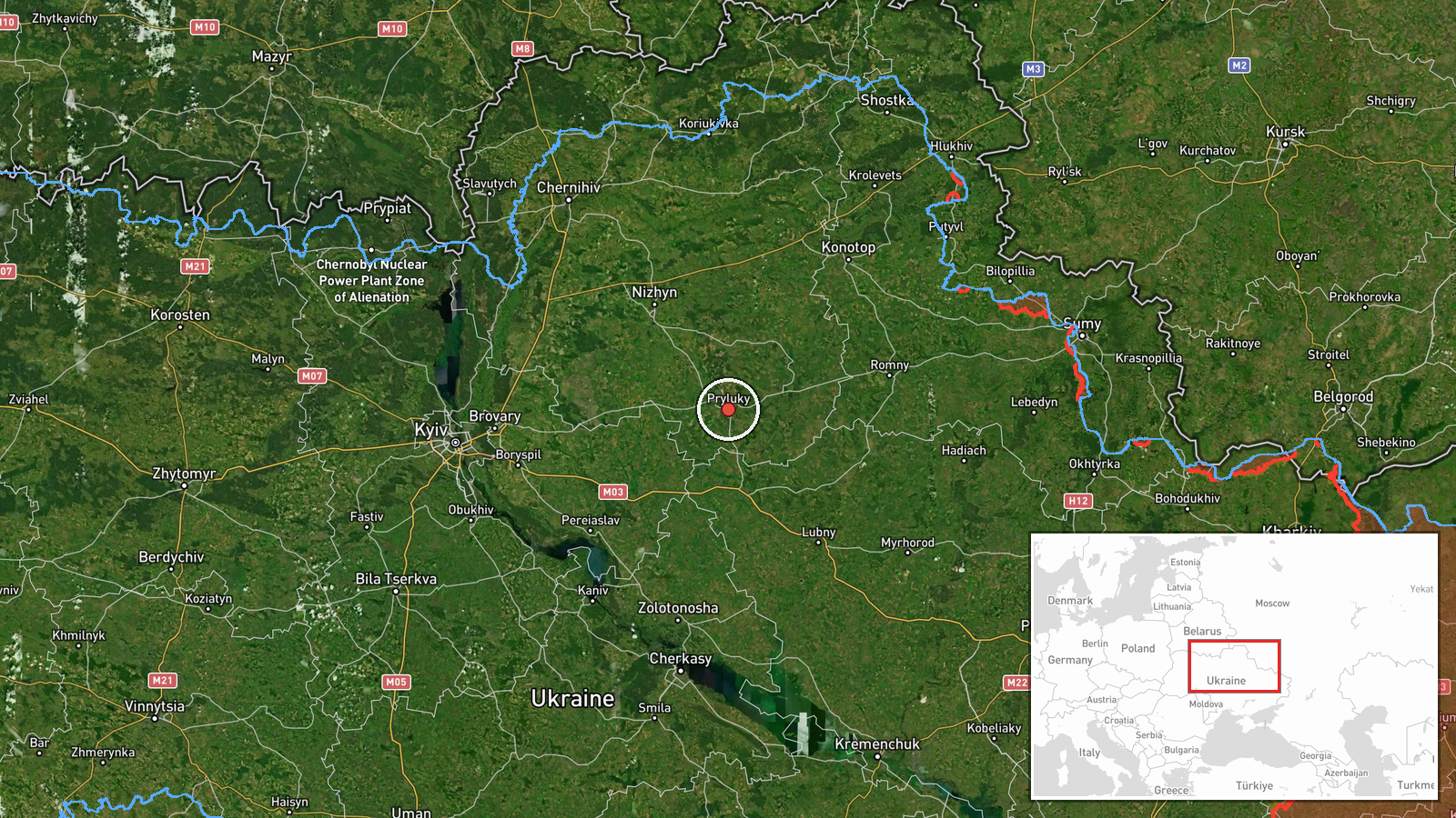
Pryluky is located in Poltava Oblast, central Ukraine, approximately 50.6°N 32.4°E. The settlement sits in the agricultural heartland of eastern central Ukraine. Kremenchuk lies in Poltava Oblast to the southeast. Both towns are major transportation and industrial hubs, situated along key river valleys in the Poltava region.
Related events nearby
- Ukrainian air monitoring: 2 Russian cruise missiles over Pryluky; 1 Russian cruise missile over Kremenchuk; 2 2026-10-07 03:47 UTC · Cruise Missile · Pryluky, Ukraine
- Ukrainian air monitoring: 1 Russian cruise missile heading toward Pryluky.2026-10-07 03:30 UTC · Cruise Missile · Pryluky, Ukraine
- Russian ballistic missiles targeted Kyiv with reported direct hits on Trypillia substation. Additionally, 13 R2026-10-07 00:44 UTC · Ballistic Missile · Trypillia Substation, Kyiv, Ukraine
- Ukrainian air monitoring: 1 Russian ballistic missile over Kyiv.2026-10-07 02:16 UTC · Ballistic Missile · Kyiv, Ukraine
- Ukrainian air monitoring: 1 Russian ballistic missile over Kyiv.2026-10-07 02:16 UTC · Ballistic Missile · Kyiv, Ukraine
▶ View this event on the live map
Intel Mapper aggregates open-source reports from monitored Telegram and X channels, geolocates them, cross-checks duplicates across sources and assigns a confidence score. Entries are updated as new confirmations arrive. Read how we verify events.