Ukrainian air monitoring reports 3 Russian Shahed drones over Kremenchuk
What happened
Ukrainian air monitoring channels reported the detection of three Russian jet-powered Shahed (Geran-3) drones transiting over Kremenchuk on October 8 at 12:55 UTC. The report came via Telegram channel @war_monitor, which tracks Ukrainian air defense activity and drone sightings. The drones were identified as Shahed-type systems, Russia's long-range attack drones modified from Iranian designs. No immediate outcome regarding interception or impact was reported in the monitoring data.
Context and assessment
Kremenchuk, a major industrial city in central Ukraine's Poltava Oblast, has been repeatedly targeted throughout the conflict due to its petroleum refinery and manufacturing facilities. The October 8 sighting represents part of sustained Russian drone activity over the region. Related monitoring reports from the same day show two additional Shahed drones detected over Kremenchuk earlier at 11:07 UTC, and one drone over nearby Oleksandriya at 12:42 UTC, suggesting coordinated or successive waves rather than isolated incidents. This pattern aligns with Russia's established practice of using expendable drone strikes against Ukrainian infrastructure and air defense saturation tactics.
Sources and confidence
Single-source reporting from Telegram channel @war_monitor, a Ukrainian air monitoring account. No cross-confirmation from independent sources or official Ukrainian defense statements is evident. Confidence score of 6.0 reflects reliance on a single channel; score would rise with corroboration from Ukrainian Air Force statements or multiple independent monitoring accounts, or fall if the channel's track record or methodology proved unreliable.
Location
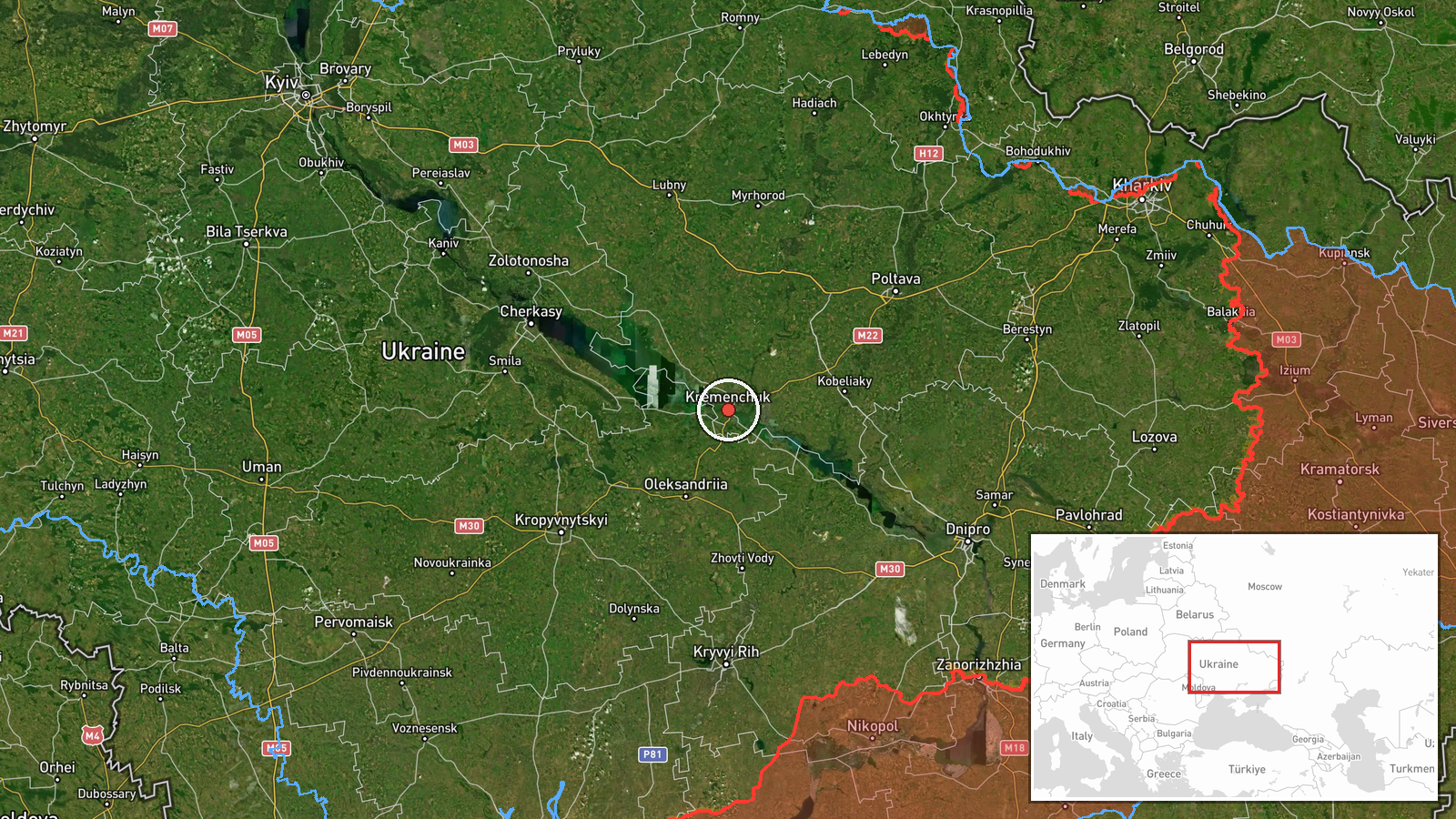
Kremenchuk is located in central Ukraine's Poltava Oblast at approximately 49.06°N, 33.40°E. The city sits on the Dnieper River and serves as a regional industrial hub. Settlement-level precision is based on the reporting channel's designation rather than specific facility identification. Nearby Oleksandriya, also affected by drone activity the same day, lies roughly 50 kilometers south.
Related events nearby
- Ukrainian air monitoring: 2 Russian jet-powered Shahed (Geran-3) drones over Kremenchuk.2026-10-08 11:07 UTC · Drone Transit · Kremenchuk, Ukraine
- Ukrainian air monitoring: 1 Russian jet-powered Shahed (Geran-3) drone over Oleksandriya.2026-10-08 12:42 UTC · Drone Transit · Oleksandriya, Ukraine
- Ukrainian MiG-29 pilot shot down a Russian attack drone. Photograph shows pilot celebrating with gesture towar2026-10-07 20:14 UTC · Drone Shootdown · Ukraine (location not reported)
▶ View this event on the live map
Intel Mapper aggregates open-source reports from monitored Telegram and X channels, geolocates them, cross-checks duplicates across sources and assigns a confidence score. Entries are updated as new confirmations arrive. Read how we verify events.