Two Russian jet-powered drones tracked transiting toward Bucha northwest of Kyiv
What happened
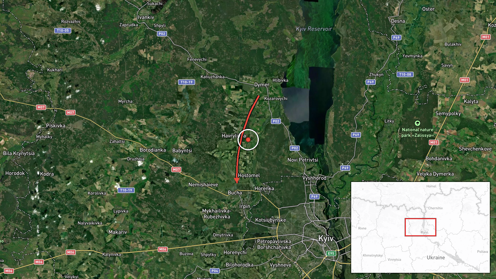
Ukrainian air monitoring reported two Russian jet-powered Shahed (Geran-3) drones passing over Dymer and heading toward Bucha and Irpin on the morning of October 8. The report was logged at 14:13 UTC. Shahed-type drones are loitering munitions typically used for strikes on infrastructure or area targets. The sighting represents part of a broader pattern of drone activity across the Kyiv region that same day, with multiple similar systems tracked over northwestern suburbs.
Context and assessment
Bucha and the surrounding Irpin area lie northwest of Kyiv's city limits and remain under Ukrainian control but within range of Russian drone operations. This sector has experienced repeated drone transits throughout October 8, with at least four additional Shahed sightings logged over nearby locations including Borshchahivka and Pushcha-Vodytsia between 09:17 and 14:20 UTC. The concentration of jet-powered Shahed activity in a single day across the northwestern approaches suggests either a coordinated strike package in preparation or routine pressure on Kyiv's outer defenses. Such drones typically target electrical infrastructure, military facilities, or administrative centers.
Sources and confidence
Single source from Telegram channel @war_monitor, a Ukrainian air-monitoring account. No cross-confirmation from independent sources provided. Confidence score of 6.0 reflects the established reputation of Ukrainian air-monitoring channels but dependence on one reporting stream. Confirmation by additional independent observers, official Ukrainian statements, or evidence of drone interception would strengthen confidence.
Location
Bucha is a settlement 25 kilometers northwest of central Kyiv, situated in Kyiv Oblast. Dymer lies approximately 15 kilometers further northwest. The Irpin River valley and suburban sprawl characterize the terrain. Proximity to Kyiv's northwestern approach corridors makes this sector a typical route for drone ingress toward the capital.
Related events nearby
- Ukrainian air monitoring: 1 Russian jet-powered Shahed (Geran-3) drone over Bucha.2026-10-08 10:05 UTC · Drone Transit · Bucha, Ukraine
- Ukrainian air monitoring: 1 Russian jet-powered Shahed (Geran-3) drone over Pushcha-Vodytsia, Kyiv.2026-10-08 14:20 UTC · Drone Transit · Pushcha-Vodytsia, Kyiv, Ukraine
- Ukrainian air monitoring: 1 Russian jet-powered Shahed (Geran-3) drone passing Pushcha-Vodytsia, Kyiv, heading2026-10-08 09:19 UTC · Drone Transit · Vynohradar, Kyiv, Ukraine
- Ukrainian air monitoring: 1 Russian Shahed-type drone in terminal descent over Borshchahivka, Kyiv.2026-10-08 09:17 UTC · Drone Transit · Borshchahivka, Kyiv, Ukraine
- Ukrainian air monitoring: 1 Russian Shahed-type drone over Borshchahivka, Kyiv.2026-10-08 09:17 UTC · Drone Transit · Borshchahivka, Kyiv, Ukraine
▶ View this event on the live map

Intel Mapper aggregates open-source reports from monitored Telegram and X channels, geolocates them, cross-checks duplicates across sources and assigns a confidence score. Entries are updated as new confirmations arrive. Read how we verify events.