Russian Shahed drone in terminal descent over Svyatopetrivske, Kyiv region
What happened
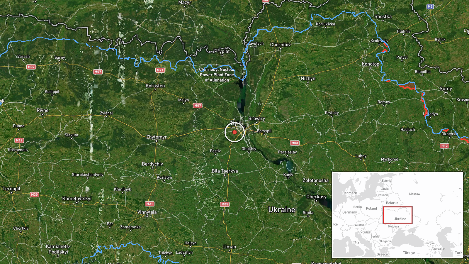
Ukrainian air monitoring reported a Russian Shahed-type drone in terminal descent over Svyatopetrivske in Kyiv region at 14:22 UTC on 8 October 2026. The report indicates the drone was descending toward the ground, suggesting either interception or impact. The same drone was tracked over the settlement three minutes earlier. Svyatopetrivske lies northwest of central Kyiv in an area subject to repeated Russian air operations.
Context and assessment
Svyatopetrivske sits in the outer suburbs of greater Kyiv, a persistent target for Russian unmanned strikes. The terminal descent report comes as part of an apparent coordinated wave: related events show Shahed drones over nearby Sofiivska Borshchahivka and Borshchahivka on the same day, with multiple aircraft in terminal descent within a two-hour window. This pattern is consistent with Russia's ongoing campaign to degrade Kyiv's civilian and military infrastructure through attrition. The frequency and geographic spread of reports suggest a multi-vector drone operation targeting the capital region.
Sources and confidence
Single source: Telegram channel @war_monitor, which aggregates Ukrainian official air monitoring data. No independent cross-confirmation in the dataset. Confidence score of 6.0 reflects reliance on a single channel, though Ukrainian air monitoring systems are generally reliable for detection. Score could be raised by secondary confirmation from Ukrainian military or international monitoring; lowered if contradicted by later reports.
Location
Svyatopetrivske, a settlement in Kyiv region approximately 20 km northwest of central Kyiv, determined by settlement-level precision (50.38°N, 30.32°E). Located in suburban terrain northwest of the capital, part of the broader urban agglomeration subject to frequent Russian air operations.
Related events nearby
- Ukrainian air monitoring: 1 Russian Shahed-type drone over Svyatopetrivske.2026-10-08 14:19 UTC · Drone Transit · Svyatopetrivske, Ukraine
- Ukrainian air monitoring: 1 Russian Shahed-type drone over Sofiivska Borshchahivka.2026-10-08 14:18 UTC · Drone Transit · Sofiivska Borshchahivka, Ukraine
- Ukrainian air monitoring: 1 Russian Shahed-type drone in terminal descent over Borshchahivka, Kyiv.2026-10-08 09:17 UTC · Drone Transit · Borshchahivka, Kyiv, Ukraine
- Ukrainian air monitoring: 1 Russian Shahed-type drone over Borshchahivka, Kyiv.2026-10-08 09:17 UTC · Drone Transit · Borshchahivka, Kyiv, Ukraine
- Ukrainian air monitoring: 1 Russian Shahed-type drone in terminal descent over Voleykiv.2026-10-08 10:09 UTC · Drone Transit · Voleykiv, Ukraine
▶ View this event on the live map

Intel Mapper aggregates open-source reports from monitored Telegram and X channels, geolocates them, cross-checks duplicates across sources and assigns a confidence score. Entries are updated as new confirmations arrive. Read how we verify events.