Russian Shahed drones detected over Kyiv region settlements
What happened
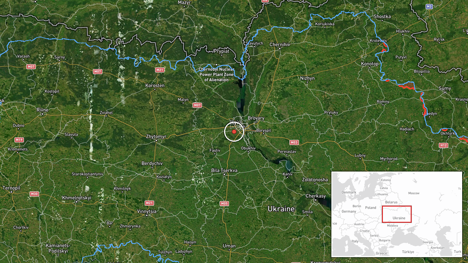
Ukrainian air monitoring reportedly detected two Russian Shahed-type drones transiting over populated areas in Kyiv region on October 9, 2026 at approximately 03:54 UTC. One drone was tracked over Svyatopetrivske, approximately 4 kilometers from the settlement center, while a second was observed over Dymer. The report does not specify whether the drones struck targets, were intercepted, or continued toward other destinations.
Context and assessment
Both settlements lie northwest of central Kyiv in densely populated suburbs. Svyatopetrivske and the Dymer area have been subject to repeated Russian drone activity over the preceding 24 hours, with related monitoring reports from October 8 documenting multiple Shahed transits and at least one drone in terminal descent over Svyatopetrivske. This pattern suggests sustained Russian targeting focus on Kyiv's northwestern approaches. Shahed drones are typically used for area denial, infrastructure strikes, and attrition against air defense resources. The frequency of sightings may indicate either concentrated strike operations or probing of Ukrainian air defenses.
Sources and confidence
Reported solely by Telegram channel @war_monitor, a Ukrainian air monitoring source. Single-source reporting and absence of corroborating channels or official Ukrainian air force statements account for the moderate confidence score of 6.0. Confirmation from independent Ukrainian military or air defense sources, or visual evidence of interceptions or impacts, would strengthen confidence. Official denial or contradictory reports would lower it.
Location
Svyatopetrivske and Dymer are settlements in Kyiv region, located approximately 25–35 kilometers northwest of central Kyiv. Svyatopetrivske lies near the Irpin River valley; Dymer is positioned along major northwest transport corridors. Precision is settlement-level; exact impact points were not specified in the report.
Related events nearby
- Ukrainian air monitoring: 1 Russian Shahed-type drone in terminal descent over Svyatopetrivske.2026-10-08 14:22 UTC · Drone Transit · Svyatopetrivske, Ukraine
- Ukrainian air monitoring: 1 Russian Shahed-type drone over Svyatopetrivske.2026-10-08 14:19 UTC · Drone Transit · Svyatopetrivske, Ukraine
- Ukrainian air monitoring: 1 Russian Shahed-type drone over Sofiivska Borshchahivka.2026-10-08 14:18 UTC · Drone Transit · Sofiivska Borshchahivka, Ukraine
- Ukrainian air monitoring: 1 Russian Shahed-type drone in terminal descent over Borshchahivka, Kyiv.2026-10-08 09:17 UTC · Drone Transit · Borshchahivka, Kyiv, Ukraine
- Ukrainian air monitoring: 1 Russian Shahed-type drone over Borshchahivka, Kyiv.2026-10-08 09:17 UTC · Drone Transit · Borshchahivka, Kyiv, Ukraine
▶ View this event on the live map

Intel Mapper aggregates open-source reports from monitored Telegram and X channels, geolocates them, cross-checks duplicates across sources and assigns a confidence score. Entries are updated as new confirmations arrive. Read how we verify events.