Two Russian Shahed Drones Tracked Over Oleksandriya
What happened
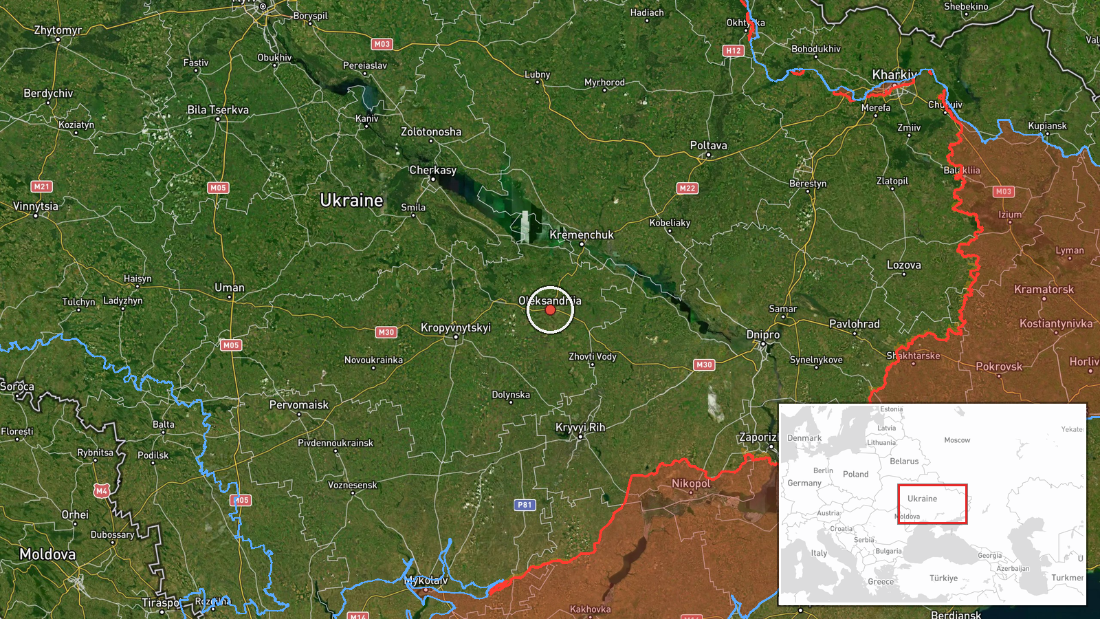
Ukrainian air monitoring services reported two Russian jet-powered Shahed (Geran-3) drones circling over Oleksandriya, a city in central Ukraine's Kirovohrad Oblast, on October 9 at approximately 12:05 UTC. The drones were detected in a loitering pattern over the settlement. No strike or impact was reported in this observation. This represents a continuation of Russian drone activity in the area, following a similar single-drone sighting over the same city the previous day.
Context and assessment
Oleksandriya sits in Ukraine's central industrial heartland, approximately 150 kilometers from the front lines and roughly 250 kilometers southeast of Kyiv. The city hosts strategic infrastructure including power facilities and transport hubs. The appearance of two jet-powered Shaheds over the city follows a pattern of sustained Russian drone reconnaissance and strike operations across Ukrainian territory on October 8–9. Related reports indicate concurrent Shahed activity over Kremenchuk on October 8 and multiple drone and ballistic strikes across Ukrainian regions on October 9, including a narrow-miss strike in Kyiv region. The loitering pattern suggests either targeting preparation, reconnaissance, or transit to a secondary objective.
Sources and confidence
Reported by Telegram channel @war_monitor, a Ukrainian military-affiliated air monitoring service. Single source confirmation only; no cross-reporting from other OSINT channels or Ukrainian official military channels noted in available data. Confidence score of 6.0 reflects the credibility of air monitoring channels but the absence of independent verification. Confirmation from additional monitoring groups or official statements would strengthen confidence.
Location
Oleksandriya, Kirovohrad Oblast, central Ukraine. Located at approximately 48.67°N, 33.12°E. The city lies on the Inhul River in relatively flat terrain characteristic of central Ukrainian steppe. No specific facility or target location was identified in the report; the drones were tracked in the general vicinity of the city.
Related events nearby
- Ukrainian air monitoring: 1 Russian jet-powered Shahed (Geran-3) drone over Oleksandriya.2026-10-08 12:42 UTC · Drone Transit · Oleksandriya, Ukraine
- Ukrainian air monitoring: 3 Russian jet-powered Shahed (Geran-3) drones over Kremenchuk.2026-10-08 12:55 UTC · Drone Transit · Kremenchuk, Ukraine
- A man narrowly escaped a jet-powered Shahed drone strike in Kyiv region, fleeing seconds before impact. Footag2026-10-09 11:45 UTC · UAS Strike · Ukraine (location not reported)
- Russia launched mass strike on Ukraine on October 7, killing at least 32 people. Zelensky remarked Putin timed2026-10-09 09:15 UTC · Ballistic Missile · Ukraine (location not reported)
- Ukrainian military personnel in a vehicle narrowly escaped a Russian FPV drone strike at the front lines. No c2026-10-09 08:23 UTC · UAS Strike · Ukraine (location not reported)
▶ View this event on the live map

Intel Mapper aggregates open-source reports from monitored Telegram and X channels, geolocates them, cross-checks duplicates across sources and assigns a confidence score. Entries are updated as new confirmations arrive. Read how we verify events.