Eight Russian Shahed drones detected over Horishni Plavni, central Ukraine
What happened
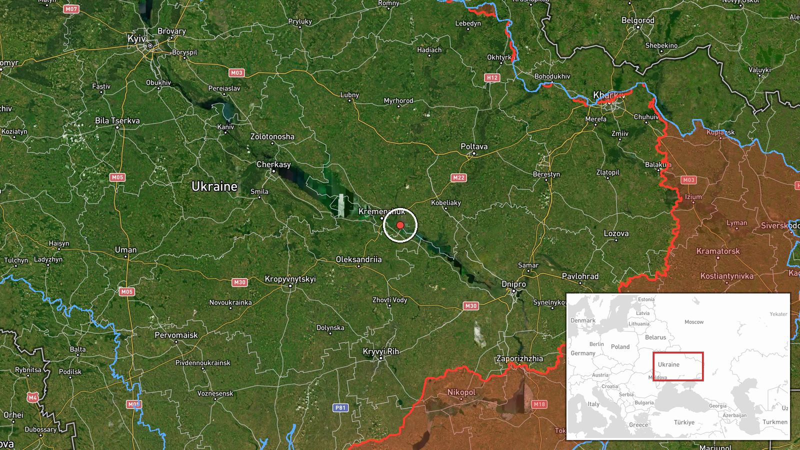
Ukrainian air monitoring reported eight Russian Shahed-2 (Geran-2) drones transiting the airspace over Horishni Plavni in central Ukraine on October 14 at 12:16 UTC. The drones were detected heading toward the Horishni Plavni and Oleksandriya sector. The report was issued by war monitoring channels tracking Russian air operations. No immediate account of interception or impact was provided in the initial detection.
Context and assessment
Horishni Plavni lies in Poltava Oblast in central Ukraine, an area that has faced increasing Russian drone strikes on energy infrastructure and military targets over recent months. The detection occurs amid a pattern of sustained Russian Shahed drone operations across central Ukrainian regions. Related detections on October 13-14 show similar formations transiting Kremenchuk district and Oleksandriya, suggesting coordinated or repeated strike attempts targeting the Dnipropetrovsk and Poltava region corridor. The Shahed-2 is a loitering munition with approximately 2,000 kilometer range, typically used against fixed infrastructure. The concentration of eight drones in this sector may indicate targeting of industrial or energy facilities.
Sources and confidence
Single source report from Telegram channel @war_monitor, a Ukrainian air monitoring outlet. Confidence score of 6.0 reflects typical detection-phase reporting without cross-confirmation of outcome. A simultaneous or near-concurrent report of eight drones over Oleksandriya (12:28 UTC) provides partial corroboration of drone activity in the region. Confirmation would require independent verification or Ukrainian air defense acknowledgment.
Location
Horishni Plavni, a city in Poltava Oblast, central Ukraine, located approximately 300 kilometers west of the front lines. The settlement sits in the Dnipro River valley, a historically industrial region. Nearby Oleksandriya lies roughly 50 kilometers southwest. The area contains energy infrastructure and Soviet-era industrial facilities typical of Russian targeting priorities.
Related events nearby
- Ukrainian air monitoring: 1 Russian Shahed-type drone heading toward Kremenchuk.2026-10-13 17:40 UTC · Drone Transit · Kremenchuk, Ukraine
- Ukrainian air monitoring: 6 Russian Shahed-type drones passing Donetsk, heading toward Kremenchuk district.2026-10-14 07:39 UTC · Drone Transit · Kremenchuk district, Ukraine
- Ukrainian air monitoring: 8 Russian Shahed-type drones over Oleksandriya.2026-10-14 12:28 UTC · Drone Transit · Oleksandriya, Ukraine
- Ukrainian air monitoring: 1 Russian jet-powered Shahed (Geran-3) drone heading toward Semenivka.2026-10-13 14:37 UTC · Drone Transit · Semenivka, Ukraine
- Ukrainian air monitoring detected 1 Russian jet-powered Shahed (Geran-3) drone transiting northern Dnipropetro2026-10-13 20:23 UTC · Drone Transit · Kamyanske Reservoir, Dnipropetrovsk Oblast, Ukrain
▶ View this event on the live map

Intel Mapper aggregates open-source reports from monitored Telegram and X channels, geolocates them, cross-checks duplicates across sources and assigns a confidence score. Entries are updated as new confirmations arrive. Read how we verify events.