Single Shahed-type drone reported over Vynohradar near Kyiv in Ukrainian air monitoring
What happened
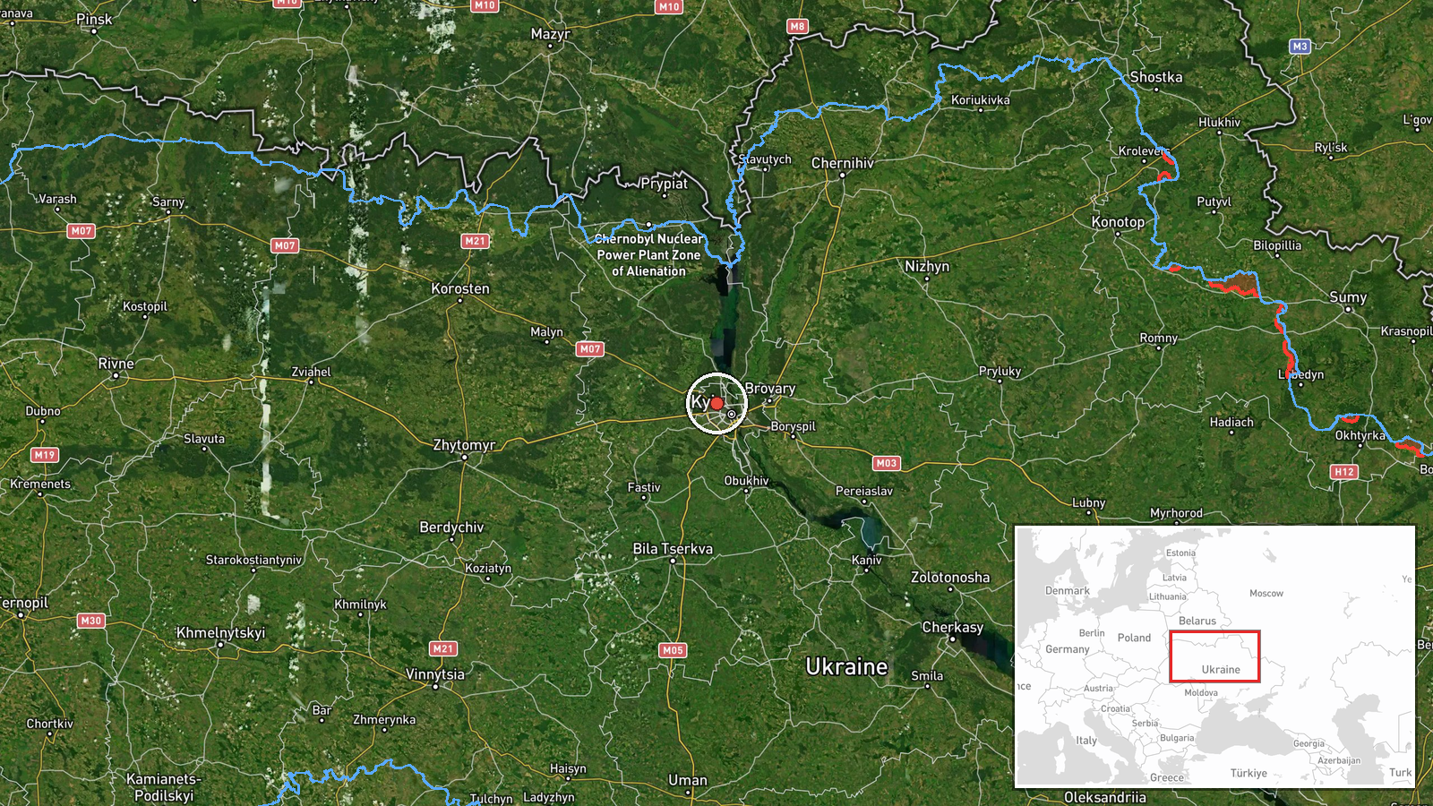
Ukrainian air monitoring, as relayed by the Telegram channel @war_monitor, reported one Russian Shahed-type drone over Vynohradar, a settlement in the Kyiv area, at 15:23 UTC on 18 October 2026. The original Ukrainian-language post, headed with the word for Kyiv, reads '1х Виноградар 2,6км', which indicates a single drone at Vynohradar along with a figure of 2.6 km that the post does not explain. The report does not describe impacts, casualties or damage, and it does not state the drone's variant or direction of travel. It is best read as a transit observation, meaning a drone was seen in the air over the settlement, rather than a confirmed strike on it.
Context and assessment
Vynohradar sits within the wider Kyiv area, where Ukraine's capital and its surrounding districts have been repeatedly reported as targets or transit corridors for long-range drones. The same monitoring feed logged a sequence of related reports earlier on 18 October. At 05:08 UTC, two or more jet-powered Geran-3 drones were reported passing Zhashkiv, heading toward Kyiv Oblast. At 07:06 and 07:08, single Shahed-type drones were reported heading toward and then over Kyiv. At 15:22, a jet-powered Geran-3 was reported passing the Kyiv Reservoir, heading toward the city, and four minutes later a single Shahed-type drone was reported over Borshchahivka. Taken together, these entries describe a day of repeated, single-airframe sightings moving through the capital's western and northwestern approaches over roughly ten hours. Operationally, a run of individually tracked drones of this kind may reflect routing along a common approach, decoy or reconnaissance activity, or simply dense sensor coverage that picks up more objects. The mix of older Shahed-type designs and the jet-powered Geran-3 suggests more than one airframe type was in use that day, though the feed alone cannot show intent or the purpose of any individual flight.
Sources and confidence
The event rests on a single Telegram channel, @war_monitor, which is the only listed source and is recorded as source count one. No independent outlet, official Ukrainian Air Force statement, local authority or geolocated imagery is attached to this entry, and the item has not been corrected. The confidence score of 6.0 reflects this single-channel basis, offset somewhat by consistency with other monitoring entries for the same day. Confidence would rise with corroboration from official air-alert statements, local officials, or verified imagery placing a drone over Vynohradar at that time. It would fall if the channel is found to have misread the post or if the 2.6 km figure contradicts other reporting.
Location
The location is recorded at settlement precision, with coordinates of approximately 50.5 N and 30.42 E assigned to the village of Vynohradar. Because the place name corresponds to a single settlement, location confidence is rated high, although the point is a settlement-level approximation rather than an exact position. Vynohradar lies in the northwestern part of the Kyiv area, close to the Kyiv Reservoir, an open water body with surrounding shoreline and low-lying terrain. The 2.6 km figure in the original post is not explained and may refer to a distance from a reference point rather than a location of the drone itself.
Related events nearby
- Ukrainian air monitoring: 1 Russian Shahed-type drone over Borshchahivka, Kyiv.2026-10-18 15:26 UTC · Drone Transit · Borshchahivka, Kyiv, Ukraine
- Ukrainian air monitoring: 1 Russian jet-powered Shahed (Geran-3) drone passing Kyiv Reservoir, heading toward 2026-10-18 15:22 UTC · Drone Transit · Kyiv, Ukraine
- Ukrainian air monitoring: 1 Russian Shahed-type drone over Kyiv.2026-10-18 07:08 UTC · Drone Transit · Kyiv, Ukraine
- Ukrainian air monitoring: 1 Russian Shahed-type drone heading toward Kyiv.2026-10-18 07:06 UTC · Drone Transit · Kyiv, Ukraine
- Ukrainian air monitoring: 2+ Russian jet-powered Shahed (Geran-3) drones passing Zhashkiv, heading toward Kyiv2026-10-18 05:08 UTC · Drone Transit · Kyiv Oblast, Ukraine
▶ View this event on the live map

Intel Mapper aggregates open-source reports from monitored Telegram and X channels, geolocates them, cross-checks duplicates across sources and assigns a confidence score. Entries are updated as new confirmations arrive. Read how we verify events.