Single Shahed-type drone reported over Vyshneve, Kyiv Oblast, amid a cluster of drone transits toward Kyiv
What happened
Ukrainian air monitoring reported one Russian Shahed-type drone over Vyshneve, a settlement in Kyiv Oblast, at about 15:27 UTC on 18 October 2026. The original Ukrainian-language post, published on the Telegram channel @war_monitor, lists the location as Vyshneve at a distance of 2 km, which suggests the observer was reporting the drone's position relative to the settlement rather than an impact or strike. The report describes a transit, not a detonation, and no damage, casualties or interceptions are mentioned in the source. The post is the only channel carrying this specific report, and its wording is brief, so the exact flight path and the drone's ultimate destination remain unconfirmed.
Context and assessment
Vyshneve sits on the western edge of the Kyiv agglomeration, along the approaches from the northwest and west that Russian long-range drones have repeatedly used to reach the capital. The same morning's records show a dense sequence of transits in the Kyiv area: a drone over Kyiv at 07:08 and another heading toward the city at 07:06, a group of two or more jet-powered Geran-3 drones passing Zhashkiv into Kyiv Oblast at 05:08, and a jet-powered Geran-3 passing the Kyiv Reservoir toward the city at 15:22, followed by a drone over Borshchahivka at 15:26. Taken together, these reports indicate a sustained pattern of single and small-group drone movements converging on the capital and its surrounding oblast over several hours. Such sequences are often consistent with routing toward Kyiv, decoy or saturation tactics, or reconnaissance, though the data does not establish which. Because this report describes only one drone, it may represent one element of a larger wave rather than an independent event.
Sources and confidence
The report rests on a single Telegram channel, @war_monitor, which means it has not yet been cross-confirmed by a second independent observer or by official Ukrainian air force statements in the dataset. The confidence score of 6.0 reflects that single-source status, offset by the specific geographic detail and the consistency of the report with a dense pattern of nearby transits recorded the same day. Confidence would rise with corroboration from Ukrainian air force reporting, regional military administration statements, or additional monitoring channels describing the same track. It would fall if the location or timing could not be matched to other observations, or if subsequent reporting disputed the drone's presence over the settlement.
Location
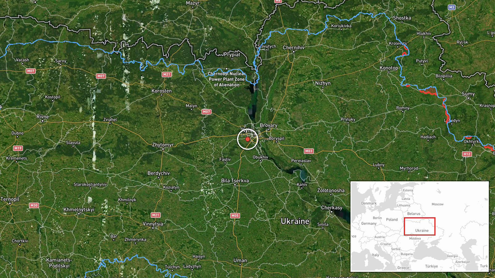
The coordinates correspond to the settlement of Vyshneve, placed at settlement-level precision with high location confidence, based on the source's stated place name and a 2 km reference. Vyshneve lies in Kyiv Oblast, just west of the city of Kyiv, in a largely suburban and rural zone of low hills and river valleys draining toward the Dnipro basin. The area contains residential districts, roads leading into the capital and open agricultural land. Nearby features in the wider Kyiv region include the Kyiv Reservoir to the north and the Irpin and Dnipro river corridors, which can shape low-altitude drone routing.
Related events nearby
- Ukrainian air monitoring: 1 Russian Shahed-type drone over Borshchahivka, Kyiv.2026-10-18 15:26 UTC · Drone Transit · Borshchahivka, Kyiv, Ukraine
- Ukrainian air monitoring: 1 Russian jet-powered Shahed (Geran-3) drone passing Kyiv Reservoir, heading toward 2026-10-18 15:22 UTC · Drone Transit · Kyiv, Ukraine
- Ukrainian air monitoring: 1 Russian Shahed-type drone over Kyiv.2026-10-18 07:08 UTC · Drone Transit · Kyiv, Ukraine
- Ukrainian air monitoring: 1 Russian Shahed-type drone heading toward Kyiv.2026-10-18 07:06 UTC · Drone Transit · Kyiv, Ukraine
- Ukrainian air monitoring: 2+ Russian jet-powered Shahed (Geran-3) drones passing Zhashkiv, heading toward Kyiv2026-10-18 05:08 UTC · Drone Transit · Kyiv Oblast, Ukraine
▶ View this event on the live map

Intel Mapper aggregates open-source reports from monitored Telegram and X channels, geolocates them, cross-checks duplicates across sources and assigns a confidence score. Entries are updated as new confirmations arrive. Read how we verify events.