Resistance FPV drone strike reportedly hits Burmese military position in Salin Township
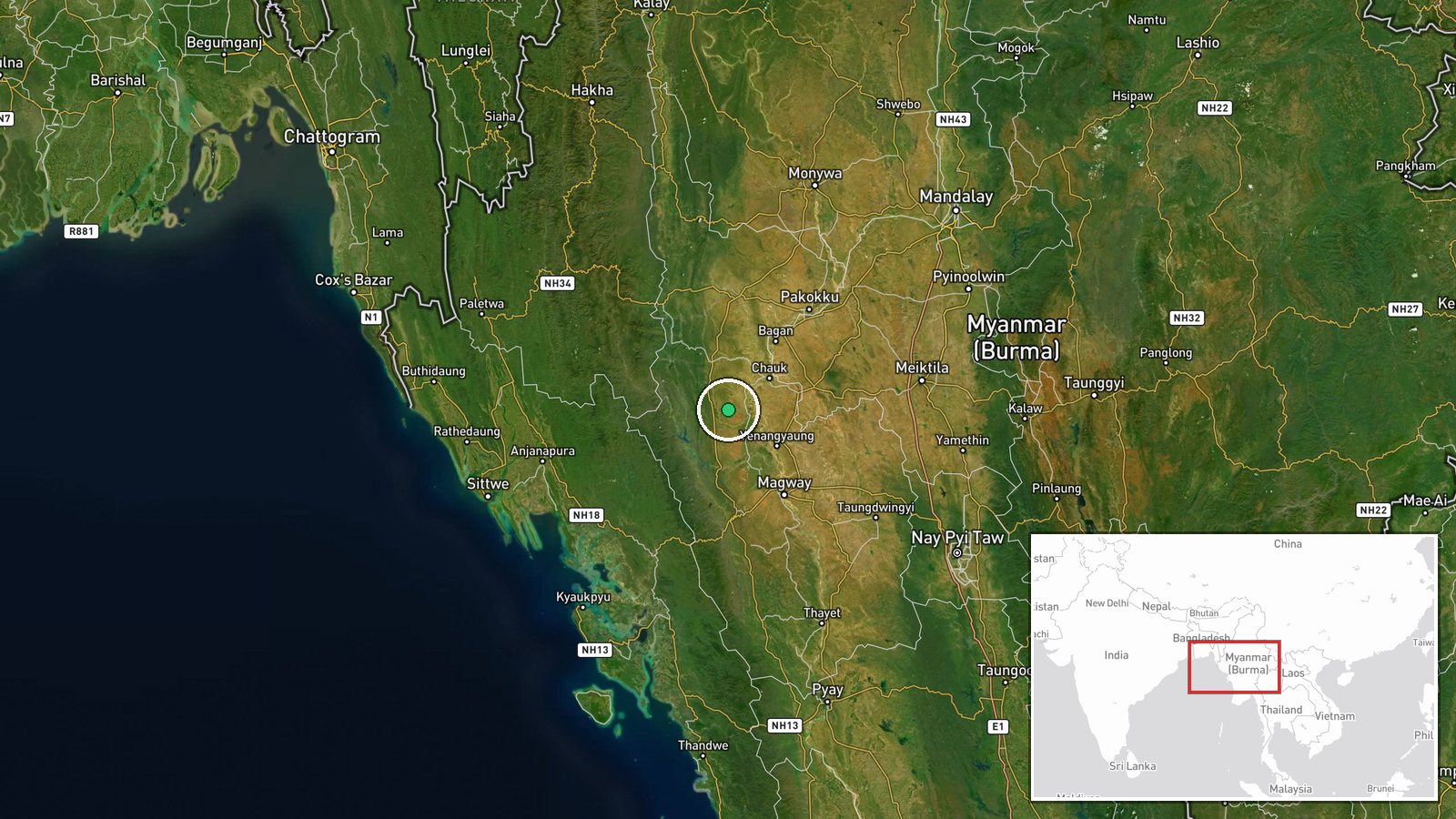
What happened
On 22 October 2026, at about 06:51 UTC, People's Defense Forces (PDF) reportedly struck a Burmese military position in Salin Township, Magway Region, central Myanmar. According to a post by the Telegram channel @war_noir, fighters used an FPV kamikaze drone armed with an MR-1 or improvised high-explosive warhead. The post's wording names the PDF and the Burmese Military but does not describe the damage, casualties, or the position's function. The accompanying text includes a clip showing a dog watching the drone, which the channel highlighted as a curiosity. The report has not been confirmed by a second independent source.
Context and assessment
Salin lies in the dry zone of central Myanmar, away from the western and northern frontlines where most major battles of the past two years have been fought. Strikes there matter because they indicate that anti-junta armed groups are contesting areas once considered relatively secure for the military. The related events in this cluster are in Rakhine State, roughly several hundred kilometres to the west. On 21 October, the Arakan Army reportedly fired an improvised 240mm rocket toward a Burmese Army base. On 22 October, a junta airstrike reportedly hit the Pi Chaung confluence, a trade hub on the Lemro river route, with local reports citing damage and a near halt to trade. These events do not establish any link to the Salin attack, and they belong to different fronts and different armed groups. Taken together, they do suggest a pattern of multiple armed actors using cheap, locally adapted weapons while the military uses air power against population and logistics nodes. An FPV drone strike fits the same low-cost approach. Operationally, the use of an FPV drone against a static position points to a small, technically capable cell that can build or procure drones and conduct close-range targeting. It may also show that the group sees value in striking military installations outside its core areas.
Sources and confidence
The report rests on a single Telegram channel, @war_noir, with no independent corroboration in the data. Source count is one, and the confidence score of 7.3 reflects a plausible claim by an unverified channel. The post includes a video, but a video alone does not verify the location, timing, or outcome. The score is held down by the absence of a PDF statement, junta comment, local-language media coverage, or independent geolocation of the footage. The score would rise if the video were geolocated to Salin, if PDF or allied media confirmed the strike, or if local outlets reported the impact. It would fall if the footage were found to be older, from another location, or recycled from earlier incidents.
Location
The coordinates, 20.6948 N and 94.5377 E, are at settlement precision and place the event at the Salin Township town area rather than a specific military facility. The geo precision flag and normal location confidence suggest the township was identified from the post, with the exact compound not confirmed. Salin is in Magway Region in the dry zone of central Myanmar, where the landscape is largely flat or gently rolling and covered by dry forest and agriculture. The Ayeyarwady River valley and its surrounding plains lie to the east and north, which shape road and river movement across the area.
Related events nearby
- Arakan Army fired an R-240 240mm rocket, improvised on sandbags and cables without a launcher, toward a Burmes2026-10-21 08:57 UTC · Artillery · Rakhine State, Myanmar
- Myanmar junta bombed the Pi Chaung confluence, a key trade hub on the Lemro river route into Rakhine; trade re2026-10-22 03:01 UTC · Airstrike · Pi Chaung confluence, Rakhine State, Myanmar
▶ View this event on the live map

Intel Mapper aggregates open-source reports from monitored Telegram and X channels, geolocates them, cross-checks duplicates across sources and assigns a confidence score. Entries are updated as new confirmations arrive. Read how we verify events.