Israeli drone strike reported on Nabatieh in southern Lebanon
What happened
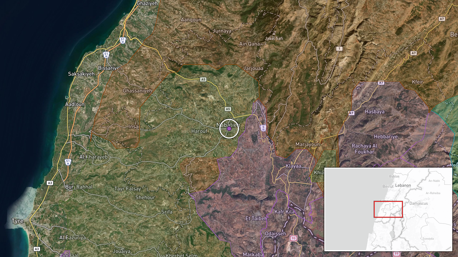
An Israeli drone strike reportedly targeted Nabatieh city in Lebanon's South Governorate on September 6, according to an Al Jazeera correspondent cited via Telegram. Nabatieh, located approximately 12 kilometers from the Israeli border, is a significant urban center in the region. The strike occurred at 15:11 UTC and was confirmed by the international news outlet's on-ground reporting. No immediate casualty figures or damage assessments were provided in the report.
Context and assessment
Nabatieh sits in southern Lebanon's populated coastal zone, a region that has experienced intensified Israeli military operations in recent days. This strike follows Israeli deployments near Ali al-Tahir focused on tunnel destruction and establishment of security buffer zones, suggesting a broader campaign targeting infrastructure and positions in southern Lebanese territory. Concurrent Israeli artillery strikes in nearby Syria's Quneitra Governorate and checkpoint deployments indicate sustained regional military operations across multiple fronts. The timing and location suggest operations may be consolidating control or degrading capabilities perceived as threatening.
Sources and confidence
Reported by Al Jazeera correspondent via Telegram channel @warmonitors. Single source confirmation limits independent verification; the account cites a major international news organization present on the ground. Confidence score of 6.0 reflects credible source but lack of corroboration from secondary channels. Additional confirmation from other news agencies or visual evidence would increase confidence; retraction by Al Jazeera or contradictory reporting would lower it.
Location
Nabatieh city in Lebanon's South Governorate, determined by exact coordinates (33.37722°N, 35.48361°E). The city lies approximately 12 kilometers north of the Israeli border in a coastal administrative zone, situated between the Mediterranean coastal areas to the west and the Litani River valley to the east. It is a major population center in the southern Lebanese region.
Related events nearby
- Israeli airstrike struck Nabatieh, Lebanon. Lebanese reporter injured during live broadcast coverage; stable c2026-09-07 12:12 UTC · Airstrike · Nabatieh, South Governorate, Lebanon
- Israeli fighter jets conducted extensive airstrikes on Nabatieh area in southern Lebanon since morning. Ongoin2026-09-06 17:23 UTC · Airstrike · Nabatieh, South Governorate, Lebanon
- Israeli airstrikes struck a three-story residential building and civilian vehicle in Kfar Raman, southern Leba2026-09-07 06:07 UTC · Airstrike · Kafr Ruman, Nabatieh Governorate, Lebanon
- Israeli artillery and gunfire targeted Quneitra Countryside in southern Syria amid escalating military tension2026-09-06 20:13 UTC · Artillery · Quneitra Countryside, Quneitra Governorate, Syria
- Families of detainees held in Israeli prisons from Daraa, Quneitra, and Rif Dimashq governorates organized a p2026-09-07 08:20 UTC · Statement · Nab'a al-Fuar, Quneitra Governorate, Syria
▶ View this event on the live map
Intel Mapper aggregates open-source reports from monitored Telegram and X channels, geolocates them, cross-checks duplicates across sources and assigns a confidence score. Entries are updated as new confirmations arrive. Read how we verify events.