Yemeni Government airstrikes target Houthi reinforcements on Taiz road
What happened
Yemeni Government armed forces conducted airstrikes targeting Houthi reinforcements moving along the Al-Barh-Al-Mukha road in Taiz Governorate on September 16. The strikes reportedly aimed at disrupting Houthi force movement in the contested region. Al Arabiya cited field sources for the report, which was circulated via Telegram channels monitoring the conflict.
Context and assessment
The Al-Barh-Al-Mukha road in western Taiz remains a key supply and movement corridor in the ongoing Yemen conflict. This airstrike follows a pattern of intense activity across Taiz on September 16, including a government anti-tank strike destroying a Houthi vehicle in western Taiz earlier that day, and combat clashes at the Bab el-Mandeb Strait involving government-aligned forces. Houthi air defense claims of intercepting Saudi F-15s over Taiz the same evening suggest sustained coalition air operations in the area. These events indicate continued pressure on Houthi logistics and reinforcement lines, though the operational scale and effectiveness of the strikes remain unclear.
Sources and confidence
Single report from Al Arabiya via Telegram (@warmonitors), dated September 16, 2026. No cross-confirmation from independent second sources or competing accounts. Confidence score of 6.0 reflects reliable reporting outlet but lack of corroboration. Independent verification, video evidence, or Houthi acknowledgment would strengthen confidence; contradictory claims or source retraction would lower it.
Location
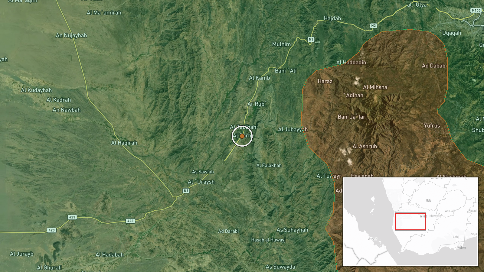
Al-Barh-Al-Mukha road is located in western Taiz Governorate, Yemen, running through contested terrain between Houthi-controlled and government-held areas. The road serves as a key logistics route in the mountainous Red Sea coastal region. Coordinates indicate the central portion of this supply corridor, approximately 80 kilometers south of the Taiz city center.
Related events nearby
- Yemeni government forces destroyed a Houthi vehicle with an ATGM strike in western Taiz Governorate.2026-09-16 15:10 UTC · Combat · West Taiz, Taiz Governorate, Yemen
- Houthi forces claimed interception of two Saudi F-15 fighter jets over Taiz Governorate using locally-made sur2026-09-16 17:14 UTC · Air Defense · Taiz Governorate, Yemen
- Yemen Government-aligned Amalika Brigade reports ongoing combat with Houthi forces at Kahbub position in Bab e2026-09-16 18:55 UTC · Combat · Bab el-Mandeb Strait, Red Sea
- Saudi/coalition aircraft conducted airstrikes targeting Houthi positions in Yemen. No specific casualties or d2026-09-15 23:05 UTC · Airstrike · Houthi-controlled areas, Yemen
▶ View this event on the live map
Intel Mapper aggregates open-source reports from monitored Telegram and X channels, geolocates them, cross-checks duplicates across sources and assigns a confidence score. Entries are updated as new confirmations arrive. Read how we verify events.