Hezbollah expands control in southern Lebanon by approximately 142 square kilometers
What happened
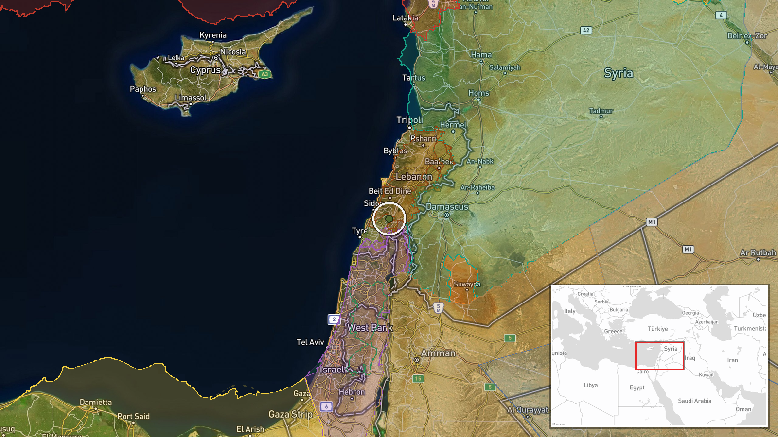
According to an updated conflict control map, Hezbollah forces have expanded their territorial control in the Liban-Sud (South Lebanon) region by roughly 142 square kilometers as of September 27, 2026. The expansion was recorded on a Wiki conflict mapping resource. The report provides no details on the specific tactical means of this expansion or whether it involved active combat operations or consolidation of previously contested areas.
Context and assessment
Southern Lebanon has been a focal point of Israel-Hezbollah operations throughout 2026. This reported Hezbollah expansion occurs the same day Israeli forces expanded control by approximately 15 square kilometers in the adjacent Nabatîyé area to the south, suggesting ongoing ground-level competition for territory in the border region. The pattern of simultaneous control changes by both actors indicates active, fluid combat dynamics rather than stable front lines. Such territorial adjustments may reflect either tactical repositioning, response to losses elsewhere, or consolidation following earlier gains. The scale of Hezbollah's reported expansion is substantially larger than the concurrent Israeli gain, though the relationship between these figures and actual military capacity remains unclear.
Sources and confidence
The report originates from a single source: a Wiki-based conflict control map. No additional corroboration from independent channels, military statements, or field observers is noted. The confidence score of 7.5 reflects the moderate reliability of crowdsourced mapping data, which can be updated rapidly but may contain errors. Confirmation from secondary sources or official statements would raise confidence; conflicting reports from rival mapping projects would lower it.
Location
Liban-Sud (South Lebanon) is a region in southern Lebanon near the Israeli border. Coordinates place the report center at approximately 33.47°N, 35.57°E. The region includes towns such as Nabatîyé, Tyre, and Sidon, with terrain ranging from coastal plains to hills. Precision is regional rather than specific to individual settlements or facilities, reflecting the scale of the reported territorial change.
Related events nearby
- Israel forces expanded control (~15 km²) in the Nabatîyé area per updated conflict control map.2026-09-26 17:57 UTC · Combat · Nabatîyé
- Pilot Khaldoun Husein Mubarak, known for threatening repeated civilian strikes after his aircraft was shot dow2026-09-26 14:11 UTC · Security · Damascus, Syria
- Israeli military patrol of 5 armored vehicles infiltrated the outskirts of Bayt Jan village west of Damascus, 2026-09-26 13:48 UTC · Security · Bayt Jan, Rif Dimashq Governorate, Syria
- Israel announces comprehensive closure of West Bank with passage restrictions from Sunday through Saturday.2026-09-27 06:40 UTC · Statement · West Bank, Palestine
▶ View this event on the live map
Intel Mapper aggregates open-source reports from monitored Telegram and X channels, geolocates them, cross-checks duplicates across sources and assigns a confidence score. Entries are updated as new confirmations arrive. Read how we verify events.