Lebanese forces expand control in Mont-Liban region by approximately 4 square kilometers
What happened
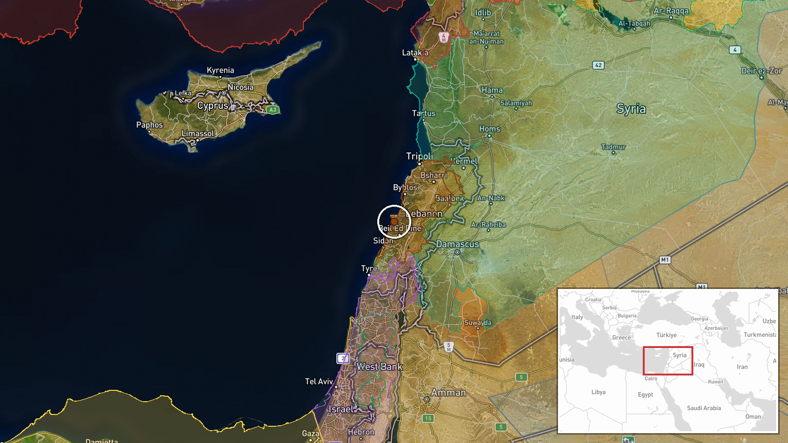
According to an updated conflict control map, Lebanese armed forces expanded their territorial control in the Mont-Liban area by roughly four square kilometers on September 17. The map update, which serves as the primary source for this report, indicates a shift in the military balance in this central Lebanese region. Mont-Liban, a mountainous area in central Lebanon, has been a zone of strategic importance throughout various phases of Lebanese internal and regional conflict.
Context and assessment
Mont-Liban's elevated terrain in the country's heartland makes it operationally significant for controlling approaches to Beirut and the central Beqaa Valley. This territorial expansion comes amid a complex security environment marked by Israeli airstrikes on southern Lebanon on September 16 and 17, including strikes on Mansouri. Concurrently, Lebanese authorities have announced refugee management initiatives coordinating with Syria. The timing and location of this control shift may reflect Lebanese state efforts to consolidate authority across its territory, though the immediate tactical drivers remain unclear. Such expansions typically indicate either successful military operations or organizational shifts in how existing positions are mapped and categorized.
Sources and confidence
A single source—Wiki's conflict control map—reported this update on September 17. The map was updated at 17:32 UTC but lacks corroborating reports from independent channels or military statements. The confidence score of 7.5 reflects moderate reliance on a specialized mapping source without secondary confirmation. Confirmation from Lebanese military statements, independent analysts, or multiple intelligence assessments would substantially increase confidence. Ground reports or satellite imagery documentation would further validate the claim.
Location
Mont-Liban (mountainous region, central Lebanon) is located at approximately 33.84°N, 35.51°E. The region is part of the Mount Lebanon Range running north-south through central Lebanon. Its elevated terrain overlooks the Mediterranean coastal plain to the west and the Beqaa Valley to the east, making it strategically positioned above major population centers and transport routes.
Related events nearby
- Lebanese judicial source identifies Hezbollah liaison officer Yasser Ala al-Din ('Hajj Alaa') connected to net2026-09-17 18:32 UTC · Security · Beirut, Lebanon
- Israeli airstrikes conducted on southern Lebanon. Details limited; source references video link (inaccessible 2026-09-16 23:20 UTC · Airstrike · Southern Lebanon, Lebanon
- Israeli warplanes conducted an airstrike on the town of Mansouri in southern Lebanon.2026-09-17 14:07 UTC · Airstrike · Mansouri, South Lebanon
- UN Deputy Special Envoy Cordone condemns abduction and deportation of Atef Hneidi by armed men allegedly linke2026-09-17 15:31 UTC · Security · Damascus, Syria
- Syrian Army announces graduation ceremony for new officer cohort to begin service in naval forces.2026-09-17 15:21 UTC · Statement · Damascus, Syria
▶ View this event on the live map
Intel Mapper aggregates open-source reports from monitored Telegram and X channels, geolocates them, cross-checks duplicates across sources and assigns a confidence score. Entries are updated as new confirmations arrive. Read how we verify events.