SDF reportedly expands control in Aleppo area by approximately 1,582 km²
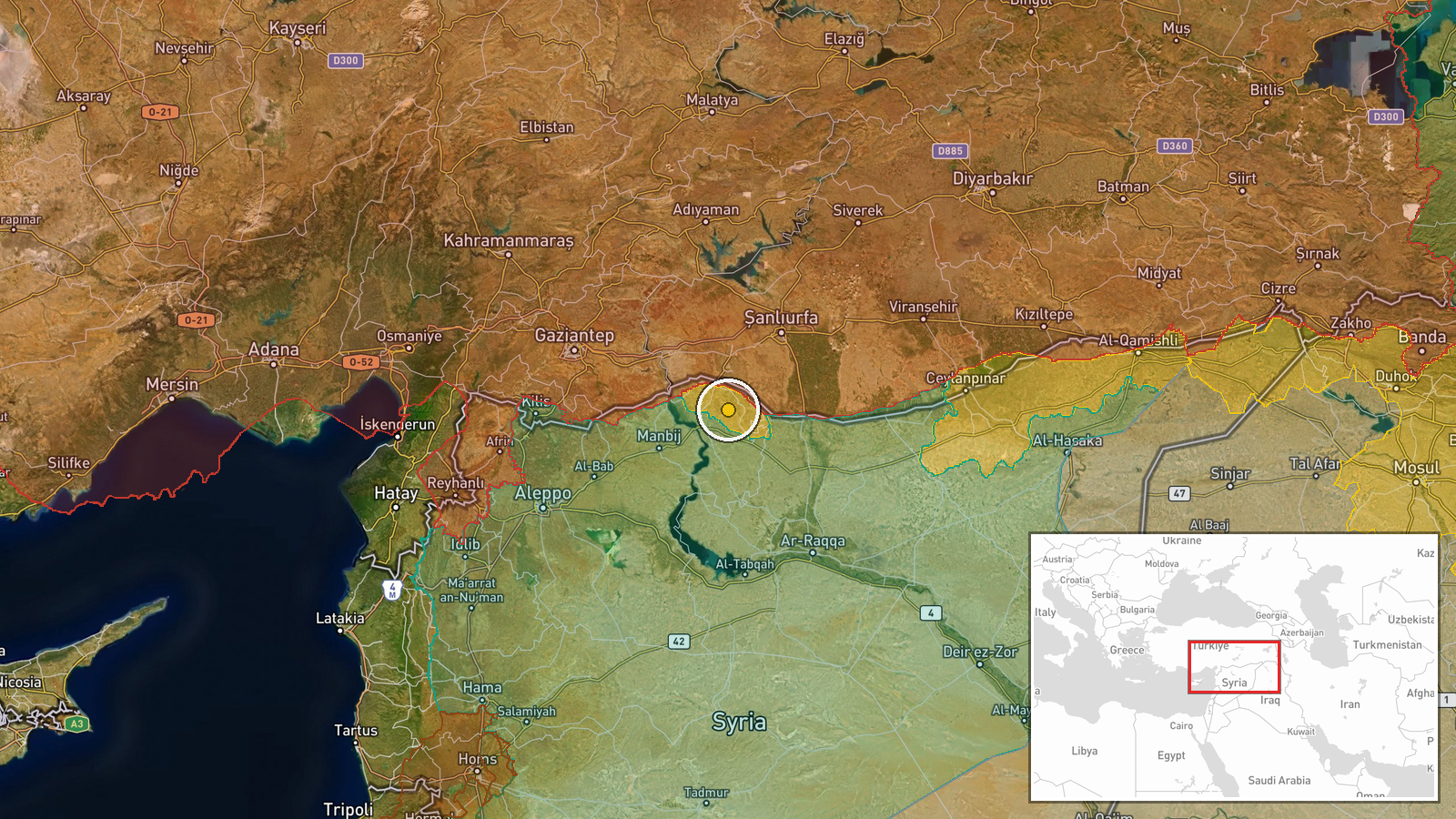
What happened
According to an updated conflict control map, the Syrian Democratic Forces (SDF) expanded their territorial control in the Aleppo region by roughly 1,582 square kilometers as of October 5, 2026. The report comes from a Wiki control map source tracking frontline positions in northern Syria. The precise locations and nature of the territorial gains are not detailed in the available source material.
Context and assessment
The Aleppo region remains a contested area in northern Syria where multiple armed groups maintain competing territorial claims. This reported SDF expansion occurs on the same day that HTS forces are documented as expanding control in the same area by a similar magnitude, suggesting significant frontline repositioning across northern Syria. The pattern of territorial shifts, combined with concurrent displacement of civilians returning to Ras al-Ain in Hasaka Governorate, may indicate broader operational changes affecting both military positions and civilian populations in northeastern Syria.
Sources and confidence
Reported by Wiki control map, a crowdsourced conflict mapping resource. The confidence score of 7.5 reflects reliance on a single source without independent corroboration from other channels. Cross-confirmation with other mapping platforms or military sources would substantially strengthen confidence. Clarification of specific locations and tactical details would also improve assessment reliability.
Location
Aleppo region in northern Syria, located at approximately 36.74°N, 38.43°E. The region encompasses the area around Syria's northernmost major city and extends into territory adjacent to the Turkish border. Aleppo governorate is a strategically significant area where Turkish, Kurdish, Syrian, and other armed groups maintain overlapping spheres of influence.
Related events nearby
- HTS forces expanded control (~1582 km²) in the Aleppo area per updated conflict control map.2026-10-05 05:56 UTC · Combat · Aleppo
- Third batch of 516 families of displaced persons returning from Al-Hasaka camps to their original areas in Ras2026-10-05 07:13 UTC · Displacement · Ras al-Ain, Hasaka Governorate, Syria
▶ View this event on the live map
Intel Mapper aggregates open-source reports from monitored Telegram and X channels, geolocates them, cross-checks duplicates across sources and assigns a confidence score. Entries are updated as new confirmations arrive. Read how we verify events.