Houthi forces expand control by ~161 km² in Ta'izz Governorate
What happened
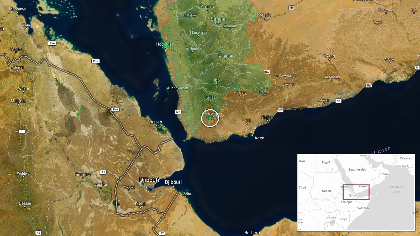
Houthi (Ansar Allah) forces expanded territorial control by approximately 161 square kilometers in the Ta'izz Governorate, according to updated conflict control mapping. The expansion was documented on October 4, 2026. The scale of the reported gain significantly exceeds concurrent territorial shifts by other parties in the same governorate, where Yemen Government (PLC) forces added roughly 9 km² and Houthis recorded a separate 4 km² gain on the same date.
Context and assessment
Ta'izz Governorate has remained a major flashpoint in Yemen's conflict, contested between Houthi forces and Saudi-backed government factions. The reported 161 km² expansion follows a larger 92 km² Houthi gain recorded earlier on October 4, suggesting sustained pressure by Houthi forces in the region. Related reports indicate Houthis seized the residence of Parliament Speaker Sultan al-Barakani in Al-Hawban, south of Taiz, following armed clashes. The pattern suggests a coordinated Houthi advance, though control map updates reflect positions at specific moments and may reflect tactical gains, map corrections, or consolidation of previously contested areas.
Sources and confidence
Single source: Wiki control map (October 4, 2026). Confidence score of 7.5 reflects reliance on a live conflict map without independent cross-confirmation from news agencies or military statements. Confidence would increase with corroboration from press reports or official announcements; it would decrease if subsequent map updates revise the figures significantly.
Location
Ta'izz Governorate, southwestern Yemen. Positioned at approximately 13.18°N, 44.02°E. The governorate encompasses the city of Taiz and surrounding highlands, a strategically significant region for control of central-southern Yemen and access to commercial routes.
Related events nearby
- Houthi (Ansar Allah) forces expanded control (~92 km²) in the Ta'izz Governorate area per updated conflict con2026-10-04 05:55 UTC · Combat · Ta'izz Governorate
- Houthi forces seized the residence of Yemeni Parliament Speaker Sultan al-Barakani in Al-Hawban, south of Taiz2026-10-04 12:27 UTC · Combat · Al-Hawban, Ta'izz Governorate, Yemen
- Houthi forces advance near Taiz in southwestern Yemen and cut the route between Taiz city and Aden port. Saudi2026-10-04 16:40 UTC · Combat · Taiz, Yemen
▶ View this event on the live map
Intel Mapper aggregates open-source reports from monitored Telegram and X channels, geolocates them, cross-checks duplicates across sources and assigns a confidence score. Entries are updated as new confirmations arrive. Read how we verify events.