Houthis expand control in Lahij Governorate amid broader Yemen territorial shifts
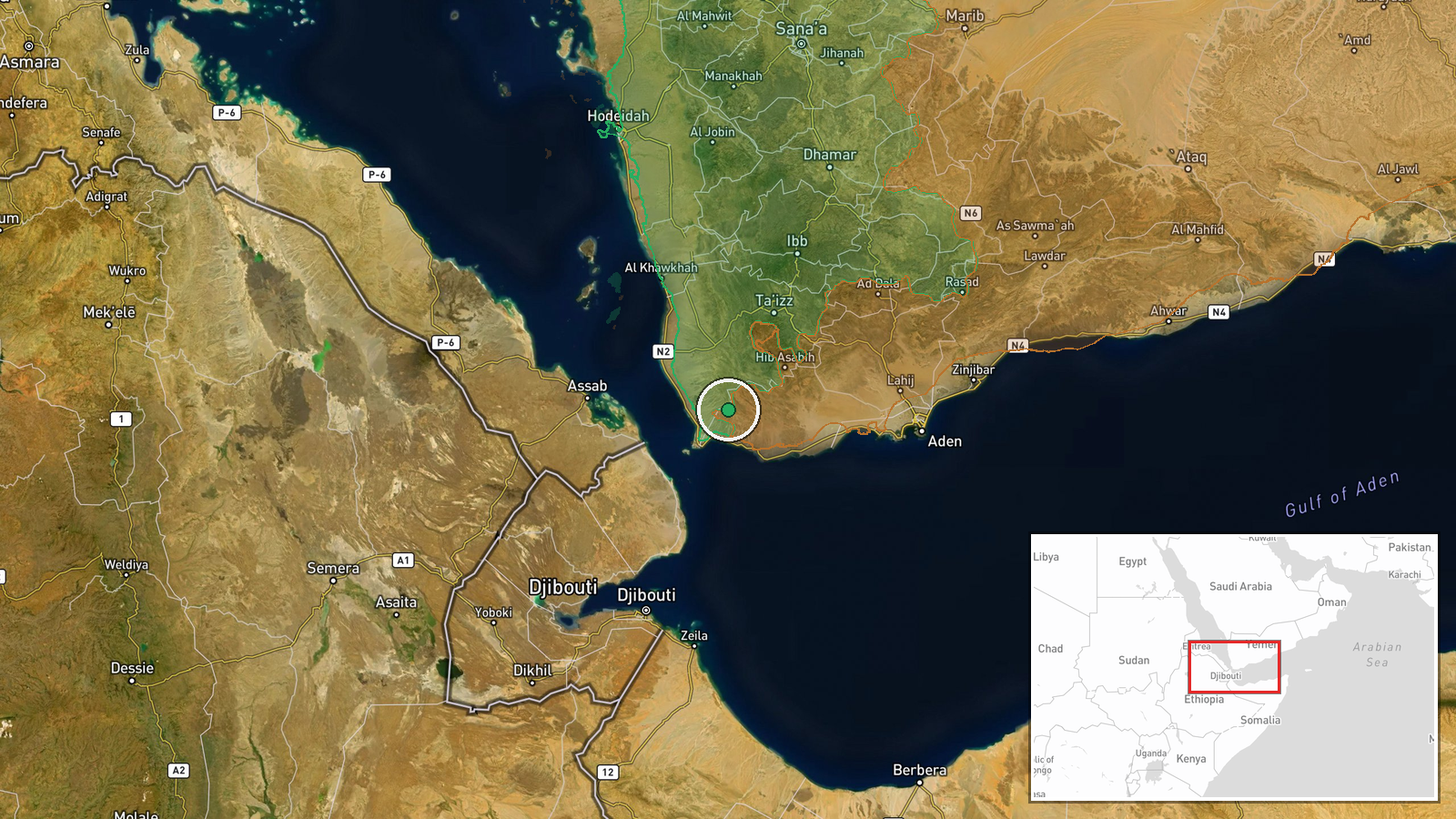
What happened
Houthi forces reportedly expanded territorial control by approximately 35 square kilometers in Lahij Governorate on October 7, according to updates to a conflict control map. The expansion was recorded in the same map update that documented concurrent changes in nearby Ta'izz Governorate, where Yemen Government forces also gained territory. The precise locations and nature of combat operations driving these changes were not detailed in the map source.
Context and assessment
Lahij Governorate lies in southwestern Yemen between the strategic Bab al-Mandab strait and the interior highlands. Control of this area provides access to transportation routes and local resources. The reported Houthi gain follows a pattern of simultaneous territorial jockeying across multiple governorates on the same date, with related events showing government forces repelling a Houthi attempt near Dhobab in Ta'izz on October 7 and capturing armored vehicles. The cumulative scale of reported Houthi gains in Ta'izz (188 km²) significantly exceeds government gains (26 km² combined over two days), suggesting sustained Houthi momentum in the wider region despite localized government successes.
Sources and confidence
Single source: Wiki control map update dated October 7, 2026. No independent cross-confirmation reported. Confidence score of 7.5 reflects reliance on one mapping platform without corroborating military reports or field verification. Score would increase with confirmation from independent map sources or official statements; it would lower if the update were subsequently revised or if underlying combat reports proved inaccurate.
Location
Lahij Governorate, southwestern Yemen, located south of Ta'izz and north of Aden, between the Red Sea and interior highlands. Coordinates given at regional precision (12.93°N, 43.71°E). Specific settlements or tactical positions involved in the expansion were not identified in the available data.
Related events nearby
- Houthi (Ansar Allah) forces expanded control (~132 km²) in the Lahij Governorate area per updated conflict con2026-10-07 17:59 UTC · Combat · Lahij Governorate
- Yemen Government (PLC) forces expanded control (~12 km²) in the Ta'izz Governorate area per updated conflict c2026-10-07 17:59 UTC · Combat · Ta'izz Governorate
- Yemeni government forces repelled a Houthi attempt to seize armored vehicles in the Dhobab area of Bab al-Mand2026-10-07 13:07 UTC · Combat · Dhobab, Taizz, Yemen
- Saudi-led coalition airstrikes targeted Houthi gatherings in Al-Mawasit District south of Taiz, Yemen. Militar2026-10-07 13:07 UTC · Airstrike · Al-Mawasit District, Taiz, Yemen
- Houthis launched two ballistic missiles and explosive drones at Aden International Airport, targeting the runw2026-10-06 23:22 UTC · Ballistic Missile · Aden International Airport, Aden, Yemen
▶ View this event on the live map
Intel Mapper aggregates open-source reports from monitored Telegram and X channels, geolocates them, cross-checks duplicates across sources and assigns a confidence score. Entries are updated as new confirmations arrive. Read how we verify events.