Saudi-led coalition strikes Houthi positions in Al-Mawasit District, Taiz
What happened
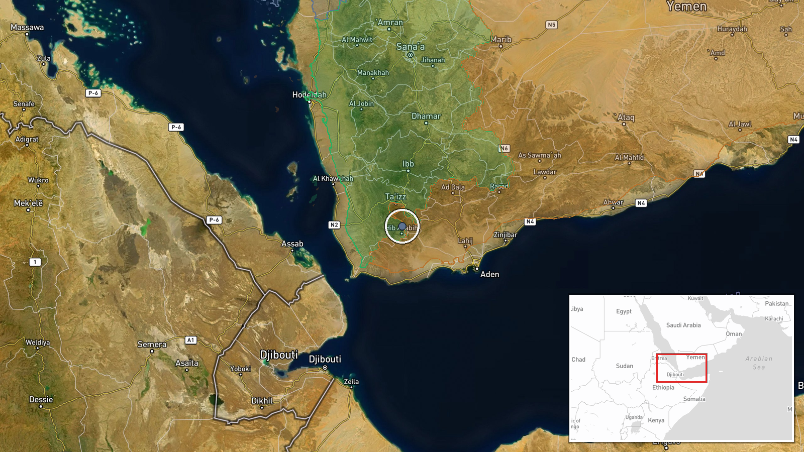
The Saudi-led coalition conducted airstrikes against reported Houthi gatherings in Al-Mawasit District, located south of Taiz city in Yemen's Taiz Governorate, on October 7, 2026. Military sources disclosed the operation via Al Hadath news channel. The strikes targeted what were described as Houthi (Ansar Allah) assembled personnel or positions in the district.
Context and assessment
Taiz Governorate remains a contested area where Houthi forces and Yemen Government-aligned troops continue intensive combat operations. Related reports from October 6 documented heavy clashes west of Taiz near Al-Misrakh and significant territorial fluctuations, with Houthis reportedly expanding control by approximately 188 square kilometers in the governorate during the same period. The coalition's air campaign has historically targeted Houthi command nodes and concentrations of fighters. This strike may reflect coalition efforts to disrupt Houthi operational buildup amid ongoing ground competition for territory in the strategically important Taiz region, which controls approaches to the Bab al-Mandab Strait.
Sources and confidence
Reported by military sources via Al Hadath, disseminated through X account @Osint613. Single-source confirmation limits confidence to moderate (6.0/10). Cross-confirmation from independent observers or official statements would strengthen assessment. Coalition confirmation or Houthi casualty claims would raise confidence; lack of secondary corroboration or geographic precision clarification would lower it.
Location
Al-Mawasit District is located in Taiz Governorate, approximately 25 kilometers south of Taiz city (coordinates 13.30°N, 44.10°E). The district sits in western Yemen's mountainous region, near key transit routes. Precision determined to settlement level based on named district designation.
Related events nearby
- Houthi (Ansar Allah) forces expanded control (~188 km²) in the Ta'izz Governorate area per updated conflict co2026-10-06 17:59 UTC · Combat · Ta'izz Governorate
- Yemen Government (PLC) forces expanded control (~14 km²) in the Ta'izz Governorate area per updated conflict c2026-10-06 17:59 UTC · Combat · Ta'izz Governorate
- Yemeni government forces repelled a Houthi attempt to seize armored vehicles in the Dhobab area of Bab al-Mand2026-10-07 13:07 UTC · Combat · Dhobab, Taizz, Yemen
- Houthis launched two ballistic missiles and explosive drones at Aden International Airport, targeting the runw2026-10-06 23:22 UTC · Ballistic Missile · Aden International Airport, Aden, Yemen
- Houthis fired 2 ballistic missiles and multiple drones at Aden International Airport runway and terminal overn2026-10-07 07:15 UTC · Ballistic Missile · Aden International Airport, Aden, Yemen
▶ View this event on the live map
Intel Mapper aggregates open-source reports from monitored Telegram and X channels, geolocates them, cross-checks duplicates across sources and assigns a confidence score. Entries are updated as new confirmations arrive. Read how we verify events.