Yemen Government forces gain ground in Ta'izz amid ongoing Houthi clashes
What happened
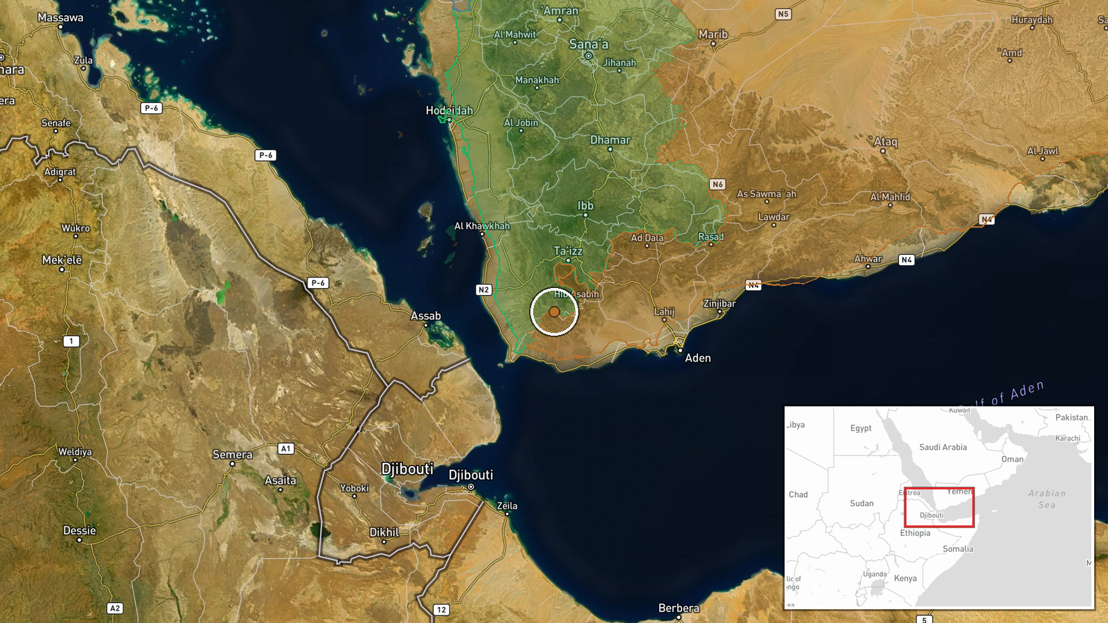
According to conflict mapping updates, Yemen Government (Presidential Leadership Council) forces reportedly expanded territorial control by approximately 14 square kilometres in Ta'izz Governorate on 6 October. The update reflects changes in the contested control map but does not specify the precise locations of gains or tactical details of the operation. This development comes alongside reported Houthi territorial expansion in the same governorate during the same period.
Context and assessment
Ta'izz Governorate has remained one of Yemen's most bitterly contested zones, with intense fighting between government-aligned forces and Houthi (Ansar Allah) fighters ongoing for years. The governorate's strategic position controlling main supply routes and population centres makes it militarily significant. Recent reports indicate heavy combat engagement west of the provincial capital, particularly around Al-Misrakh. The simultaneous reporting of gains by both sides in the same region suggests fluid front lines typical of positional warfare in this area, where control can shift rapidly. Such territorial fluctuations may indicate sustained military pressure from the government side, though the modest scale of reported gains relative to Houthi-reported expansion invites caution about interpretation.
Sources and confidence
Single source via Wiki conflict control map, which aggregates multiple open-source intelligence inputs but operates with inherent limitations in real-time accuracy. Cross-referenced against same-day reports of intense clashes near Al-Misrakh. Confidence score of 7.5 reflects the authoritative nature of the control map source but single-source limitation and lack of independent corroboration from military or humanitarian observers.
Location
Ta'izz Governorate in southwestern Yemen, approximately 13.1°N, 43.9°E. The specific sub-location of territorial gains not determined from available data; likely pertains to contested areas west of Taiz city based on related combat reports. The region sits in Yemen's western highlands with significant population centres and transport corridors.
Related events nearby
- Houthi (Ansar Allah) forces expanded control (~188 km²) in the Ta'izz Governorate area per updated conflict co2026-10-06 17:59 UTC · Combat · Ta'izz Governorate
- Intense clashes between Yemeni Government forces and Houthis ongoing west of Taiz. Heavy combat engagement in 2026-10-06 14:59 UTC · Combat · Al-Misrakh, Taiz Governorate, Yemen
▶ View this event on the live map
Intel Mapper aggregates open-source reports from monitored Telegram and X channels, geolocates them, cross-checks duplicates across sources and assigns a confidence score. Entries are updated as new confirmations arrive. Read how we verify events.