Houthi forces expand control by 188 km² in Ta'izz Governorate
What happened
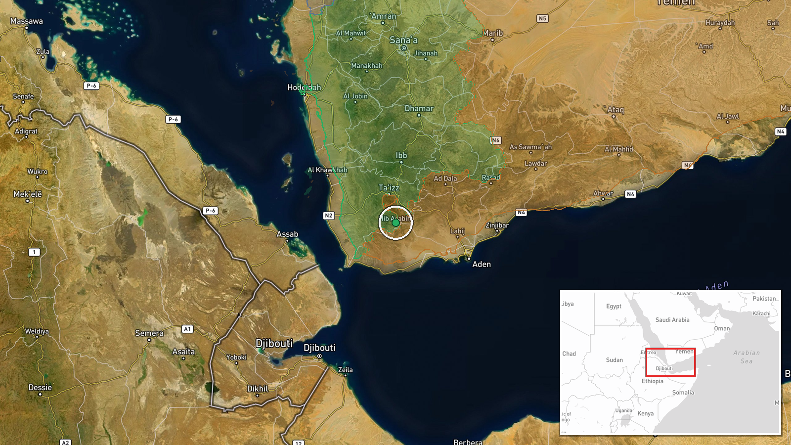
Houthi (Ansar Allah) forces reportedly expanded territorial control by approximately 188 square kilometers in the Ta'izz Governorate according to an updated conflict control map posted on October 6, 2026. The expansion occurred amid ongoing combat operations in the region. The same mapping update indicates that Yemen Government (PLC) forces also gained control of roughly 14 square kilometers in the same governorate during the same period, suggesting fluid and contested territorial dynamics.
Context and assessment
Ta'izz Governorate has remained one of Yemen's most contested zones throughout the conflict, with control frequently shifting between Houthi and Government-aligned forces. The reported Houthi expansion follows intense clashes reported west of Taiz city near Al-Misrakh on the same day, indicating sustained military pressure in the area. The simultaneous Government gains suggest fragmented control with multiple competing forces rather than wholesale territorial loss, consistent with the pattern of localized engagements that have characterized the Ta'izz front. The scale of claimed Houthi gains may reflect consolidation of previously disputed ground or advances in specific sectors rather than a unified breakthrough.
Sources and confidence
Reported by Wiki control map, a crowdsourced mapping platform tracking conflict control across Yemen. Single source limits independent verification; no corroborating military statements from Houthi or Government forces are noted. Confidence is moderate due to reliance on one mapping source and the inherent difficulty in real-time territorial assessment. Confirmation through satellite imagery or direct military statements would strengthen confidence significantly.
Location
Ta'izz Governorate, southwestern Yemen, located between the central highlands and the Red Sea coast. The governorate encompasses the strategic city of Taiz, historically Yemen's commercial hub. Related combat reports reference Al-Misrakh area west of the city, indicating the expansion likely encompasses multiple contested zones across the governorate's fragmented front lines rather than a single concentrated area.
Related events nearby
- Yemen Government (PLC) forces expanded control (~14 km²) in the Ta'izz Governorate area per updated conflict c2026-10-06 17:59 UTC · Combat · Ta'izz Governorate
- Intense clashes between Yemeni Government forces and Houthis ongoing west of Taiz. Heavy combat engagement in 2026-10-06 14:59 UTC · Combat · Al-Misrakh, Taiz Governorate, Yemen
- British RAF KC-3 Voyager aerial refueling tankers tracked conducting missions near southern Yemen, likely supp2026-10-05 21:18 UTC · Deployment · Southern Yemen, Yemen
▶ View this event on the live map
Intel Mapper aggregates open-source reports from monitored Telegram and X channels, geolocates them, cross-checks duplicates across sources and assigns a confidence score. Entries are updated as new confirmations arrive. Read how we verify events.