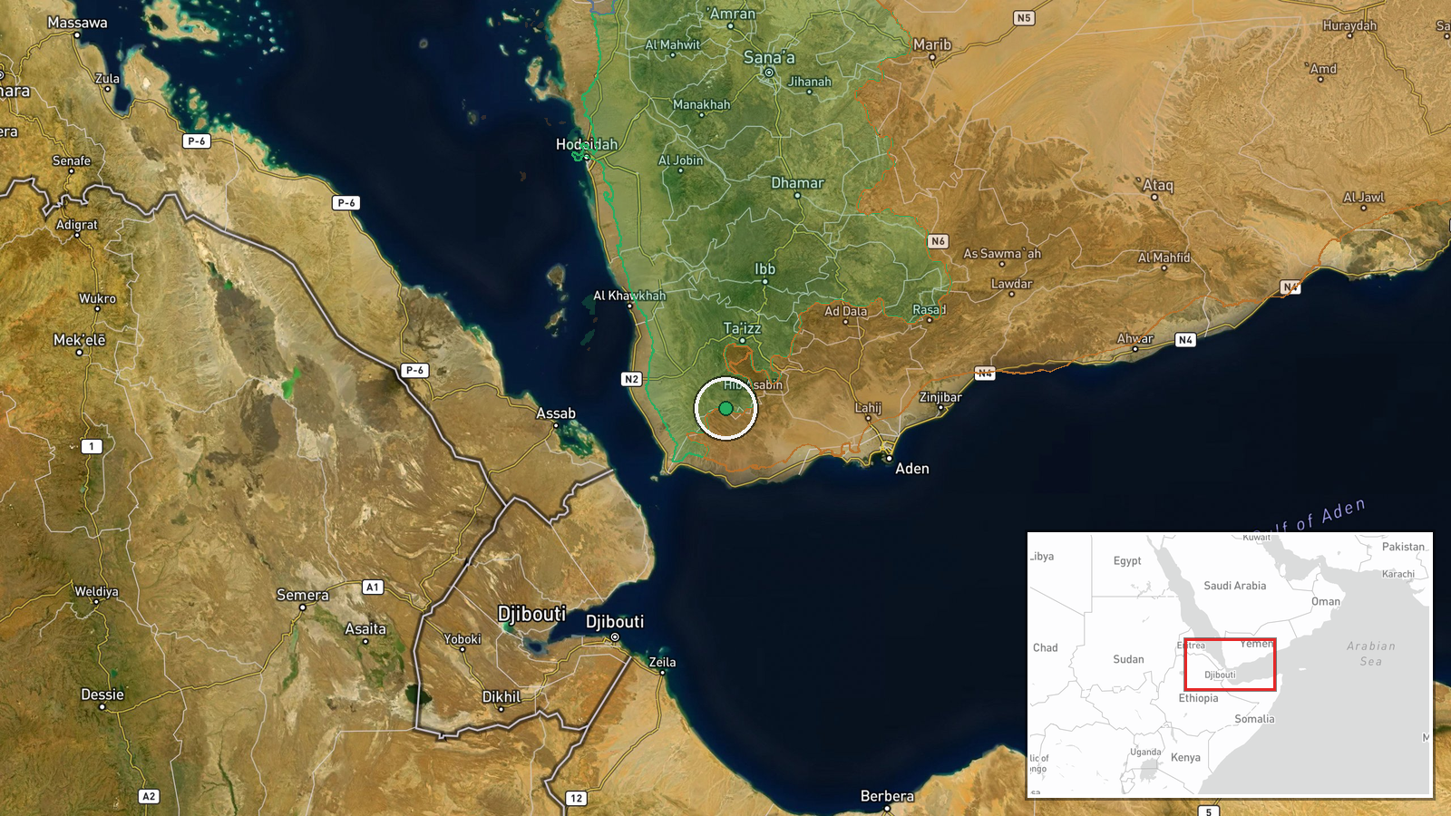
Houthi forces expand control in Ta'izz Governorate by approximately 18 km²
What happened
According to updated conflict control mapping, Houthi (Ansar Allah) forces have expanded their territorial control in the Ta'izz Governorate by roughly 18 square kilometers. The expansion was recorded on October 10, 2026. The precise nature of the military operations driving this territorial gain—whether through direct combat, tactical repositioning, or withdrawal by opposing forces—is not detailed in the available reporting.
Context and assessment
Ta'izz Governorate has remained a contested zone throughout Yemen's conflict, with control fluctuating between Houthi and Yemeni Government-aligned forces. This reported expansion follows drone strikes conducted by the Yemeni National Army against Houthi positions near Rada' on October 9, suggesting intensifying operational tempo in the region despite government counter-offensive efforts. The timing coincides with broader Houthi activities in the Red Sea and surrounding areas. Such territorial adjustments, though measured in area rather than strategic towns, may reflect incremental consolidation of contested ground or exploitation of tactical opportunities during ongoing clashes.
Sources and confidence
Reported solely by Wiki control map. Single-source reporting limits independent verification; control maps rely on aggregated intelligence and may reflect delayed updates or interpretation of scattered field reports. Confidence rating of 7.5/10 reflects the source's general reliability but the absence of corroborating independent confirmation. Direct military or government statements about territorial changes would strengthen confidence.
Location
Ta'izz Governorate, western Yemen, centered approximately at 13.1°N, 43.9°E. The governorate is a mountainous region along the Red Sea coast south of Sana'a, encompassing the port city of Ta'izz and surrounding rural and tribal areas. The expansion likely occurred along active front lines, possibly near Rada' or other contested zones where recent drone strikes were reported.
Related events nearby
- Yemeni Government military released video footage of drone strikes conducted against Houthi positions. Specifi2026-10-09 21:00 UTC · UAS Strike · Near Rada`, Ta'izz, Yemen (front line, estimated)
- Yemen's National Army conducted drone strikes against Houthi positions. Details on specific targets and casual2026-10-09 19:34 UTC · UAS Strike · Near Rada`, Ta'izz, Yemen (front line, estimated)
- Yemeni Government forces conducting mine-clearing operations in Bab al-Mandeb Strait, removing ordnance placed2026-10-10 15:47 UTC · Security · Bab al-Mandeb Strait, Red Sea
▶ View this event on the live map

Intel Mapper aggregates open-source reports from monitored Telegram and X channels, geolocates them, cross-checks duplicates across sources and assigns a confidence score. Entries are updated as new confirmations arrive. Read how we verify events.