Iran releases video of ballistic missile launches from Larak Island
What happened
Iran released video footage on August 31 showing ballistic missile launches from Larak Island in the Strait of Hormuz, according to X account @ConflictTR. The videos document part of Iran's stated retaliation campaign following U.S. airstrikes on Islamic Revolutionary Guard Corps (IRGC) missile launcher positions on the island on August 30. The IRGC had announced its intention to respond after the American strikes, which targeted two launcher sites reportedly preparing to fire sea-mine-equipped rockets.
Context and assessment
Larak Island in the Strait of Hormuz is a significant Iranian military position and strategic location controlling one of the world's most critical shipping corridors. The video release follows a rapid escalation sequence: U.S. strikes on IRGC launchers on August 30, Iranian retaliation statements, ballistic missile fire toward U.S. naval assets in the strait on August 30–31, and now the publication of launch footage. The timing and nature of video release suggests Iran is documenting its military response for domestic and international audiences, consistent with patterns of strategic signaling during periods of acute tension. The sequence indicates ongoing confrontation over Iranian military capabilities in the strait.
Sources and confidence
Reported by X account @ConflictTR, a Turkish conflict monitoring channel, on August 31. Single source with no cross-confirmation listed. Confidence score of 6.0 reflects reliance on one reporting channel. Confirmation would be strengthened by independent verification of video authenticity, corroboration from additional regional monitors, or Iranian official statements with timestamps. Lower confidence reflects typical verification challenges with video content in active conflict settings.
Location
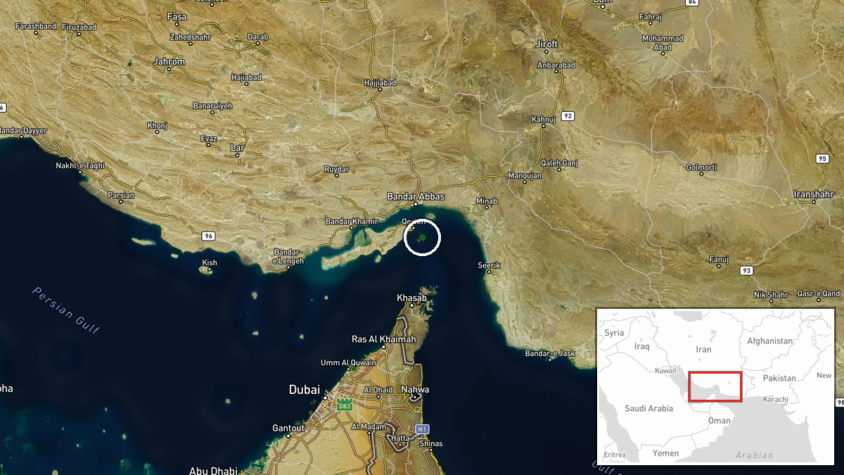
Larak Island, located in the Strait of Hormuz at coordinates 26.86°N, 56.36°E, in Iran's Hormozgan Province. The island sits in shallow Persian Gulf waters and is a known Iranian IRGC military installation. Geographic precision assessed at regional level due to video source; exact launcher positions within the island cannot be determined from available data. The strait location places launches in proximity to major international shipping routes and U.S. naval operating areas.
Related events nearby
- Iran's Islamic Revolutionary Guard Corps (IRGC) announces it will retaliate for U.S. airstrikes on Larak Islan2026-08-30 19:53 UTC · Statement · Larak Island, Strait of Hormuz, Iran
- U.S. airstrikes targeted Iranian missile launcher positions on Larak Island in the Strait of Hormuz. Weapons w2026-08-30 19:30 UTC · Statement · Larak Island, Strait of Hormuz, Iran
- U.S. forces struck two Iranian IRGC missile launchers on Larak Island in the Strait of Hormuz. IRGC was prepar2026-08-30 19:20 UTC · Airstrike · Lark Island, Strait of Hormuz, Iran
- Iran fires ballistic missiles toward U.S. naval assets in the Strait of Hormuz as retaliation for recent Ameri2026-08-30 21:30 UTC · Ballistic Missile · Strait of Hormuz, Iran-Oman Waters
- Iran fires ballistic missiles in response to U.S. airstrikes on Larak Island IRGC positions. Retaliation follo2026-08-30 21:28 UTC · Ballistic Missile · Strait of Hormuz, Iran-Oman Waters
▶ View this event on the live map
Intel Mapper aggregates open-source reports from monitored Telegram and X channels, geolocates them, cross-checks duplicates across sources and assigns a confidence score. Entries are updated as new confirmations arrive. Read how we verify events.