Iran reportedly deploys camera-guided missiles against U.S. warships in Persian Gulf
What happened
According to a social media report citing intelligence sources, Iran fired electro-optical missiles equipped with onboard cameras and sensors at U.S. warships in the Persian Gulf on September 10. The missiles reportedly feature course-correction capability, allowing them to adjust trajectory in flight using visual and sensory guidance. Intelligence assessments suggest Russian technical assistance contributed to the system's development, though specifics remain unclear. No damage or casualties have been reported in available sources.
Context and assessment
The reported deployment marks an escalation in Iranian naval capabilities and coincides with intensifying maritime tensions in the Persian Gulf. On September 9, a tanker off the Dubai coast sustained damage in what appeared to be an Iranian drone strike, and Iran claimed to have captured a U.S. unmanned underwater vehicle in the Strait of Hormuz. These incidents suggest a coordinated campaign to challenge U.S. naval presence and assets in the region. The introduction of precision-guided anti-ship systems would represent a qualitative shift in Iranian threat capability and may indicate Tehran's intent to raise the cost of U.S. operations in contested waters.
Sources and confidence
Single-source reporting via X (@WarMonitor3), citing unnamed intelligence channels. No independent cross-confirmation from U.S. military or media outlets has surfaced. Confidence score of 6/10 reflects limited sourcing and lack of official verification. Confirmation by U.S. Navy statements, allied defense officials, or multiple independent intelligence channels would strengthen confidence; absence of corroborating reports within 48 hours would lower it.
Location
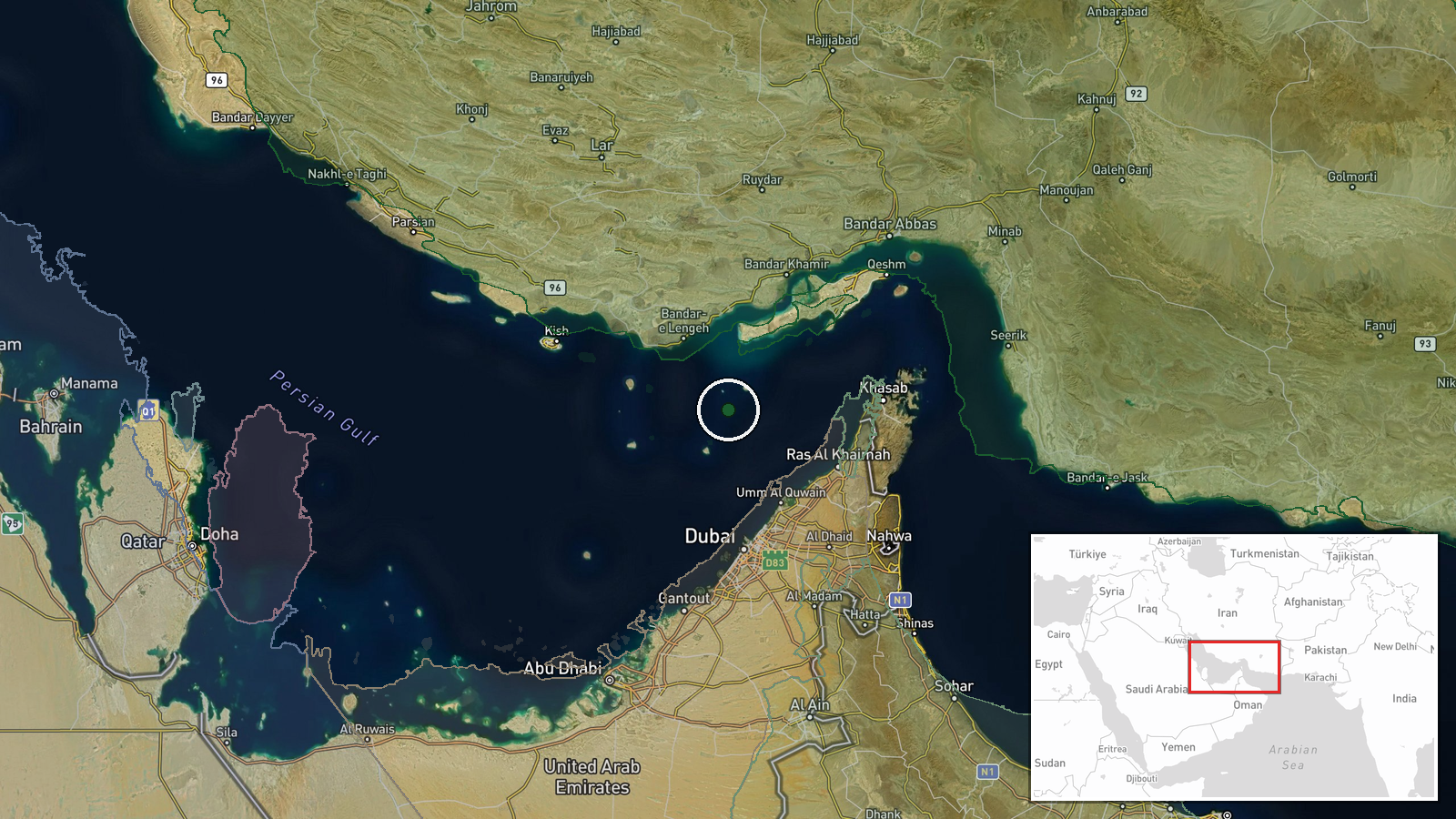
Persian Gulf region, centered approximately 26°N, 55°E. The attack reportedly targeted U.S. warships operating in international waters within the gulf. The Strait of Hormuz, a critical shipping chokepoint connecting the gulf to the Arabian Sea, lies nearby. Related incidents suggest operations across the broader gulf corridor.
Related events nearby
- Iran's IRGC Navy announced targeting a US-operated Saildrone unmanned surface vessel (USV) at the entrance to 2026-09-10 17:11 UTC · UAS Strike · Strait of Hormuz entrance
- Explosions reported on Qeshm Island in southern Iran. Cause remains unclear; no immediate attribution to any p2026-09-10 07:46 UTC · Explosion · Qeshm Island, Hormozgan Province, Iran
- Two vessels struck in Strait of Hormuz, 4 nautical miles west of Oman. No casualties or damage details confirm2026-09-11 00:00 UTC · Cargo Ship · Strait of Hormuz, 4 nautical miles west of Oman
- US forces conducted airstrike on Sirik in southern Iran's Hormozgan Province. Minimal details available; no ca2026-09-10 07:46 UTC · Airstrike · Sirik, Hormozgan Province, Iran
▶ View this event on the live map
Intel Mapper aggregates open-source reports from monitored Telegram and X channels, geolocates them, cross-checks duplicates across sources and assigns a confidence score. Entries are updated as new confirmations arrive. Read how we verify events.