Saudi-backed Yemeni forces advance on Houthi positions in Marib offensive
What happened
Saudi-backed Yemeni government forces reportedly advanced along the northern Marib frontline against Houthi positions on October 5, according to a report from conflict monitoring channels. The operation is described as part of a broader 'Operation Yemen Dawn' campaign. The report provides limited detail on specific territorial gains, unit movements, or tactical developments. The timing coincides with related airstrikes and drone operations targeting Houthi-held areas elsewhere in Yemen.
Context and assessment
Marib Governorate, located in central Yemen, represents a strategic prize in the ongoing conflict between Saudi-backed government forces and the Iran-aligned Houthi movement. Control of Marib's oil and gas infrastructure and its position along transportation routes makes it operationally significant. The reported advance follows a formal announcement on October 4 by Yemen's President Rashad al-Alimi of a full-scale offensive to retake Houthi-controlled territory. This ground operation appears coordinated with simultaneous aerial activities: drone strikes on October 4 and coalition airstrikes on Sana'a on October 5. The Houthi movement has denied territorial losses in other areas and claimed Saudi Arabia executed 106 operations in 24 hours, suggesting significant escalation across multiple fronts.
Sources and confidence
Reported by conflict monitoring channel X (@ConflictTR) on October 5. Single source limits independent verification. Confidence score of 6.0 reflects this single-source reporting and lack of cross-confirmation from other channels or independent observers. Corroboration from government statements, humanitarian sources, or opposing force claims would increase confidence. Visual evidence or detailed tactical reporting would further strengthen assessment.
Location
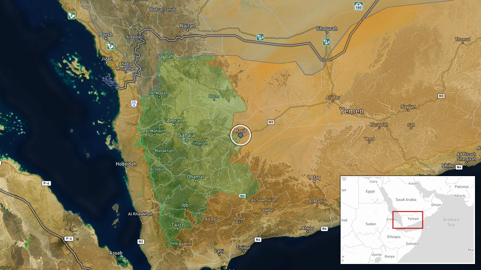
Marib Governorate, central Yemen, coordinates 15.46°N, 45.32°E. The northern Marib frontline refers to contested territory between government and Houthi forces along the governorate's boundary. Marib city lies on the Wadi Hadramawt and historically serves as a regional commercial hub. The area's elevation and desert terrain affect military operations and logistics.
Related events nearby
- Saudi Arabia-backed Yemeni forces conducted drone strikes targeting Houthi positions. Limited details availabl2026-10-04 20:19 UTC · UAS Strike · Central Yemen
- Saudi-led coalition conducted airstrikes on Houthi-controlled Sana'a. Part of ongoing 'Operation Dawn of Yemen2026-10-05 09:47 UTC · Airstrike · Sana'a, Yemen
- Yemen's President Rashad al-Alimi announces full-scale military offensive to retake Houthi-controlled territor2026-10-04 13:11 UTC · Statement · Sana'a, Yemen
- Houthi movement denies Saudi-backed government forces have made territorial advances in the Bab el-Mandeb stra2026-10-05 09:20 UTC · Statement · Sana'a, Yemen
- Houthi forces claim Saudi Arabia conducted 106 military operations within 24 hours. Statement reflects escalat2026-10-04 22:40 UTC · Statement · Sana'a, Yemen
▶ View this event on the live map
Intel Mapper aggregates open-source reports from monitored Telegram and X channels, geolocates them, cross-checks duplicates across sources and assigns a confidence score. Entries are updated as new confirmations arrive. Read how we verify events.