Panama tanker struck by projectile in Strait of Hormuz; 12 crew injured
What happened
A Panama-flagged oil tanker transiting the Strait of Hormuz was struck by an unidentified projectile on October 6, injuring 12 crew members according to India's Foreign Ministry. The Sultanate of Oman coordinated the evacuation of 10 crew members from the vessel. The source and type of projectile remain unconfirmed. The attack occurred during continued maritime incidents in the waterway.
Context and assessment
The Strait of Hormuz is a critical global oil chokepoint through which roughly one-third of seaborne petroleum passes daily. The attack follows a pattern of reported strikes against commercial shipping in the waterway: Iran's Islamic Revolutionary Guard Corps (IRGC) reportedly conducted at least 12 attacks on tankers between September 29 and October 5, using projectiles that caused fires and engine damage. The concentration and timing of incidents suggests deliberate targeting of merchant vessels in the strait. Such attacks typically aim to raise insurance premiums, deter shipping, or signal political pressure regarding sanctions and regional disputes.
Sources and confidence
Reported by single X account (@Osint613) citing India's Foreign Ministry statement and Omani evacuation coordination. No corroborating independent confirmation noted in available data. Confidence score of 6.0 reflects sole-source reporting and unidentified projectile. Cross-confirmation from maritime authorities, vessel operator statements, or ship tracking data would substantially strengthen confidence. Visual evidence or Iranian/Omani official statements could provide alternative verification.
Location
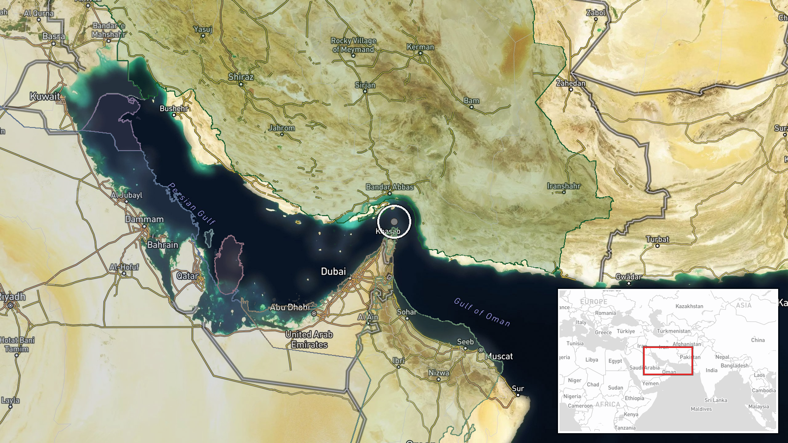
Strait of Hormuz, the narrow waterway separating Oman from Iran, at approximately 26.55°N, 56.4°E. Precision is regional rather than specific due to vessel movement during transit. The strait is approximately 34 nautical miles wide at its narrowest point and represents the primary shipping lane for Persian Gulf oil exports to global markets.
Related events nearby
- Iran's IRGC conducted 12 tanker attacks in the Strait of Hormuz between September 29 and October 5, striking v2026-10-06 16:51 UTC · Naval · Strait of Hormuz
▶ View this event on the live map
Intel Mapper aggregates open-source reports from monitored Telegram and X channels, geolocates them, cross-checks duplicates across sources and assigns a confidence score. Entries are updated as new confirmations arrive. Read how we verify events.