Iranian army says loaded crude tanker hit mine in Strait of Hormuz; single-source claim
What happened
A single account published on X by the channel ConflictTR, relaying a statement attributed to the Iranian army, says a tanker carrying 2 million barrels of crude oil struck a mine in the Strait of Hormuz. The report, written in Turkish and linking to the original post, is timestamped 17 October 2026 at 05:40 UTC. The source wording attributes the claim to the army rather than to shipping operators or independent observers. The report does not name the tanker, its flag, owner, or crew status, and does not say whether anyone was injured or whether the vessel sank or remained afloat. The event is filed under an artillery attack type, a label that does not match the mine-strike mechanism described in the source text and should be read as a database classification rather than a confirmed method.
Context and assessment
The Strait of Hormuz is a narrow chokepoint between Iran and the Musandam peninsula of Oman, linking the Persian Gulf to the Gulf of Oman. A large share of seaborne oil passes through it, so incidents there carry outsized market and shipping significance. A related event recorded about an hour earlier, on 16 October at 22:33 UTC, describes Iran as having resumed heavy attacks on ships in the strait, a considerable increase from earlier levels, amid US blockades and sanctions. If that description is accurate, the mine report fits a broader pattern of escalating maritime pressure in which the waterway becomes a venue for coercion and for contesting sanctions enforcement. Operationally, mines are area-denial weapons that are relatively cheap, difficult to attribute quickly, and can persist in shipping lanes long after they are laid. A claimed mine strike on a loaded tanker could indicate deliberate denial, the presence of legacy ordnance, or a signalling statement aimed at blockade policy. The dataset alone cannot distinguish these possibilities. Because the claim originates with the Iranian military, it should be treated as a party's account until verified.
Sources and confidence
The only listed source is the X account @ConflictTR, and the dataset contains no corroborating report from another channel. The confidence score of 6.3 reflects a single-source claim, an unverified official assertion relayed through a secondary account, a Turkish-language post, and a mismatch between the recorded attack type and the described mechanism. Confidence would rise with independent maritime reporting, vessel-tracking data showing a laden tanker disruption, advisories from maritime security bodies, or imagery of the vessel. It would fall if the claim were retracted, if no vessel could be identified, or if traffic data showed no unusual incident at the stated time.
Location
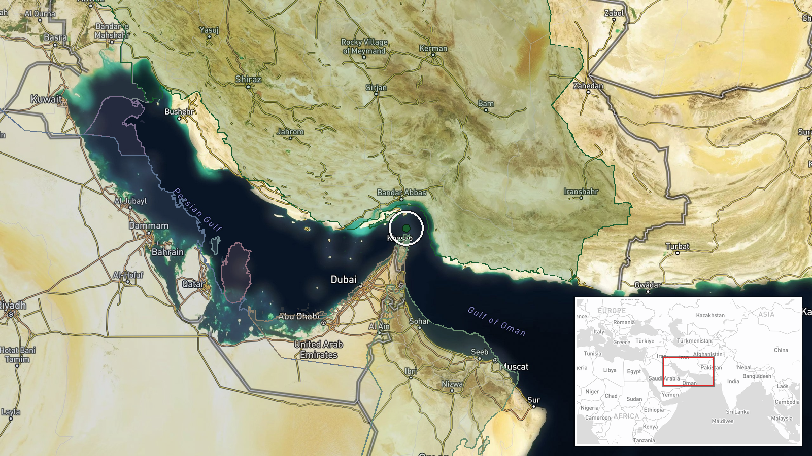
The location is recorded at region level with low location confidence. The coordinates, about 26.55 N and 56.4 E, place the point in the central part of the strait rather than at a specific vessel position or port, and appear to derive from the strait name in the report. The strait is roughly 40 kilometres wide at its narrowest, with Iranian territory and islands such as Qeshm to the north and Oman's Musandam peninsula to the south. Designated shipping lanes run through it, which concentrates commercial traffic and makes mine risk a route-level concern.
Related events nearby
- Iran has resumed heavy attacks on ships in the Strait of Hormuz, a considerable increase from earlier levels, 2026-10-16 22:33 UTC · Combat · Strait of Hormuz
▶ View this event on the live map

Intel Mapper aggregates open-source reports from monitored Telegram and X channels, geolocates them, cross-checks duplicates across sources and assigns a confidence score. Entries are updated as new confirmations arrive. Read how we verify events.