Japan tracks three PLA Navy ships south of Miyako, then northwest toward the East China Sea
What happened
Japan's Joint Staff reported that at about 4 p.m. on October 16, 2026, Japanese forces identified three Chinese People's Liberation Army Navy vessels roughly 220 kilometers south of Miyako Island in Okinawa Prefecture, moving northeast. The group comprised a Luyang III-class missile destroyer (hull number 122), a Jiangkai II-class frigate (576) and a Fuchi-class supply ship (889). On October 17, the Joint Staff said it had confirmed the same ships transiting northwest between Okinawa Main Island and Miyako toward the East China Sea. Japan's Defense Ministry said P-1 patrol aircraft from Kanoya and Naha conducted surveillance and intelligence gathering. The report was published in Japanese on the Joint Staff's X account, and this page was logged on October 19, 2026, after the observation dates.
Context and assessment
The waters between Miyako and Okinawa Main Island form one of the principal passages linking the East China Sea with the western Pacific through the Ryukyu island chain. Japan routinely monitors Chinese naval movements through these straits, and transits of this kind are a recurring feature of the regional security picture. The combination of a destroyer, a frigate and a replenishment ship is noteworthy because a supply vessel is typically associated with sustained at-sea operations rather than a brief passage, though the report does not state the group's purpose or destination. A related item on the same date describes the USS Theodore Roosevelt leaving Yokosuka and a claim that this would bring three American carriers to the CENTCOM area. That claim is a single-source assertion about a different theater and is not connected to the PLA movement in any reported way, so it should be treated as background rather than as evidence of coordination. Operationally, the transit may reflect routine training, deployment rotation or a展示 of presence in the western Pacific, but the available data do not establish which.
Sources and confidence
The only channel is the Joint Staff's official X account, which is an authoritative government source but a single one, and no independent outlet, satellite image or Chinese statement is cited in the data. The confidence score of 6.1 reflects that single-channel status together with the low location confidence and the region-level geographic precision. Confidence would rise with corroboration from Japanese Ministry of Defense releases, regional media that reproduce the observations, imagery of the vessels, or a statement from China's Ministry of National Defense. It would fall if later Japanese reporting revised the hull numbers, positions or dates, or if the observation were attributed to a different group.
Location
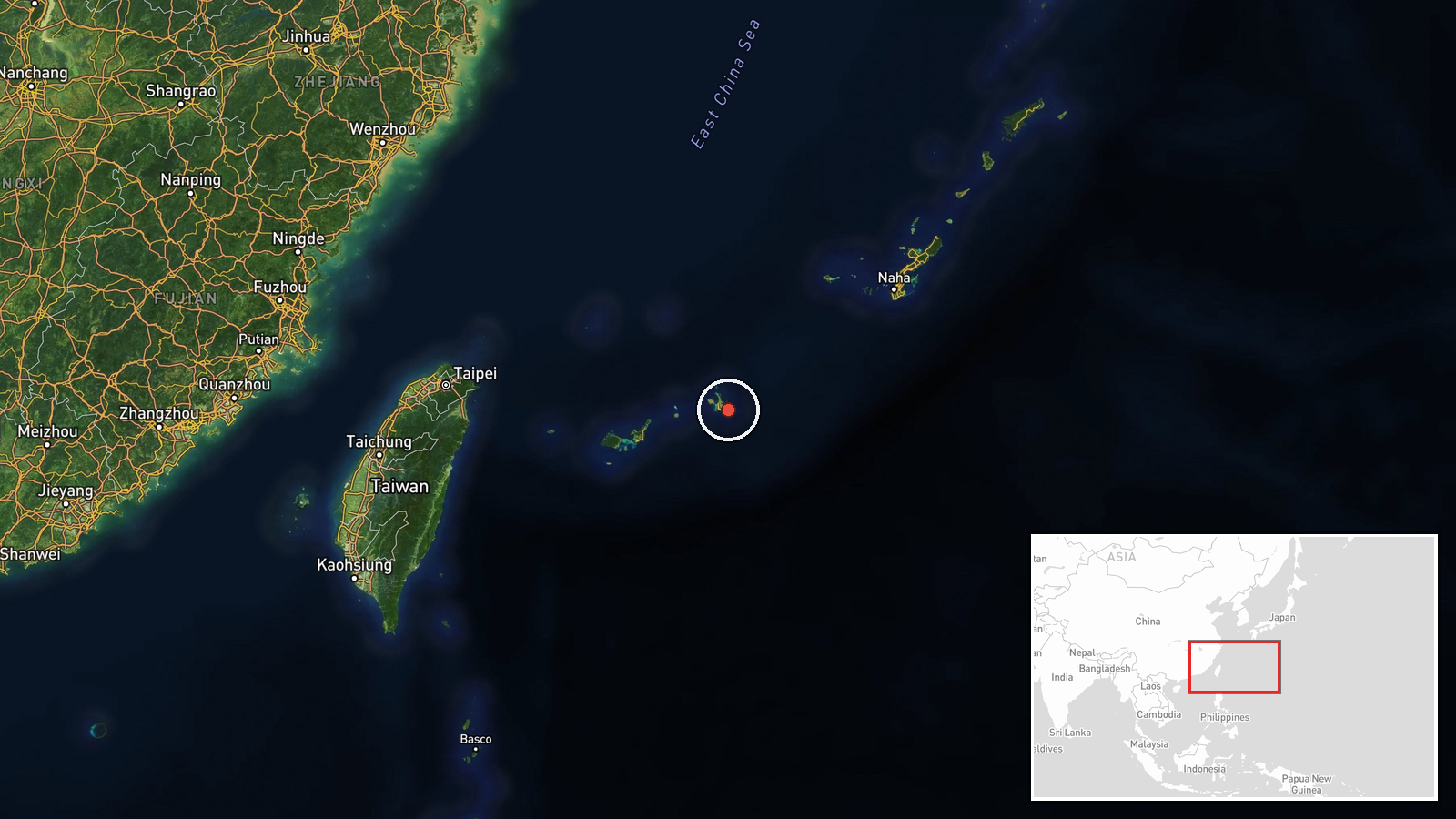
The location is a region-level estimate: the coordinates sit in the Philippine Sea at the approximate center of the stated area, about 220 kilometers south of Miyako Island, and do not mark a fixed point or facility. The surrounding area is open ocean east of the Ryukyu chain. The Miyako Strait lies to the north of Miyako Island between it and Okinawa Main Island, and the ships' reported route ran through that passage toward the East China Sea. No settlement or port is involved in the report.
Related events nearby
- USS Theodore Roosevelt departed Yokosuka, Japan, resuming transit toward CENTCOM; source claims this brings th2026-10-19 07:32 UTC · Aircraft Carrier · Philippine Sea, off Japan
▶ View this event on the live map

Intel Mapper aggregates open-source reports from monitored Telegram and X channels, geolocates them, cross-checks duplicates across sources and assigns a confidence score. Entries are updated as new confirmations arrive. Read how we verify events.